Property Record
3605 Old Airport Rd, Allentown, PA 18109

NEARBY LISTINGS FOR SALE OR LEASE
Property Detail
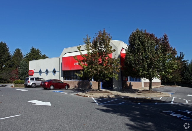
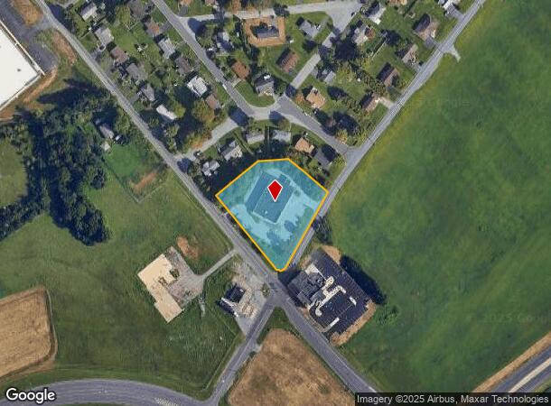
3605 Old Airport Rd
Storebuilding
Northampton
X
Pennsylvania
42095C0241E
2.98 AC
2025
Lehigh Valley
2025
Philadelphia
017704
Allentown-Bethlehem-Easton, PA-NJ
11,301 SF
M5SE1-7-6-0214
DEMOGRAPHICS near 3605 Old Airport Rd
1 Mile
3 Mile
5 Mile
2024 Total Population
2,132
50,884
214,811
2029 Population
2,134
51,223
216,084
Pop Growth 2024-2029
+ 0.09%
+ 0.67%
+ 0.59%
Average Age
43
43
40
2024 Total Households
827
21,209
82,759
HH Growth 2024-2029
+ 0.12%
+ 0.70%
+ 0.68%
Median Household Inc
$86,941
$71,023
$61,093
Avg Household Size
2.60
2.40
2.40
2024 Avg HH Vehicles
2.00
2.00
2.00
Median Home Value
$275,752
$247,252
$213,623
Median Year Built
1969
1968
1959
Nearby Places
Map Layers
Map Styles
 Street
 Aerial
- Restaurants
- Banks
- Shops
- Fitness
- Groceries
PUBLIC TRANSPORTATION
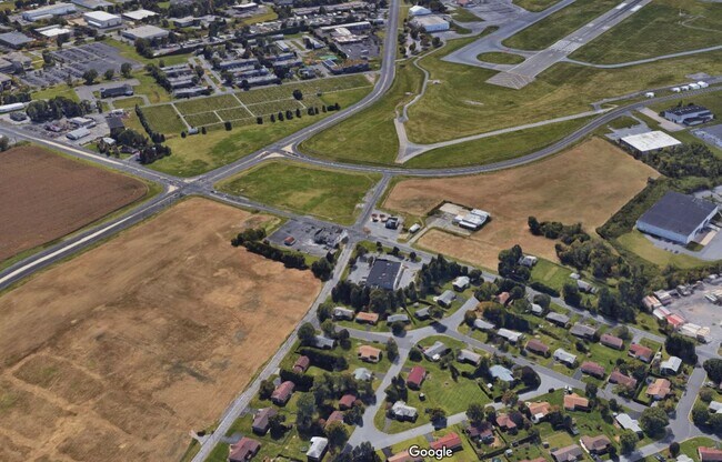
AIRPORT
Lehigh Valley International
DRIVE
WALK
Distance
Lehigh Valley International
6 min
2.3 mi
Freight Ports
Port of Philadelphia
DRIVE
WALK
Distance
Port of Philadelphia
91 min
67.9 mi
SALE & LEASE HISTORY
LISTING DATE
SALE/LEASE

May 11, 2019
For Sale
Nearby Properties
Address
Land Use
TOTAL SIZE
Lot Size
Zoning
Address
Land Use
TOTAL SIZE
Lot Size
Zoning
93,719 SF
789.61 AC
AI
Address
Land Use
TOTAL SIZE
Lot Size
Zoning
649,498 SF
22.51 AC
I
Address
Land Use
TOTAL SIZE
Lot Size
Zoning
298,543 SF
55.08 AC
PIO
Address
Land Use
TOTAL SIZE
Lot Size
Zoning
453,600 SF
32.57 AC
PIO
Address
Land Use
TOTAL SIZE
Lot Size
Zoning
1,046,625 SF
69.55 AC
RS
Address
Land Use
TOTAL SIZE
Lot Size
Zoning
520,201 SF
77.66 AC
PIO
Address
Land Use
TOTAL SIZE
Lot Size
Zoning
13,164 SF
27.89 AC
RT
Address
Land Use
TOTAL SIZE
Lot Size
Zoning
29,982 SF
14.39 AC
RT
Address
Land Use
TOTAL SIZE
Lot Size
Zoning
72,678 SF
17.21 AC
PC
Address
Land Use
TOTAL SIZE
Lot Size
Zoning
1,050,392 SF
218.15 AC
RS
Address
Land Use
TOTAL SIZE
Lot Size
Zoning
509,445 SF
43.15 AC
PIO
Address
Land Use
TOTAL SIZE
Lot Size
Zoning
104,379 SF
21.57 AC
CS
Address
Land Use
TOTAL SIZE
Lot Size
Zoning
164,451 SF
15.06 AC
PI
Address
Land Use
TOTAL SIZE
Lot Size
Zoning
57,441 SF
19.85 AC
CS
Address
Land Use
TOTAL SIZE
Lot Size
Zoning
8,352 SF
17.24 AC
MR
Address
Land Use
TOTAL SIZE
Lot Size
Zoning
276,484 SF
31.19 AC
A
Address
Land Use
TOTAL SIZE
Lot Size
Zoning
95,776 SF
23.70 AC
INS
Address
Land Use
TOTAL SIZE
Lot Size
Zoning
134,774 SF
11.74 AC
PC
Address
Land Use
TOTAL SIZE
Lot Size
Zoning
452,012 SF
40.39 AC
PC
Address
Land Use
TOTAL SIZE
Lot Size
Zoning
100,754 SF
16.01 AC
PIO
Address
Land Use
TOTAL SIZE
Lot Size
Zoning
189,805 SF
11.43 AC
I-3
Address
Land Use
TOTAL SIZE
Lot Size
Zoning
208,440 SF
18 AC
B/LI
Address
Land Use
TOTAL SIZE
Lot Size
Zoning
96,999 SF
19.37 AC
INS
Address
Land Use
TOTAL SIZE
Lot Size
Zoning
35,877 SF
9 AC
R-MH
Address
Land Use
TOTAL SIZE
Lot Size
Zoning
75,091 SF
5.23 AC
PUD
Address
Land Use
TOTAL SIZE
Lot Size
Zoning
11,356 SF
16.26 AC
RG
Address
Land Use
TOTAL SIZE
Lot Size
Zoning
197,120 SF
14.06 AC
PIO
Address
Land Use
TOTAL SIZE
Lot Size
Zoning
84,438 SF
7.81 AC
AI
Address
Land Use
TOTAL SIZE
Lot Size
Zoning
57,635 SF
2.69 AC
I
Address
Land Use
TOTAL SIZE
Lot Size
Zoning
1,000 SF
24.24 AC
AI
The World's #1 Commercial Real Estate Marketplace
Connect with us
© 2025 CoStar Group
The information above has been obtained from sources believed reliable. While we do not doubt its accuracy we have not verified it and make no guarantee, warranty or representation about it. It is your responsibility to independently confirm its accuracy and completeness. Any projections, opinions, assumptions, or estimates used are for example only and do not represent the current or future performance of the property. The value of this transaction to you depends on tax and other factors which should be evaluated by your tax, financial, and legal advisors. You and your advisors should conduct a careful, independent investigation of the property to determine to your satisfaction the suitability of the property for your needs.