Property Record
3605 Augusta Hwy, Gilbert, SC 29054
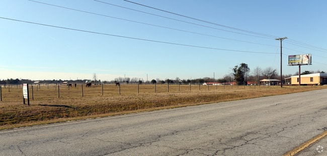

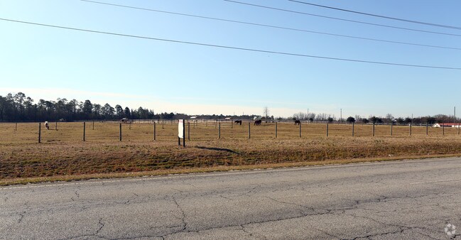
Property Detail
3605 Augusta Hwy
005100-02-153
PARCELS C & D
Commercialbuilding
Lexington
ID
South Carolina
B and X Area of moderate flood hazard, usually the area between the limits of the 100-year and 500-year floods.
4.05 AC
2025
Lexington
2024
Columbia
021306
Columbia, SC
5,194 SF
NEARBY LISTINGS FOR SALE OR LEASE
-
-
View all Gilbert listings for sale on LoopNet.com
DEMOGRAPHICS near 3605 Augusta Hwy
1 mile
3 mile
5 mile
2025 Total Population
1,255
7,550
27,749
2030 Population
1,330
7,991
29,272
Pop Growth 2025-2030
+ 5.98%
+ 5.84%
+ 5.49%
Average Age
41
41
40
2025 Total Households
465
2,791
10,298
HH Growth 2025-2030
+ 6.24%
+ 5.98%
+ 5.70%
Median Household Inc
$106,875
$111,149
$105,338
Avg Household Size
2.70
2.70
2.70
2025 Avg HH Vehicles
3.00
3.00
2.00
Median Home Value
$306,849
$336,726
$317,588
Median Year Built
1999
2002
2002
Nearby Places
Map Layers
Map Styles
 Street
 Aerial
Layers
 Traffic
 Biking
Places
Listings with unknown addresses are not visible on the map
- Restaurants
- Banks
- Shops
- Fitness
- Groceries
PUBLIC TRANSPORTATION
AIRPORT
Columbia Metro
Drive
Walk
Distance
Columbia Metro
39 min
17.0 mi
Nearby Properties
Address
Land Use
TOTAL SIZE
Lot Size
Zoning
Address
Land Use
TOTAL SIZE
Lot Size
Zoning
52.36 AC
RD
Address
Land Use
TOTAL SIZE
Lot Size
Zoning
61.35 AC
Address
Land Use
TOTAL SIZE
Lot Size
Zoning
4,800 SF
9.22 AC
RD
Address
Land Use
TOTAL SIZE
Lot Size
Zoning
24,000 SF
4.61 AC
ID
Address
Land Use
TOTAL SIZE
Lot Size
Zoning
10,640 SF
1.63 AC
RD
Address
Land Use
TOTAL SIZE
Lot Size
Zoning
18,080 SF
7.32 AC
ID
Address
Land Use
TOTAL SIZE
Lot Size
Zoning
1,950 SF
8.90 AC
RD
Address
Land Use
TOTAL SIZE
Lot Size
Zoning
1,712 SF
4.65 AC
ID
Address
Land Use
TOTAL SIZE
Lot Size
Zoning
9,100 SF
1.97 AC
RD
Address
Land Use
TOTAL SIZE
Lot Size
Zoning
4,800 SF
2.23 AC
RD
Address
Land Use
TOTAL SIZE
Lot Size
Zoning
11,808 SF
7 AC
R
Address
Land Use
TOTAL SIZE
Lot Size
Zoning
5,757 SF
0.96 AC
ID
Address
Land Use
TOTAL SIZE
Lot Size
Zoning
31.96 AC
Address
Land Use
TOTAL SIZE
Lot Size
Zoning
788 SF
5 AC
ID
Address
Land Use
TOTAL SIZE
Lot Size
Zoning
10,289 SF
2.82 AC
RD
Address
Land Use
TOTAL SIZE
Lot Size
Zoning
7,000 SF
2 AC
ID
Address
Land Use
TOTAL SIZE
Lot Size
Zoning
7.21 AC
RD
Address
Land Use
TOTAL SIZE
Lot Size
Zoning
14.83 AC
RD
Address
Land Use
TOTAL SIZE
Lot Size
Zoning
4.11 AC
RD
Address
Land Use
TOTAL SIZE
Lot Size
Zoning
14,000 SF
2 AC
ID
Address
Land Use
TOTAL SIZE
Lot Size
Zoning
9,600 SF
4.84 AC
ID
Address
Land Use
TOTAL SIZE
Lot Size
Zoning
3,400 SF
6 AC
RD
Address
Land Use
TOTAL SIZE
Lot Size
Zoning
8,000 SF
0.67 AC
ID
Address
Land Use
TOTAL SIZE
Lot Size
Zoning
1,000 SF
1.85 AC
ID
Address
Land Use
TOTAL SIZE
Lot Size
Zoning
12,480 SF
2.50 AC
ID
Address
Land Use
TOTAL SIZE
Lot Size
Zoning
3,068 SF
0.96 AC
ID
Address
Land Use
TOTAL SIZE
Lot Size
Zoning
6,600 SF
1.68 AC
C1
Address
Land Use
TOTAL SIZE
Lot Size
Zoning
5,000 SF
2.37 AC
ID
Address
Land Use
TOTAL SIZE
Lot Size
Zoning
10.82 AC
RD
Address
Land Use
TOTAL SIZE
Lot Size
Zoning
20.79 AC
RD
The World's #1 Commercial Real Estate Marketplace
Connect with us
© 2026 CoStar Group
The information above has been obtained from sources believed reliable. While we do not doubt its accuracy we have not verified it and make no guarantee, warranty or representation about it. It is your responsibility to independently confirm its accuracy and completeness. Any projections, opinions, assumptions, or estimates used are for example only and do not represent the current or future performance of the property. The value of this transaction to you depends on tax and other factors which should be evaluated by your tax, financial, and legal advisors. You and your advisors should conduct a careful, independent investigation of the property to determine to your satisfaction the suitability of the property for your needs.