Property Record
3605 Sandy Plains Rd, Marietta, GA 30066


Current Lease Availabilities
NEARBY LISTINGS FOR SALE OR LEASE
Property Detail
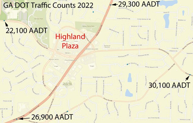
3605 Sandy Plains Rd
Regionalshoppingcenterormallwithanchorstore
Cobb
X
Georgia
13057C0375E
16.35 AC
2025
Town Center/Marietta
2025
Atlanta
030340
Atlanta-Sandy Springs-Roswell, GA
139,694 SF
16-0334-0-005-0
DEMOGRAPHICS near 3605 Sandy Plains Rd
1 Mile
3 Mile
5 Mile
2024 Total Population
7,707
67,707
178,997
2029 Population
7,753
68,596
185,190
Pop Growth 2024-2029
+ 0.60%
+ 1.31%
+ 3.46%
Average Age
40
41
41
2024 Total Households
2,518
23,353
63,717
HH Growth 2024-2029
+ 0.56%
+ 1.40%
+ 3.69%
Median Household Inc
$147,677
$137,811
$125,375
Avg Household Size
3.00
2.90
2.80
2024 Avg HH Vehicles
2.00
2.00
2.00
Median Home Value
$460,663
$419,318
$407,274
Median Year Built
1986
1984
1986
Nearby Places
Map Layers
Map Styles
 Street
 Aerial
- Restaurants
- Banks
- Shops
- Fitness
- Groceries
PUBLIC TRANSPORTATION
AIRPORT
Hartsfield - Jackson Atlanta International
DRIVE
WALK
Distance
Hartsfield - Jackson Atlanta International
51 min
33.0 mi
Freight Ports
Georgia Ports - Savannah
DRIVE
WALK
Distance
Georgia Ports - Savannah
314 min
272.4 mi
Nearby Properties
Address
Land Use
TOTAL SIZE
Lot Size
Zoning
Address
Land Use
TOTAL SIZE
Lot Size
Zoning
118,464 SF
15.73 AC
CRC
Address
Land Use
TOTAL SIZE
Lot Size
Zoning
113,274 SF
14.30 AC
NRC
Address
Land Use
TOTAL SIZE
Lot Size
Zoning
5 AC
PSC/NS
Address
Land Use
TOTAL SIZE
Lot Size
Zoning
126,855 SF
13.71 AC
NS
Address
Land Use
TOTAL SIZE
Lot Size
Zoning
158,427 SF
11.17 AC
GC
Address
Land Use
TOTAL SIZE
Lot Size
Zoning
96,575 SF
14.19 AC
CRC
Address
Land Use
TOTAL SIZE
Lot Size
Zoning
9,840 SF
9.76 AC
CRC
Address
Land Use
TOTAL SIZE
Lot Size
Zoning
41,268 SF
13.78 AC
Address
Land Use
TOTAL SIZE
Lot Size
Zoning
138,200 SF
17.70 AC
CRC/WS
Address
Land Use
TOTAL SIZE
Lot Size
Zoning
90,942 SF
1.33 AC
NRC/WS
Address
Land Use
TOTAL SIZE
Lot Size
Zoning
121,844 SF
17.61 AC
CRC/WS
Address
Land Use
TOTAL SIZE
Lot Size
Zoning
56,868 SF
6.41 AC
CRC
Address
Land Use
TOTAL SIZE
Lot Size
Zoning
105,216 SF
10.42 AC
GC
Address
Land Use
TOTAL SIZE
Lot Size
Zoning
109,792 SF
2.56 AC
CRC
Address
Land Use
TOTAL SIZE
Lot Size
Zoning
33,410 SF
4.54 AC
GC/WS
Address
Land Use
TOTAL SIZE
Lot Size
Zoning
79,905 SF
3.39 AC
NRC
Address
Land Use
TOTAL SIZE
Lot Size
Zoning
56,899 SF
13.85 AC
NRC/R-15
Address
Land Use
TOTAL SIZE
Lot Size
Zoning
2.78 AC
OI
Address
Land Use
TOTAL SIZE
Lot Size
Zoning
33.26 AC
R20
Address
Land Use
TOTAL SIZE
Lot Size
Zoning
41,749 SF
3.61 AC
LRC
Address
Land Use
TOTAL SIZE
Lot Size
Zoning
78,906 SF
5.39 AC
CRC
Address
Land Use
TOTAL SIZE
Lot Size
Zoning
90,812 SF
3.10 AC
NRC
Address
Land Use
TOTAL SIZE
Lot Size
Zoning
15,927 SF
2.36 AC
NRC
Address
Land Use
TOTAL SIZE
Lot Size
Zoning
41.28 AC
R20
Address
Land Use
TOTAL SIZE
Lot Size
Zoning
65,870 SF
6.24 AC
CRC
Address
Land Use
TOTAL SIZE
Lot Size
Zoning
66,166 SF
6.37 AC
Address
Land Use
TOTAL SIZE
Lot Size
Zoning
81,271 SF
5.06 AC
NRC/WS
Address
Land Use
TOTAL SIZE
Lot Size
Zoning
1,515 SF
13.89 AC
Address
Land Use
TOTAL SIZE
Lot Size
Zoning
190,648 SF
5.10 AC
GC/WS
The World's #1 Commercial Real Estate Marketplace
Connect with us
© 2026 CoStar Group
The information above has been obtained from sources believed reliable. While we do not doubt its accuracy we have not verified it and make no guarantee, warranty or representation about it. It is your responsibility to independently confirm its accuracy and completeness. Any projections, opinions, assumptions, or estimates used are for example only and do not represent the current or future performance of the property. The value of this transaction to you depends on tax and other factors which should be evaluated by your tax, financial, and legal advisors. You and your advisors should conduct a careful, independent investigation of the property to determine to your satisfaction the suitability of the property for your needs.