Property Record
361 E 6Th St, Red Hill, PA 18076


Save to a Folder
{{folder.Name}}
{{folder.ListingIds.length}} Properties
{{folder.ListingIds.length}} Property
Create a New Folder
This Property Is For Sale
Property Detail
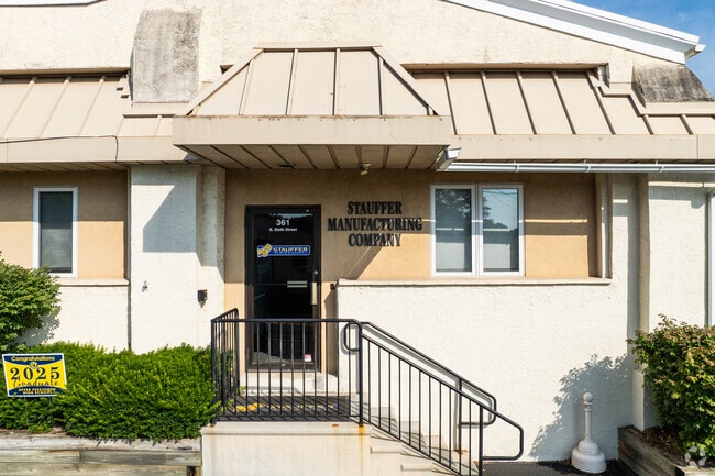
361 E 6Th St
17-00-00895-006
90 X IRR 4.62 AC
Warehouse
Montgomery
LI
Pennsylvania
B and X Area of moderate flood hazard, usually the area between the limits of the 100-year and 500-year floods.
42
2026
4.62 AC
2026
West Montgomery Cty
207900
Philadelphia
40,000 SF
Philadelphia-Camden-Wilmington, PA-NJ-DE-MD
NEARBY LISTINGS FOR SALE OR LEASE
DEMOGRAPHICS near 361 E 6Th St
1 mile
3 mile
5 mile
2025 Total Population
5,473
19,778
31,341
2030 Population
5,609
20,148
31,750
Pop Growth 2025-2030
+ 2.48%
+ 1.87%
+ 1.30%
Average Age
42
41
42
2025 Total Households
2,122
7,290
11,627
HH Growth 2025-2030
+ 2.40%
+ 1.80%
+ 1.25%
Median Household Inc
$99,586
$99,305
$105,142
Avg Household Size
2.50
2.60
2.60
2025 Avg HH Vehicles
2.00
2.00
2.00
Median Home Value
$311,111
$340,814
$373,407
Median Year Built
1988
1980
1977
Nearby Places
Map Layers
Map Styles
 Street
 Aerial
Layers
 Traffic
 Biking
Places
Listings with unknown addresses are not visible on the map
- Restaurants
- Banks
- Shops
- Fitness
- Groceries
PUBLIC TRANSPORTATION
AIRPORT
Lehigh Valley International
Drive
Walk
Distance
Lehigh Valley International
45 min
29.5 mi
Freight Ports
Port of Philadelphia
Drive
Walk
Distance
Port of Philadelphia
64 min
38.9 mi
Nearby Properties
Address
Land Use
TOTAL SIZE
Lot Size
Zoning
Address
Land Use
TOTAL SIZE
Lot Size
Zoning
202,162 SF
43.74 AC
R1
Address
Land Use
TOTAL SIZE
Lot Size
Zoning
238,859 SF
25.57 AC
R1
Address
Land Use
TOTAL SIZE
Lot Size
Zoning
155,554 SF
20.09 AC
LIC
Address
Land Use
TOTAL SIZE
Lot Size
Zoning
152,003 SF
8.05 AC
I
Address
Land Use
TOTAL SIZE
Lot Size
Zoning
137,273 SF
18.06 AC
IN
Address
Land Use
TOTAL SIZE
Lot Size
Zoning
78,045 SF
48.01 AC
R1
Address
Land Use
TOTAL SIZE
Lot Size
Zoning
1,212.07 AC
R1
Address
Land Use
TOTAL SIZE
Lot Size
Zoning
74,052 SF
21.35 AC
R1
Address
Land Use
TOTAL SIZE
Lot Size
Zoning
427,573 SF
37.69 AC
LI
Address
Land Use
TOTAL SIZE
Lot Size
Zoning
138,107 SF
16.42 AC
SC
Address
Land Use
TOTAL SIZE
Lot Size
Zoning
44,420 SF
730 AC
R1
Address
Land Use
TOTAL SIZE
Lot Size
Zoning
38,890 SF
1.75 AC
R3
Address
Land Use
TOTAL SIZE
Lot Size
Zoning
697.54 AC
R1
Address
Land Use
TOTAL SIZE
Lot Size
Zoning
287,614 SF
30.40 AC
LIC1
Address
Land Use
TOTAL SIZE
Lot Size
Zoning
42,045 SF
2.81 AC
I
Address
Land Use
TOTAL SIZE
Lot Size
Zoning
237,905 SF
22.23 AC
LI
Address
Land Use
TOTAL SIZE
Lot Size
Zoning
72,843 SF
5.99 AC
R4
Address
Land Use
TOTAL SIZE
Lot Size
Zoning
69,402 SF
6.89 AC
I
Address
Land Use
TOTAL SIZE
Lot Size
Zoning
61,534 SF
6.08 AC
I
Address
Land Use
TOTAL SIZE
Lot Size
Zoning
35,723 SF
22.16 AC
R1
Address
Land Use
TOTAL SIZE
Lot Size
Zoning
118,910 SF
4.08 AC
LI
Address
Land Use
TOTAL SIZE
Lot Size
Zoning
34,896 SF
26.97 AC
R1
Address
Land Use
TOTAL SIZE
Lot Size
Zoning
31,274 SF
13.32 AC
LI
Address
Land Use
TOTAL SIZE
Lot Size
Zoning
32,124 SF
2.70 AC
I
Address
Land Use
TOTAL SIZE
Lot Size
Zoning
65,620 SF
11.77 AC
LIC1
Address
Land Use
TOTAL SIZE
Lot Size
Zoning
35,570 SF
4.84 AC
LIC
Address
Land Use
TOTAL SIZE
Lot Size
Zoning
102,480 SF
18.75 AC
LIC1
Address
Land Use
TOTAL SIZE
Lot Size
Zoning
27,400 SF
LIC1
Address
Land Use
TOTAL SIZE
Lot Size
Zoning
29,626 SF
18.43 AC
R1
Address
Land Use
TOTAL SIZE
Lot Size
Zoning
26,248 SF
3.90 AC
LIC1
The World's #1 Commercial Real Estate Marketplace
Connect with us
© 2026 CoStar Group
The information above has been obtained from sources believed reliable. While we do not doubt its accuracy we have not verified it and make no guarantee, warranty or representation about it. It is your responsibility to independently confirm its accuracy and completeness. Any projections, opinions, assumptions, or estimates used are for example only and do not represent the current or future performance of the property. The value of this transaction to you depends on tax and other factors which should be evaluated by your tax, financial, and legal advisors. You and your advisors should conduct a careful, independent investigation of the property to determine to your satisfaction the suitability of the property for your needs.