Property Record
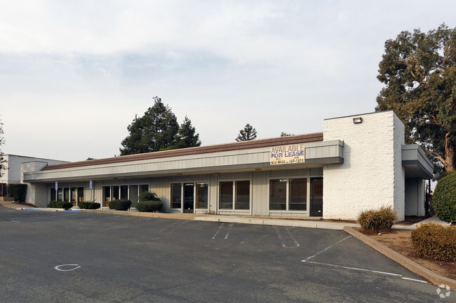
361 E Leland Rd, Pittsburg, CA 94565


Property Detail
361 E Leland Rd
Oakland-Fremont-Berkeley, CA
TRACT 5956 POR LOT 4
088-580-008-6
CONTRA COSTA
Officebuilding
California
B and X Area of moderate flood hazard, usually the area between the limits of the 100-year and 500-year floods.
4
2025
0.31 AC
2025
Antioch/Pittsburg
313104
East Bay/Oakland
4,484 SF
NEARBY LISTINGS FOR SALE OR LEASE
DEMOGRAPHICS near 361 E Leland Rd
1 mile
3 mile
5 mile
2025 Total Population
25,247
78,695
154,006
2030 Population
25,478
79,445
155,728
Pop Growth 2025-2030
+ 0.91%
+ 0.95%
+ 1.12%
Average Age
37
38
38
2025 Total Households
7,888
24,345
47,958
HH Growth 2025-2030
+ 1.01%
+ 1.02%
+ 1.12%
Median Household Inc
$70,962
$87,188
$88,506
Avg Household Size
3.10
3.10
3.10
2025 Avg HH Vehicles
2.00
2.00
2.00
Median Home Value
$497,241
$628,048
$636,769
Median Year Built
1971
1978
1978
Nearby Places
Map Layers
Map Styles
 Street
 Aerial
Transit
 Traffic
 Biking
Places
Listings with unknown addresses are not visible on the map
- Restaurants
- Banks
- Shops
- Fitness
- Groceries
PUBLIC TRANSPORTATION
AIRPORT
Metro Oakland International
Drive
Walk
Distance
Metro Oakland International
53 min
39.9 mi
Stockton Metro
Drive
Walk
Distance
Stockton Metro
65 min
45.4 mi
Freight Ports
Port of Oakland
Drive
Walk
Distance
Port of Oakland
42 min
32.7 mi
SALE & LEASE HISTORY
LISTING DATE
SALE/LEASE

Oct 14, 2016
For Lease
Nov 21, 2019
For Sale
Jun 07, 2017
For Lease
Jan 20, 2017
For Sale
Nearby Properties
Address
Land Use
TOTAL SIZE
Lot Size
Zoning
Address
Land Use
TOTAL SIZE
Lot Size
Zoning
187.08 AC
Address
Land Use
TOTAL SIZE
Lot Size
Zoning
460,821 SF
48.27 AC
Address
Land Use
TOTAL SIZE
Lot Size
Zoning
29.68 AC
Address
Land Use
TOTAL SIZE
Lot Size
Zoning
246.20 AC
Address
Land Use
TOTAL SIZE
Lot Size
Zoning
227,244 SF
10.50 AC
Address
Land Use
TOTAL SIZE
Lot Size
Zoning
3,472 SF
11.68 AC
Address
Land Use
TOTAL SIZE
Lot Size
Zoning
206,910 SF
10.10 AC
Address
Land Use
TOTAL SIZE
Lot Size
Zoning
157,250 SF
3.94 AC
Address
Land Use
TOTAL SIZE
Lot Size
Zoning
187,532 SF
10.55 AC
Address
Land Use
TOTAL SIZE
Lot Size
Zoning
164,816 SF
8.72 AC
Address
Land Use
TOTAL SIZE
Lot Size
Zoning
107.94 AC
Address
Land Use
TOTAL SIZE
Lot Size
Zoning
119,482 SF
6.08 AC
Address
Land Use
TOTAL SIZE
Lot Size
Zoning
4,312 SF
10.18 AC
Address
Land Use
TOTAL SIZE
Lot Size
Zoning
7,678 SF
1.89 AC
Address
Land Use
TOTAL SIZE
Lot Size
Zoning
93,770 SF
14.35 AC
Address
Land Use
TOTAL SIZE
Lot Size
Zoning
2,352 SF
7.29 AC
Address
Land Use
TOTAL SIZE
Lot Size
Zoning
74,045 SF
3.25 AC
Address
Land Use
TOTAL SIZE
Lot Size
Zoning
161,131 SF
15.97 AC
Address
Land Use
TOTAL SIZE
Lot Size
Zoning
47,307 SF
6.70 AC
Address
Land Use
TOTAL SIZE
Lot Size
Zoning
4,240 SF
11.04 AC
Address
Land Use
TOTAL SIZE
Lot Size
Zoning
204,831 SF
9.08 AC
Address
Land Use
TOTAL SIZE
Lot Size
Zoning
66,039 SF
2.33 AC
Address
Land Use
TOTAL SIZE
Lot Size
Zoning
91,344 SF
4.79 AC
R4
Address
Land Use
TOTAL SIZE
Lot Size
Zoning
420,048 SF
23.71 AC
Address
Land Use
TOTAL SIZE
Lot Size
Zoning
112,736 SF
1.78 AC
Address
Land Use
TOTAL SIZE
Lot Size
Zoning
13,552 SF
10.28 AC
Address
Land Use
TOTAL SIZE
Lot Size
Zoning
880 SF
31.41 AC
Address
Land Use
TOTAL SIZE
Lot Size
Zoning
137,208 SF
10.37 AC
Address
Land Use
TOTAL SIZE
Lot Size
Zoning
191,866 SF
4.40 AC
Address
Land Use
TOTAL SIZE
Lot Size
Zoning
125,774 SF
12.48 AC
The World's #1 Commercial Real Estate Marketplace
Connect with us
© 2026 CoStar Group
The information above has been obtained from sources believed reliable. While we do not doubt its accuracy we have not verified it and make no guarantee, warranty or representation about it. It is your responsibility to independently confirm its accuracy and completeness. Any projections, opinions, assumptions, or estimates used are for example only and do not represent the current or future performance of the property. The value of this transaction to you depends on tax and other factors which should be evaluated by your tax, financial, and legal advisors. You and your advisors should conduct a careful, independent investigation of the property to determine to your satisfaction the suitability of the property for your needs.