Property Record
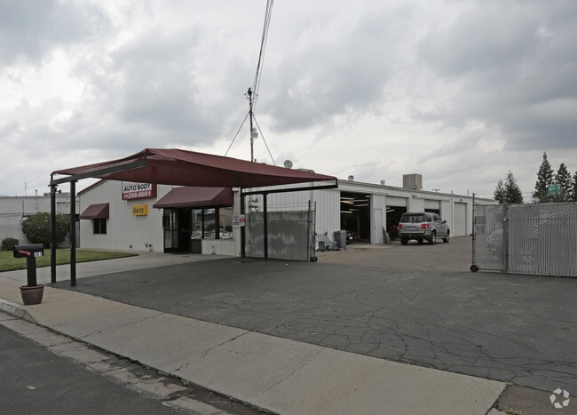
361 N Minnewawa Ave, Clovis, CA 93612


Property Detail
361 N Minnewawa Ave
491-200-10
LOT 10 TRACT 2209 HERNDON INDUSTRIAL PARK NO 1
Autorepair
Fresno
M1RA
California
C and X Area of minimal flood hazard, usually depicted on FIRMs as above the 500-year flood level.
10
2025
0.38 AC
2025
Northeast Fresno
005602
Fresno
7,410 SF
Fresno, CA
NEARBY LISTINGS FOR SALE OR LEASE
DEMOGRAPHICS near 361 N Minnewawa Ave
1 mile
3 mile
5 mile
2025 Total Population
11,699
122,771
290,252
2030 Population
11,794
124,405
294,525
Pop Growth 2025-2030
+ 0.81%
+ 1.33%
+ 1.47%
Average Age
41
38
38
2025 Total Households
4,396
44,822
102,793
HH Growth 2025-2030
+ 0.84%
+ 1.39%
+ 1.45%
Median Household Inc
$103,138
$86,456
$87,644
Avg Household Size
2.60
2.70
2.80
2025 Avg HH Vehicles
2.00
2.00
2.00
Median Home Value
$491,055
$451,051
$458,285
Median Year Built
1991
1987
1987
Nearby Places
Map Layers
Map Styles
 Street
 Aerial
Layers
 Traffic
 Biking
Places
Listings with unknown addresses are not visible on the map
- Restaurants
- Banks
- Shops
- Fitness
- Groceries
PUBLIC TRANSPORTATION
COMMUTER RAIL
Fresno (San Joaquins - Amtrak)
Drive
Walk
Distance
Fresno (San Joaquins - Amtrak)
12 min
9.5 mi
AIRPORT
Fresno Yosemite International
Drive
Walk
Distance
Fresno Yosemite International
11 min
7.4 mi
Freight Ports
Port of Stockton
Drive
Walk
Distance
Port of Stockton
157 min
129.2 mi
SALE & LEASE HISTORY
LISTING DATE
SALE/LEASE

Oct 15, 2025
For Sale
Nov 10, 2022
For Sale
Mar 21, 2025
For Sale
Nearby Properties
Address
Land Use
TOTAL SIZE
Lot Size
Zoning
Address
Land Use
TOTAL SIZE
Lot Size
Zoning
397,556 SF
20.45 AC
CP
Address
Land Use
TOTAL SIZE
Lot Size
Zoning
110,872 SF
2.62 AC
CP
Address
Land Use
TOTAL SIZE
Lot Size
Zoning
180,770 SF
19.03 AC
PCC
Address
Land Use
TOTAL SIZE
Lot Size
Zoning
239,000 SF
20.34 AC
R2
Address
Land Use
TOTAL SIZE
Lot Size
Zoning
239,437 SF
31.16 AC
RA
Address
Land Use
TOTAL SIZE
Lot Size
Zoning
192,062 SF
11.50 AC
RS5
Address
Land Use
TOTAL SIZE
Lot Size
Zoning
188,913 SF
7.90 AC
Address
Land Use
TOTAL SIZE
Lot Size
Zoning
165,476 SF
13.90 AC
CP
Address
Land Use
TOTAL SIZE
Lot Size
Zoning
268,956 SF
13.25 AC
R3
Address
Land Use
TOTAL SIZE
Lot Size
Zoning
249,818 SF
12.24 AC
PCC
Address
Land Use
TOTAL SIZE
Lot Size
Zoning
96,386 SF
8.47 AC
RT
Address
Land Use
TOTAL SIZE
Lot Size
Zoning
174,577 SF
8.40 AC
RM1
Address
Land Use
TOTAL SIZE
Lot Size
Zoning
182,606 SF
6.51 AC
RA
Address
Land Use
TOTAL SIZE
Lot Size
Zoning
200,826 SF
19.23 AC
R2
Address
Land Use
TOTAL SIZE
Lot Size
Zoning
102,688 SF
10.59 AC
CP
Address
Land Use
TOTAL SIZE
Lot Size
Zoning
175,117 SF
10 AC
C1
Address
Land Use
TOTAL SIZE
Lot Size
Zoning
191,177 SF
19.19 AC
C2
Address
Land Use
TOTAL SIZE
Lot Size
Zoning
91,715 SF
4.50 AC
R3
Address
Land Use
TOTAL SIZE
Lot Size
Zoning
152,918 SF
15.85 AC
C2
Address
Land Use
TOTAL SIZE
Lot Size
Zoning
157,702 SF
4.61 AC
R2A
Address
Land Use
TOTAL SIZE
Lot Size
Zoning
132,084 SF
9.68 AC
RM1
Address
Land Use
TOTAL SIZE
Lot Size
Zoning
129,860 SF
6.10 AC
Address
Land Use
TOTAL SIZE
Lot Size
Zoning
86,678 SF
4.16 AC
CP
Address
Land Use
TOTAL SIZE
Lot Size
Zoning
32,151 SF
14.84 AC
Address
Land Use
TOTAL SIZE
Lot Size
Zoning
67,465 SF
12.60 AC
C
Address
Land Use
TOTAL SIZE
Lot Size
Zoning
69,399 SF
7.31 AC
CP
Address
Land Use
TOTAL SIZE
Lot Size
Zoning
73,821 SF
6.52 AC
CP
Address
Land Use
TOTAL SIZE
Lot Size
Zoning
8.11 AC
Address
Land Use
TOTAL SIZE
Lot Size
Zoning
156,738 SF
12.05 AC
R3A
Address
Land Use
TOTAL SIZE
Lot Size
Zoning
86,136 SF
5.50 AC
M2
The World's #1 Commercial Real Estate Marketplace
Connect with us
© 2026 CoStar Group
The information above has been obtained from sources believed reliable. While we do not doubt its accuracy we have not verified it and make no guarantee, warranty or representation about it. It is your responsibility to independently confirm its accuracy and completeness. Any projections, opinions, assumptions, or estimates used are for example only and do not represent the current or future performance of the property. The value of this transaction to you depends on tax and other factors which should be evaluated by your tax, financial, and legal advisors. You and your advisors should conduct a careful, independent investigation of the property to determine to your satisfaction the suitability of the property for your needs.