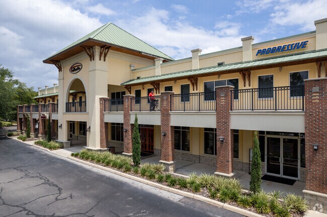
Property Record
361 Nw 39Th Rd, Gainesville, FL 32607


Property Detail
361 Nw 39Th Rd
06501-006-000
COM NW COR SEC RUN E 3310.83 FT S 1622.70 FT W 719.13 FT POB S 934.64 FT N 67 DEG W 386.20 FT N 22 DEG E 25.00 FT N 67 DEG W 20 FT S 22 DEG W 25.00 FT N 67 DEG W 125.78 FT N 3 DEG E 154.08 FT N 67 DEG W 158.00 FT S 79 DEG W 156.97 FT N 38 DEG W 275.9
Regionalshoppingcenterormallwithanchorstore
ALACHUA
PD
Florida
A Areas with a 1% annual chance of flooding and a 26% chance of flooding over the life of a 30-year mortgage.
12.71 AC
2025
West Gainesville
2025
Other Market Areas
002217
Gainesville, FL
101,498 SF
NEARBY LISTINGS FOR SALE OR LEASE
DEMOGRAPHICS near 361 Nw 39Th Rd
1 mile
3 mile
5 mile
2025 Total Population
6,524
106,642
189,929
2030 Population
6,812
110,093
196,414
Pop Growth 2025-2030
+ 4.41%
+ 3.24%
+ 3.41%
Average Age
36
33
35
2025 Total Households
3,057
42,063
78,170
HH Growth 2025-2030
+ 5.20%
+ 3.78%
+ 3.93%
Median Household Inc
$55,266
$47,804
$56,060
Avg Household Size
2.10
2.10
2.20
2025 Avg HH Vehicles
2.00
2.00
2.00
Median Home Value
$292,656
$319,477
$315,705
Median Year Built
1973
1985
1985
Nearby Places
Map Layers
Map Styles
 Street
 Aerial
Layers
 Traffic
 Biking
Places
Listings with unknown addresses are not visible on the map
- Restaurants
- Banks
- Shops
- Fitness
- Groceries
PUBLIC TRANSPORTATION
AIRPORT
Gainesville Regional
Drive
Walk
Distance
Gainesville Regional
22 min
10.4 mi
Freight Ports
Jacksonville Port
Drive
Walk
Distance
Jacksonville Port
107 min
80.2 mi
SALE & LEASE HISTORY
LISTING DATE
SALE/LEASE

Nov 04, 2016
For Lease
Nearby Properties
Address
Land Use
TOTAL SIZE
Lot Size
Zoning
Address
Land Use
TOTAL SIZE
Lot Size
Zoning
3,617,778 SF
276.74 AC
ED
Address
Land Use
TOTAL SIZE
Lot Size
Zoning
790,340 SF
526 AC
ED
Address
Land Use
TOTAL SIZE
Lot Size
Zoning
698,640 SF
24.04 AC
U9
Address
Land Use
TOTAL SIZE
Lot Size
Zoning
108,640 SF
20 AC
ED
Address
Land Use
TOTAL SIZE
Lot Size
Zoning
17.87 AC
ED
Address
Land Use
TOTAL SIZE
Lot Size
Zoning
382,760 SF
109.58 AC
MD
Address
Land Use
TOTAL SIZE
Lot Size
Zoning
430,590 SF
16.95 AC
ED
Address
Land Use
TOTAL SIZE
Lot Size
Zoning
682,400 SF
20 AC
ED
Address
Land Use
TOTAL SIZE
Lot Size
Zoning
959,910 SF
2.50 AC
PD
Address
Land Use
TOTAL SIZE
Lot Size
Zoning
399,130 SF
18.13 AC
ED
Address
Land Use
TOTAL SIZE
Lot Size
Zoning
1,005,666 SF
11.60 AC
MD
Address
Land Use
TOTAL SIZE
Lot Size
Zoning
20.95 AC
MD
Address
Land Use
TOTAL SIZE
Lot Size
Zoning
416,200 SF
20 AC
ED
Address
Land Use
TOTAL SIZE
Lot Size
Zoning
334,819 SF
1.79 AC
U9
Address
Land Use
TOTAL SIZE
Lot Size
Zoning
325,519 SF
1.25 AC
U8
Address
Land Use
TOTAL SIZE
Lot Size
Zoning
582,311 SF
20 AC
ED
Address
Land Use
TOTAL SIZE
Lot Size
Zoning
348,458 SF
81.44 AC
ED
Address
Land Use
TOTAL SIZE
Lot Size
Zoning
372,990 SF
20 AC
ED
Address
Land Use
TOTAL SIZE
Lot Size
Zoning
357,020 SF
20 AC
ED
Address
Land Use
TOTAL SIZE
Lot Size
Zoning
508,106 SF
27.40 AC
PD
Address
Land Use
TOTAL SIZE
Lot Size
Zoning
233,910 SF
3.64 AC
PD
Address
Land Use
TOTAL SIZE
Lot Size
Zoning
571,635 SF
55.49 AC
RMF6
Address
Land Use
TOTAL SIZE
Lot Size
Zoning
392,241 SF
25 AC
U9
Address
Land Use
TOTAL SIZE
Lot Size
Zoning
271,079 SF
0.94 AC
PD
Address
Land Use
TOTAL SIZE
Lot Size
Zoning
279,647 SF
1.66 AC
PD
Address
Land Use
TOTAL SIZE
Lot Size
Zoning
117,563 SF
1.61 AC
U8
Address
Land Use
TOTAL SIZE
Lot Size
Zoning
362,539 SF
2.11 AC
U8
Address
Land Use
TOTAL SIZE
Lot Size
Zoning
414,780 SF
1.99 AC
PD
Address
Land Use
TOTAL SIZE
Lot Size
Zoning
299,737 SF
1.14 AC
DT
Address
Land Use
TOTAL SIZE
Lot Size
Zoning
392,472 SF
11.38 AC
U9
The World's #1 Commercial Real Estate Marketplace
Connect with us
© 2026 CoStar Group
The information above has been obtained from sources believed reliable. While we do not doubt its accuracy we have not verified it and make no guarantee, warranty or representation about it. It is your responsibility to independently confirm its accuracy and completeness. Any projections, opinions, assumptions, or estimates used are for example only and do not represent the current or future performance of the property. The value of this transaction to you depends on tax and other factors which should be evaluated by your tax, financial, and legal advisors. You and your advisors should conduct a careful, independent investigation of the property to determine to your satisfaction the suitability of the property for your needs.