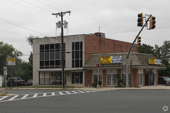
Property Record
3610 Decatur Ave, Kensington, MD 20895
Current Lease Availabilities
General Retail LEASE
$30.00 SF/YR
5,505 - 7,616 SF
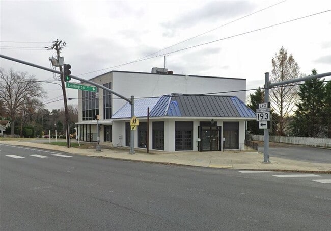
NEARBY LISTINGS FOR SALE OR LEASE
Property Detail
3610 Decatur Ave
Washington-Arlington-Alexandria, DC-VA-MD-WV
Kensington
13-01131642
NORTH KENSINGTON
Officebuilding
Montgomery
X
Maryland
24031C0365D
p13
2024
0.15 AC
2025
Kensington/Wheaton
704200
Washington, DC
6,372 SF
DEMOGRAPHICS near 3610 Decatur Ave
1 Mile
3 Mile
5 Mile
2024 Total Population
17,725
175,337
457,792
2029 Population
17,611
173,266
451,477
Pop Growth 2024-2029
(0.64%)
(1.18%)
(1.38%)
Average Age
41
40
41
2024 Total Households
6,258
63,419
175,468
HH Growth 2024-2029
(0.81%)
(1.26%)
(1.40%)
Median Household Inc
$129,699
$115,218
$113,409
Avg Household Size
2.70
2.60
2.50
2024 Avg HH Vehicles
2.00
2.00
2.00
Median Home Value
$635,514
$541,148
$630,027
Median Year Built
1957
1964
1967
Nearby Places
- Restaurants
- Banks
- Shops
- Fitness
- Groceries
PUBLIC TRANSPORTATION
COMMUTER RAIL
Kensington (BRUNSWICK - WASHINGTON - Maryland Area Regional Commuter Trains (The MARC), Brunswick Line - Maryland Area Regional Commuter Trains (The MARC))
DRIVE
WALK
Distance
Kensington (BRUNSWICK - WASHINGTON - Maryland Area Regional Commuter Trains (The MARC), Brunswick Line - Maryland Area Regional Commuter Trains (The MARC))
2 min
11 min
0.6 mi
Garrett Park (BRUNSWICK - WASHINGTON - Maryland Area Regional Commuter Trains (The MARC), Brunswick Line - Maryland Area Regional Commuter Trains (The MARC))
DRIVE
WALK
Distance
Garrett Park (BRUNSWICK - WASHINGTON - Maryland Area Regional Commuter Trains (The MARC), Brunswick Line - Maryland Area Regional Commuter Trains (The MARC))
6 min
1.9 mi
AIRPORT
Ronald Reagan Washington Ntl
DRIVE
WALK
Distance
Ronald Reagan Washington Ntl
31 min
16.0 mi
Washington Dulles International
DRIVE
WALK
Distance
Washington Dulles International
45 min
28.0 mi
Baltimore/Washington International Thurgood Marshall
DRIVE
WALK
Distance
Baltimore/Washington International Thurgood Marshall
46 min
33.2 mi
Freight Ports
Port of Baltimore
DRIVE
WALK
Distance
Port of Baltimore
50 min
36.1 mi
Nearby Properties
Address
Land Use
TOTAL SIZE
Lot Size
Zoning
Address
Land Use
TOTAL SIZE
Lot Size
Zoning
4,400,000 SF
7.92 AC
R60
Address
Land Use
TOTAL SIZE
Lot Size
Zoning
1,332,482 SF
3.79 AC
CR2.0
Address
Land Use
TOTAL SIZE
Lot Size
Zoning
775,490 SF
14.21 AC
R60
Address
Land Use
TOTAL SIZE
Lot Size
Zoning
1,775,186 SF
75.19 AC
GR1.5
Address
Land Use
TOTAL SIZE
Lot Size
Zoning
1,119,608 SF
90.30 AC
R90
Address
Land Use
TOTAL SIZE
Lot Size
Zoning
178,124 SF
11 AC
R60
Address
Land Use
TOTAL SIZE
Lot Size
Zoning
515,000 SF
5.23 AC
CR1.5
Address
Land Use
TOTAL SIZE
Lot Size
Zoning
432,000 SF
1.77 AC
CR4.0
Address
Land Use
TOTAL SIZE
Lot Size
Zoning
379,100 SF
11.80 AC
CR4.0
Address
Land Use
TOTAL SIZE
Lot Size
Zoning
575,000 SF
110.35 AC
R60
Address
Land Use
TOTAL SIZE
Lot Size
Zoning
626,132 SF
7.28 AC
CR0.5
Address
Land Use
TOTAL SIZE
Lot Size
Zoning
380,452 SF
2.38 AC
CR3.0
Address
Land Use
TOTAL SIZE
Lot Size
Zoning
431,630 SF
25.77 AC
R60
Address
Land Use
TOTAL SIZE
Lot Size
Zoning
364,000 SF
CR6.0
Address
Land Use
TOTAL SIZE
Lot Size
Zoning
379,878 SF
2.13 AC
CR
Address
Land Use
TOTAL SIZE
Lot Size
Zoning
815,414 SF
3.27 AC
CR4.0
Address
Land Use
TOTAL SIZE
Lot Size
Zoning
674,400 SF
3.21 AC
CR3.0
Address
Land Use
TOTAL SIZE
Lot Size
Zoning
362,353 SF
27.72 AC
R90
Address
Land Use
TOTAL SIZE
Lot Size
Zoning
291,194 SF
0.72 AC
CR4.0
Address
Land Use
TOTAL SIZE
Lot Size
Zoning
80,359 SF
11.61 AC
CRT1.
Address
Land Use
TOTAL SIZE
Lot Size
Zoning
454,275 SF
1.12 AC
CR7.2
Address
Land Use
TOTAL SIZE
Lot Size
Zoning
465,983 SF
1.38 AC
CR3.0
Address
Land Use
TOTAL SIZE
Lot Size
Zoning
429,137 SF
1.80 AC
CR4.0
Address
Land Use
TOTAL SIZE
Lot Size
Zoning
51.89 AC
R60
Address
Land Use
TOTAL SIZE
Lot Size
Zoning
460,492 SF
3.56 AC
CR4.0
Address
Land Use
TOTAL SIZE
Lot Size
Zoning
524,982 SF
7.90 AC
R10
Address
Land Use
TOTAL SIZE
Lot Size
Zoning
291,945 SF
10.49 AC
R10
Address
Land Use
TOTAL SIZE
Lot Size
Zoning
418,657 SF
CR4.0
Address
Land Use
TOTAL SIZE
Lot Size
Zoning
4,400,000 SF
47.92 AC
R60
Address
Land Use
TOTAL SIZE
Lot Size
Zoning
276,462 SF
15.11 AC
R60
The World's #1 Commercial Real Estate Marketplace
Connect with us
© 2025 CoStar Group
The information above has been obtained from sources believed reliable. While we do not doubt its accuracy we have not verified it and make no guarantee, warranty or representation about it. It is your responsibility to independently confirm its accuracy and completeness. Any projections, opinions, assumptions, or estimates used are for example only and do not represent the current or future performance of the property. The value of this transaction to you depends on tax and other factors which should be evaluated by your tax, financial, and legal advisors. You and your advisors should conduct a careful, independent investigation of the property to determine to your satisfaction the suitability of the property for your needs.