Property Record
3610 River Rd, New Braunfels, TX 78132


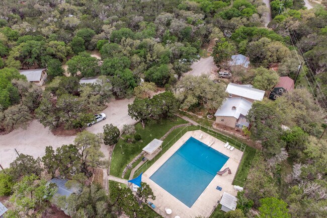
Property Detail
3610 River Rd
72-0003-0007-00
A- 3 SUR- 2 J M VERAMENDI, ACRES 20.0
Commercialnec
COMAL
AE The base floodplain where base flood elevations are provided. AE Zones are now used on new format FIRMs instead of A1-A30 Zones.
Texas
0
20 AC
2025
Comal County
310901
San Antonio
18,773 SF
San Antonio-New Braunfels, TX
NEARBY LISTINGS FOR SALE OR LEASE
DEMOGRAPHICS near 3610 River Rd
1 mile
3 mile
5 mile
2025 Total Population
143
16,734
69,546
2030 Population
171
19,842
81,944
Pop Growth 2025-2030
+ 19.58%
+ 18.57%
+ 17.83%
Average Age
45
44
41
2025 Total Households
52
6,883
27,760
HH Growth 2025-2030
+ 21.15%
+ 18.60%
+ 17.92%
Median Household Inc
$120,833
$87,715
$86,993
Avg Household Size
2.80
2.40
2.40
2025 Avg HH Vehicles
3.00
2.00
2.00
Median Home Value
$829,545
$590,670
$450,984
Median Year Built
2006
2003
2005
Nearby Places
Map Layers
Map Styles
 Street
 Aerial
Layers
 Traffic
 Biking
Places
Listings with unknown addresses are not visible on the map
- Restaurants
- Banks
- Shops
- Fitness
- Groceries
PUBLIC TRANSPORTATION
AIRPORT
San Antonio International
Drive
Walk
Distance
San Antonio International
42 min
31.3 mi
Freight Ports
Calhoun Port
Drive
Walk
Distance
Calhoun Port
177 min
148.3 mi
SALE & LEASE HISTORY
LISTING DATE
SALE/LEASE

Apr 23, 2023
For Sale
Nearby Properties
Address
Land Use
TOTAL SIZE
Lot Size
Zoning
Address
Land Use
TOTAL SIZE
Lot Size
Zoning
350,595 SF
21.78 AC
Address
Land Use
TOTAL SIZE
Lot Size
Zoning
304,097 SF
14.98 AC
Address
Land Use
TOTAL SIZE
Lot Size
Zoning
251,498 SF
8.63 AC
Address
Land Use
TOTAL SIZE
Lot Size
Zoning
325,518 SF
12.97 AC
Address
Land Use
TOTAL SIZE
Lot Size
Zoning
225,158 SF
52.63 AC
Address
Land Use
TOTAL SIZE
Lot Size
Zoning
271,410 SF
13.13 AC
Address
Land Use
TOTAL SIZE
Lot Size
Zoning
229,773 SF
11.18 AC
Address
Land Use
TOTAL SIZE
Lot Size
Zoning
282,995 SF
21.83 AC
Address
Land Use
TOTAL SIZE
Lot Size
Zoning
238,683 SF
9.42 AC
Address
Land Use
TOTAL SIZE
Lot Size
Zoning
102,856 SF
16.06 AC
Address
Land Use
TOTAL SIZE
Lot Size
Zoning
88,620 SF
10.11 AC
Address
Land Use
TOTAL SIZE
Lot Size
Zoning
152,240 SF
14.13 AC
Address
Land Use
TOTAL SIZE
Lot Size
Zoning
170,019 SF
4.46 AC
Address
Land Use
TOTAL SIZE
Lot Size
Zoning
105,976 SF
30.86 AC
Address
Land Use
TOTAL SIZE
Lot Size
Zoning
179,869 SF
10 AC
Address
Land Use
TOTAL SIZE
Lot Size
Zoning
105,729 SF
12.66 AC
Address
Land Use
TOTAL SIZE
Lot Size
Zoning
165,768 SF
15.39 AC
Address
Land Use
TOTAL SIZE
Lot Size
Zoning
117,201 SF
4.72 AC
Address
Land Use
TOTAL SIZE
Lot Size
Zoning
122,247 SF
5.75 AC
Address
Land Use
TOTAL SIZE
Lot Size
Zoning
120,466 SF
9.61 AC
Address
Land Use
TOTAL SIZE
Lot Size
Zoning
85,352 SF
24.20 AC
Address
Land Use
TOTAL SIZE
Lot Size
Zoning
124,384 SF
3.73 AC
Address
Land Use
TOTAL SIZE
Lot Size
Zoning
106,075 SF
4.30 AC
Address
Land Use
TOTAL SIZE
Lot Size
Zoning
43,097 SF
5.50 AC
Address
Land Use
TOTAL SIZE
Lot Size
Zoning
48,685 SF
6 AC
Address
Land Use
TOTAL SIZE
Lot Size
Zoning
95,010 SF
4.12 AC
Address
Land Use
TOTAL SIZE
Lot Size
Zoning
78,020 SF
3.93 AC
Address
Land Use
TOTAL SIZE
Lot Size
Zoning
5,161 SF
30.09 AC
Address
Land Use
TOTAL SIZE
Lot Size
Zoning
25,748 SF
3.54 AC
Address
Land Use
TOTAL SIZE
Lot Size
Zoning
65,904 SF
6 AC
The World's #1 Commercial Real Estate Marketplace
Connect with us
© 2026 CoStar Group
The information above has been obtained from sources believed reliable. While we do not doubt its accuracy we have not verified it and make no guarantee, warranty or representation about it. It is your responsibility to independently confirm its accuracy and completeness. Any projections, opinions, assumptions, or estimates used are for example only and do not represent the current or future performance of the property. The value of this transaction to you depends on tax and other factors which should be evaluated by your tax, financial, and legal advisors. You and your advisors should conduct a careful, independent investigation of the property to determine to your satisfaction the suitability of the property for your needs.