Property Record
3611 Mary Ann Point Rd, Johns Island, SC 29455

NEARBY LISTINGS FOR SALE OR LEASE
Property Detail
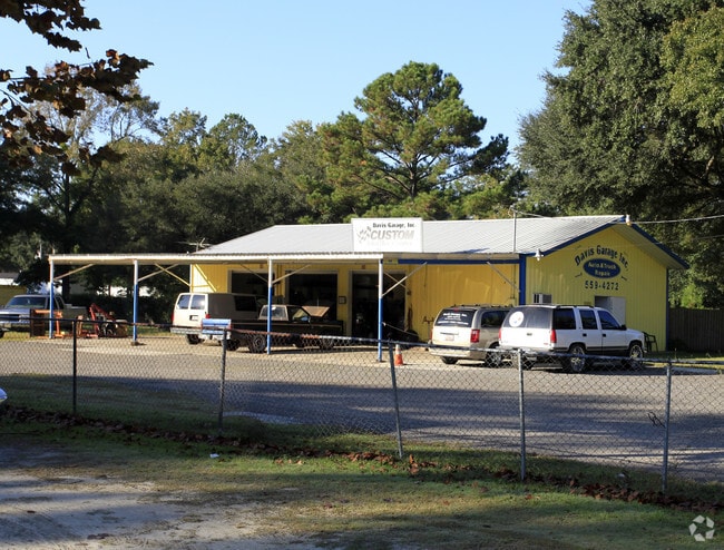
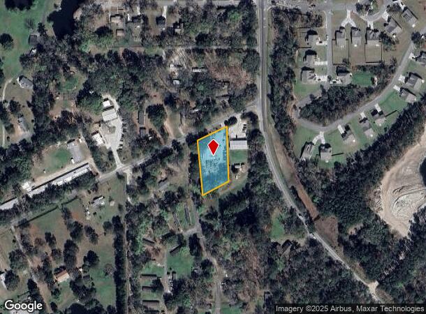
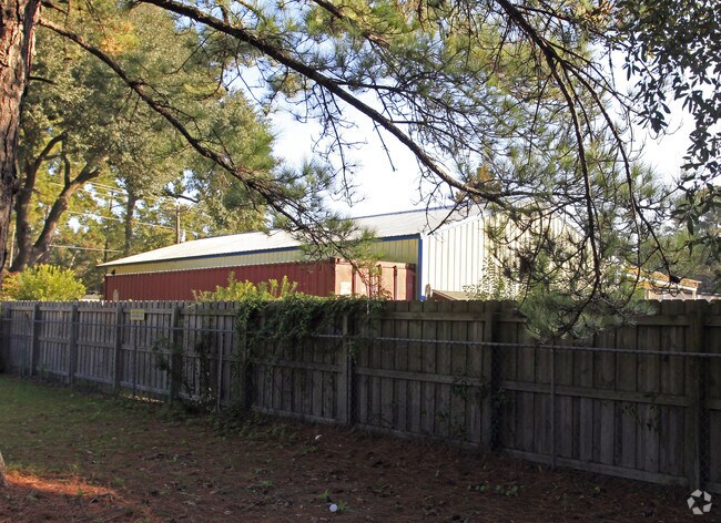
3611 Mary Ann Point Rd
Charleston-North Charleston, SC
Humbert
253-00-00-130
SUBDIVISION NAME -HUMBERT DESCRIPTION -LT 5 PT BACK PEN PLANTATION
Commercialnec
Charleston
X
South Carolina
45019C0655K
5
2025
0.69 AC
2024
West Islands
002108
Charleston/N Charleston
1,800 SF
DEMOGRAPHICS near 3611 Mary Ann Point Rd
1 Mile
3 Mile
5 Mile
2024 Total Population
967
11,510
27,590
2029 Population
1,034
12,357
29,693
Pop Growth 2024-2029
+ 6.93%
+ 7.36%
+ 7.62%
Average Age
42
41
41
2024 Total Households
370
4,615
11,346
HH Growth 2024-2029
+ 6.76%
+ 7.19%
+ 7.42%
Median Household Inc
$64,846
$91,236
$90,307
Avg Household Size
2.50
2.40
2.40
2024 Avg HH Vehicles
2.00
2.00
2.00
Median Home Value
$416,477
$364,648
$382,359
Median Year Built
1988
2001
2006
Nearby Places
Map Layers
Map Styles
 Street
 Aerial
- Restaurants
- Banks
- Shops
- Fitness
- Groceries
PUBLIC TRANSPORTATION
AIRPORT
Charleston AFB/International
DRIVE
WALK
Distance
Charleston AFB/International
33 min
19.8 mi
Freight Ports
Columbus Street Terminal
DRIVE
WALK
Distance
Columbus Street Terminal
24 min
12.7 mi
Nearby Properties
Address
Land Use
TOTAL SIZE
Lot Size
Zoning
Address
Land Use
TOTAL SIZE
Lot Size
Zoning
2,901 SF
4.76 AC
Address
Land Use
TOTAL SIZE
Lot Size
Zoning
49,853 SF
15.75 AC
Address
Land Use
TOTAL SIZE
Lot Size
Zoning
34.54 AC
Address
Land Use
TOTAL SIZE
Lot Size
Zoning
10,176 SF
3.02 AC
Address
Land Use
TOTAL SIZE
Lot Size
Zoning
960 SF
1.15 AC
Address
Land Use
TOTAL SIZE
Lot Size
Zoning
1,342 SF
7.76 AC
Address
Land Use
TOTAL SIZE
Lot Size
Zoning
2,024 SF
Address
Land Use
TOTAL SIZE
Lot Size
Zoning
10,500 SF
5.78 AC
Address
Land Use
TOTAL SIZE
Lot Size
Zoning
5,392 SF
2 AC
Address
Land Use
TOTAL SIZE
Lot Size
Zoning
943 SF
2.81 AC
Address
Land Use
TOTAL SIZE
Lot Size
Zoning
34.93 AC
Address
Land Use
TOTAL SIZE
Lot Size
Zoning
13.71 AC
Address
Land Use
TOTAL SIZE
Lot Size
Zoning
2,815 SF
5.75 AC
Address
Land Use
TOTAL SIZE
Lot Size
Zoning
60,592 SF
9.73 AC
Address
Land Use
TOTAL SIZE
Lot Size
Zoning
Address
Land Use
TOTAL SIZE
Lot Size
Zoning
900 SF
3.23 AC
Address
Land Use
TOTAL SIZE
Lot Size
Zoning
Address
Land Use
TOTAL SIZE
Lot Size
Zoning
128 SF
1.28 AC
GI
Address
Land Use
TOTAL SIZE
Lot Size
Zoning
14.87 AC
Address
Land Use
TOTAL SIZE
Lot Size
Zoning
Address
Land Use
TOTAL SIZE
Lot Size
Zoning
2,000 SF
7.64 AC
Address
Land Use
TOTAL SIZE
Lot Size
Zoning
1,248 SF
105.11 AC
Address
Land Use
TOTAL SIZE
Lot Size
Zoning
Address
Land Use
TOTAL SIZE
Lot Size
Zoning
10.50 AC
Address
Land Use
TOTAL SIZE
Lot Size
Zoning
Address
Land Use
TOTAL SIZE
Lot Size
Zoning
2,369 SF
7.08 AC
Address
Land Use
TOTAL SIZE
Lot Size
Zoning
10,448 SF
0.92 AC
Address
Land Use
TOTAL SIZE
Lot Size
Zoning
Address
Land Use
TOTAL SIZE
Lot Size
Zoning
Address
Land Use
TOTAL SIZE
Lot Size
Zoning
3,360 SF
0.89 AC
The World's #1 Commercial Real Estate Marketplace
Connect with us
© 2026 CoStar Group
The information above has been obtained from sources believed reliable. While we do not doubt its accuracy we have not verified it and make no guarantee, warranty or representation about it. It is your responsibility to independently confirm its accuracy and completeness. Any projections, opinions, assumptions, or estimates used are for example only and do not represent the current or future performance of the property. The value of this transaction to you depends on tax and other factors which should be evaluated by your tax, financial, and legal advisors. You and your advisors should conduct a careful, independent investigation of the property to determine to your satisfaction the suitability of the property for your needs.