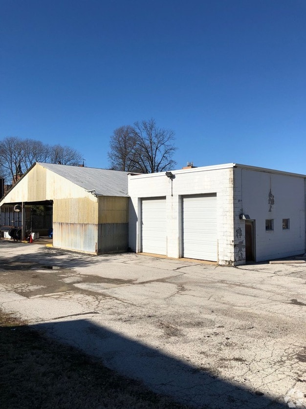
Property Record
3619 Indiana Ave, Saint Louis, MO 63118


NEARBY LISTINGS FOR SALE OR LEASE
Property Detail
3619 Indiana Ave
1653-00-0170-0
St Louis Commons Addn
Commercialnec
C. B. 1653 INDIANA 1.089 ACS OF ST LOUIS COMMONS ADDN BLK 66 BD S-217 FT 93/4 IN NNL WINNEBAGO
X
St. Louis City
2903850103C
Missouri
2024
1.03 AC
2025
St Louis City South
124300
St. Louis
3,333 SF
St. Louis, MO-IL
DEMOGRAPHICS near 3619 Indiana Ave
1 Mile
3 Mile
5 Mile
2024 Total Population
18,813
106,088
245,145
2029 Population
17,889
99,081
231,302
Pop Growth 2024-2029
(4.91%)
(6.60%)
(5.65%)
Average Age
36
38
39
2024 Total Households
8,164
49,715
117,431
HH Growth 2024-2029
(4.95%)
(6.58%)
(5.79%)
Median Household Inc
$46,546
$53,441
$53,043
Avg Household Size
2.20
2.00
2.00
2024 Avg HH Vehicles
1.00
1.00
1.00
Median Home Value
$180,049
$184,764
$177,322
Median Year Built
1945
1946
1948
Nearby Places
Map Layers
Map Styles
 Street
 Aerial
- Restaurants
- Banks
- Shops
- Fitness
- Groceries
PUBLIC TRANSPORTATION
COMMUTER RAIL
Union Station (Lambert Airport Shiloh-Scott - St. Louis MetroLink (MetroLink), Shrewsbury-Lansdowne I-44 Emerson Park - St. Louis MetroLink (MetroLink))
DRIVE
WALK
Distance
Union Station (Lambert Airport Shiloh-Scott - St. Louis MetroLink (MetroLink), Shrewsbury-Lansdowne I-44 Emerson Park - St. Louis MetroLink (MetroLink))
7 min
3.5 mi
Civic Center (Lambert Airport Shiloh-Scott - St. Louis MetroLink (MetroLink), Shrewsbury-Lansdowne I-44 Emerson Park - St. Louis MetroLink (MetroLink))
DRIVE
WALK
Distance
Civic Center (Lambert Airport Shiloh-Scott - St. Louis MetroLink (MetroLink), Shrewsbury-Lansdowne I-44 Emerson Park - St. Louis MetroLink (MetroLink))
7 min
3.8 mi
AIRPORT
St Louis Lambert International
DRIVE
WALK
Distance
St Louis Lambert International
28 min
18.5 mi
Scott AFB/Midamerica St Louis
DRIVE
WALK
Distance
Scott AFB/Midamerica St Louis
44 min
28.7 mi
Freight Ports
Port Milwaukee
DRIVE
WALK
Distance
Port Milwaukee
423 min
373.0 mi
SALE & LEASE HISTORY
LISTING DATE
SALE/LEASE

Nov 12, 2020
For Lease
Feb 13, 2019
For Sale
Nearby Properties
Address
Land Use
TOTAL SIZE
Lot Size
Zoning
Address
Land Use
TOTAL SIZE
Lot Size
Zoning
1,037,632 SF
3.34 AC
I
Address
Land Use
TOTAL SIZE
Lot Size
Zoning
1.72 AC
I
Address
Land Use
TOTAL SIZE
Lot Size
Zoning
1.71 AC
I
Address
Land Use
TOTAL SIZE
Lot Size
Zoning
229.57 AC
B
Address
Land Use
TOTAL SIZE
Lot Size
Zoning
10.97 AC
I
Address
Land Use
TOTAL SIZE
Lot Size
Zoning
177.77 AC
A
Address
Land Use
TOTAL SIZE
Lot Size
Zoning
7.38 AC
I
Address
Land Use
TOTAL SIZE
Lot Size
Zoning
1,089,750 SF
8.43 AC
I
Address
Land Use
TOTAL SIZE
Lot Size
Zoning
246,345 SF
4.17 AC
J
Address
Land Use
TOTAL SIZE
Lot Size
Zoning
1.98 AC
H
Address
Land Use
TOTAL SIZE
Lot Size
Zoning
360,580 SF
26.13 AC
KJ
Address
Land Use
TOTAL SIZE
Lot Size
Zoning
303,680 SF
2.09 AC
I
Address
Land Use
TOTAL SIZE
Lot Size
Zoning
192,892 SF
4.44 AC
I
Address
Land Use
TOTAL SIZE
Lot Size
Zoning
264,261 SF
0.54 AC
I
Address
Land Use
TOTAL SIZE
Lot Size
Zoning
628,939 SF
2.73 AC
J
Address
Land Use
TOTAL SIZE
Lot Size
Zoning
278,272 SF
6.81 AC
I
Address
Land Use
TOTAL SIZE
Lot Size
Zoning
256,400 SF
3.67 AC
H
Address
Land Use
TOTAL SIZE
Lot Size
Zoning
2.03 AC
HC
Address
Land Use
TOTAL SIZE
Lot Size
Zoning
275,012 SF
4.39 AC
C
Address
Land Use
TOTAL SIZE
Lot Size
Zoning
467,800 SF
1.30 AC
K
Address
Land Use
TOTAL SIZE
Lot Size
Zoning
5.28 AC
I
Address
Land Use
TOTAL SIZE
Lot Size
Zoning
220,982 SF
2.83 AC
HB
Address
Land Use
TOTAL SIZE
Lot Size
Zoning
186,194 SF
0.47 AC
I
Address
Land Use
TOTAL SIZE
Lot Size
Zoning
393,003 SF
4.09 AC
G
Address
Land Use
TOTAL SIZE
Lot Size
Zoning
39,863 SF
5.83 AC
H
Address
Land Use
TOTAL SIZE
Lot Size
Zoning
8.21 AC
I
Address
Land Use
TOTAL SIZE
Lot Size
Zoning
281,048 SF
1.58 AC
I
Address
Land Use
TOTAL SIZE
Lot Size
Zoning
4.15 AC
K
Address
Land Use
TOTAL SIZE
Lot Size
Zoning
307,048 SF
4.59 AC
JK
Address
Land Use
TOTAL SIZE
Lot Size
Zoning
287,782 SF
21.01 AC
JK
The World's #1 Commercial Real Estate Marketplace
Connect with us
© 2026 CoStar Group
The information above has been obtained from sources believed reliable. While we do not doubt its accuracy we have not verified it and make no guarantee, warranty or representation about it. It is your responsibility to independently confirm its accuracy and completeness. Any projections, opinions, assumptions, or estimates used are for example only and do not represent the current or future performance of the property. The value of this transaction to you depends on tax and other factors which should be evaluated by your tax, financial, and legal advisors. You and your advisors should conduct a careful, independent investigation of the property to determine to your satisfaction the suitability of the property for your needs.