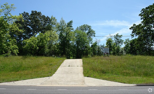
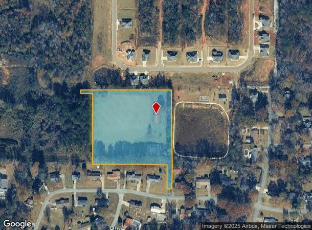
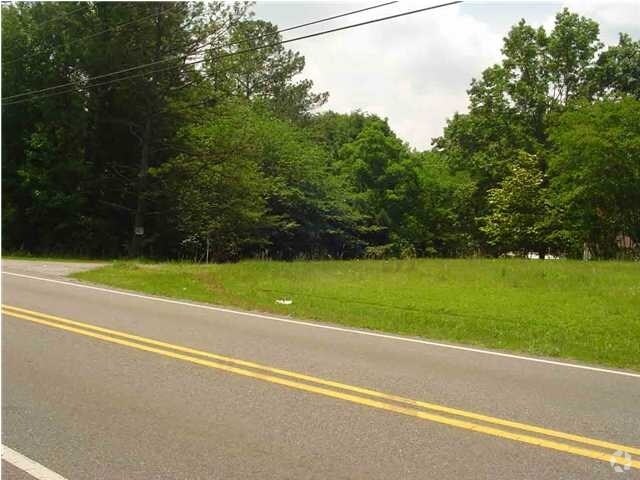
Property Record
3619 Knollwood Dr, Anniston, AL 36207
NEARBY LISTINGS FOR SALE OR LEASE
Property Detail
3619 Knollwood Dr
Anniston-Oxford-Jacksonville, AL
Springdale
21-05-15-0-001-020.000
SEC 15 TSP 16S RNG 8E BEG @ NW COR LOT 1 BLK FIRST ADD TO SPRING VALLEY SUBD TH S 134 W 30 N 150 W 473 N 465 W 75 N 20 E 578
Realpropertynec
Calhoun
X
Alabama
01015C0318E
1
2025
17.90 AC
2025
Gadsden/Anniston Area
001000
Other Market Areas
2,353 SF
DEMOGRAPHICS near 3619 Knollwood Dr
1 Mile
3 Mile
5 Mile
2024 Total Population
2,382
16,392
38,882
2029 Population
2,320
16,135
38,627
Pop Growth 2024-2029
(2.60%)
(1.57%)
(0.66%)
Average Age
48
43
42
2024 Total Households
1,023
6,988
16,175
HH Growth 2024-2029
(2.74%)
(1.75%)
(0.70%)
Median Household Inc
$78,462
$53,171
$43,537
Avg Household Size
2.20
2.20
2.20
2024 Avg HH Vehicles
2.00
2.00
2.00
Median Home Value
$184,772
$168,420
$141,927
Median Year Built
1978
1975
1973
Nearby Places
Map Layers
Map Styles
 Street
 Aerial
- Restaurants
- Banks
- Shops
- Fitness
- Groceries
PUBLIC TRANSPORTATION
COMMUTER RAIL
Anniston Amtrak Station (Crescent - Amtrak)
DRIVE
WALK
Distance
Anniston Amtrak Station (Crescent - Amtrak)
9 min
4.7 mi
Freight Ports
Port of Panama City
DRIVE
WALK
Distance
Port of Panama City
364 min
294.2 mi
Nearby Properties
Address
Land Use
TOTAL SIZE
Lot Size
Zoning
Address
Land Use
TOTAL SIZE
Lot Size
Zoning
319,650 SF
10.69 AC
Address
Land Use
TOTAL SIZE
Lot Size
Zoning
45,466 SF
18 AC
Address
Land Use
TOTAL SIZE
Lot Size
Zoning
12,496 SF
7.39 AC
Address
Land Use
TOTAL SIZE
Lot Size
Zoning
23,480 SF
14 AC
Address
Land Use
TOTAL SIZE
Lot Size
Zoning
73,027 SF
1.60 AC
Address
Land Use
TOTAL SIZE
Lot Size
Zoning
5.32 AC
Address
Land Use
TOTAL SIZE
Lot Size
Zoning
126,689 SF
8.49 AC
Address
Land Use
TOTAL SIZE
Lot Size
Zoning
18.90 AC
Address
Land Use
TOTAL SIZE
Lot Size
Zoning
17,254 SF
22 AC
Address
Land Use
TOTAL SIZE
Lot Size
Zoning
4,356 SF
60.40 AC
Address
Land Use
TOTAL SIZE
Lot Size
Zoning
1,335 SF
76 AC
Address
Land Use
TOTAL SIZE
Lot Size
Zoning
138,072 SF
11.60 AC
Address
Land Use
TOTAL SIZE
Lot Size
Zoning
341,374 SF
15.88 AC
Address
Land Use
TOTAL SIZE
Lot Size
Zoning
74,927 SF
2.47 AC
Address
Land Use
TOTAL SIZE
Lot Size
Zoning
346,532 SF
41 AC
Address
Land Use
TOTAL SIZE
Lot Size
Zoning
64,772 SF
2.56 AC
Address
Land Use
TOTAL SIZE
Lot Size
Zoning
160,000 SF
21 AC
Address
Land Use
TOTAL SIZE
Lot Size
Zoning
56,520 SF
2.51 AC
Address
Land Use
TOTAL SIZE
Lot Size
Zoning
4,366 SF
0.97 AC
Address
Land Use
TOTAL SIZE
Lot Size
Zoning
76,250 SF
14.60 AC
Address
Land Use
TOTAL SIZE
Lot Size
Zoning
4,030 SF
11.20 AC
Address
Land Use
TOTAL SIZE
Lot Size
Zoning
102,436 SF
12.52 AC
Address
Land Use
TOTAL SIZE
Lot Size
Zoning
534,926 SF
21.75 AC
Address
Land Use
TOTAL SIZE
Lot Size
Zoning
Address
Land Use
TOTAL SIZE
Lot Size
Zoning
54,232 SF
2.27 AC
Address
Land Use
TOTAL SIZE
Lot Size
Zoning
47,700 SF
Address
Land Use
TOTAL SIZE
Lot Size
Zoning
50,180 SF
7.60 AC
Address
Land Use
TOTAL SIZE
Lot Size
Zoning
135,128 SF
10.01 AC
Address
Land Use
TOTAL SIZE
Lot Size
Zoning
3.67 AC
Address
Land Use
TOTAL SIZE
Lot Size
Zoning
86,508 SF
20 AC
The World's #1 Commercial Real Estate Marketplace
Connect with us
© 2025 CoStar Group
The information above has been obtained from sources believed reliable. While we do not doubt its accuracy we have not verified it and make no guarantee, warranty or representation about it. It is your responsibility to independently confirm its accuracy and completeness. Any projections, opinions, assumptions, or estimates used are for example only and do not represent the current or future performance of the property. The value of this transaction to you depends on tax and other factors which should be evaluated by your tax, financial, and legal advisors. You and your advisors should conduct a careful, independent investigation of the property to determine to your satisfaction the suitability of the property for your needs.