Property Record
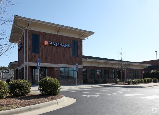
3619 Rogers Rd, Wake Forest, NC 27587


NEARBY LISTINGS FOR SALE OR LEASE
Property Detail
3619 Rogers Rd
Raleigh-Cary, NC
Heritage Square Sub
1749.02-69-8495-000
LOL-130 HERITAGE SQUARE SUB BM2004-821
Financialbuilding
Wake
X
North Carolina
3720174900K
l-13
0
1.40 AC
2025
Route 1
054222
Raleigh/Durham
4,172 SF
DEMOGRAPHICS near 3619 Rogers Rd
1 Mile
3 Mile
5 Mile
2024 Total Population
9,216
58,392
118,209
2029 Population
10,087
63,917
129,386
Pop Growth 2024-2029
+ 9.45%
+ 9.46%
+ 9.46%
Average Age
39
38
39
2024 Total Households
3,311
20,842
42,854
HH Growth 2024-2029
+ 9.45%
+ 9.43%
+ 9.45%
Median Household Inc
$118,842
$110,789
$106,256
Avg Household Size
2.80
2.70
2.70
2024 Avg HH Vehicles
2.00
2.00
2.00
Median Home Value
$404,528
$384,296
$370,819
Median Year Built
2008
2007
2005
Nearby Places
Map Layers
Map Styles
 Street
 Aerial
- Restaurants
- Banks
- Shops
- Fitness
- Groceries
PUBLIC TRANSPORTATION
AIRPORT
Raleigh-Durham International
DRIVE
WALK
Distance
Raleigh-Durham International
32 min
20.7 mi
SALE & LEASE HISTORY
LISTING DATE
SALE/LEASE

Jan 10, 2023
For Lease
Feb 24, 2021
For Sale
Nearby Properties
Address
Land Use
TOTAL SIZE
Lot Size
Zoning
Address
Land Use
TOTAL SIZE
Lot Size
Zoning
378,421 SF
19.06 AC
RMX
Address
Land Use
TOTAL SIZE
Lot Size
Zoning
283,870 SF
11.39 AC
RMX
Address
Land Use
TOTAL SIZE
Lot Size
Zoning
362,583 SF
26.53 AC
RX-3
Address
Land Use
TOTAL SIZE
Lot Size
Zoning
383,266 SF
52.30 AC
CX-3
Address
Land Use
TOTAL SIZE
Lot Size
Zoning
442,480 SF
52.02 AC
GR3
Address
Land Use
TOTAL SIZE
Lot Size
Zoning
323,530 SF
37.96 AC
RX-3
Address
Land Use
TOTAL SIZE
Lot Size
Zoning
306,712 SF
14.03 AC
PUD
Address
Land Use
TOTAL SIZE
Lot Size
Zoning
263,777 SF
93.84 AC
GR3
Address
Land Use
TOTAL SIZE
Lot Size
Zoning
232,734 SF
57.28 AC
GR3
Address
Land Use
TOTAL SIZE
Lot Size
Zoning
306,050 SF
30.45 AC
GR10
Address
Land Use
TOTAL SIZE
Lot Size
Zoning
194,593 SF
13.09 AC
CX-3
Address
Land Use
TOTAL SIZE
Lot Size
Zoning
188,828 SF
19.91 AC
OX-3
Address
Land Use
TOTAL SIZE
Lot Size
Zoning
243,797 SF
22.57 AC
GR10
Address
Land Use
TOTAL SIZE
Lot Size
Zoning
248,945 SF
16.41 AC
GR10
Address
Land Use
TOTAL SIZE
Lot Size
Zoning
225,390 SF
14.95 AC
GR10
Address
Land Use
TOTAL SIZE
Lot Size
Zoning
283,795 SF
31.33 AC
ICD
Address
Land Use
TOTAL SIZE
Lot Size
Zoning
227,653 SF
10.84 AC
TC
Address
Land Use
TOTAL SIZE
Lot Size
Zoning
162,909 SF
9.84 AC
RMX
Address
Land Use
TOTAL SIZE
Lot Size
Zoning
196,091 SF
37.21 AC
RL
Address
Land Use
TOTAL SIZE
Lot Size
Zoning
136,644 SF
4.38 AC
RMX
Address
Land Use
TOTAL SIZE
Lot Size
Zoning
186,546 SF
6.84 AC
RMX
Address
Land Use
TOTAL SIZE
Lot Size
Zoning
166,192 SF
13.59 AC
GR10
Address
Land Use
TOTAL SIZE
Lot Size
Zoning
143,060 SF
7.19 AC
RMX
Address
Land Use
TOTAL SIZE
Lot Size
Zoning
109,190 SF
1.46 AC
CX-5
Address
Land Use
TOTAL SIZE
Lot Size
Zoning
139,600 SF
23.64 AC
LI
Address
Land Use
TOTAL SIZE
Lot Size
Zoning
170,334 SF
23.99 AC
GR10
Address
Land Use
TOTAL SIZE
Lot Size
Zoning
104,919 SF
29.07 AC
GR3
Address
Land Use
TOTAL SIZE
Lot Size
Zoning
154,602 SF
40 AC
ICD
Address
Land Use
TOTAL SIZE
Lot Size
Zoning
137,650 SF
36.63 AC
GR5
Address
Land Use
TOTAL SIZE
Lot Size
Zoning
84,528 SF
14.44 AC
NB
The World's #1 Commercial Real Estate Marketplace
Connect with us
© 2026 CoStar Group
The information above has been obtained from sources believed reliable. While we do not doubt its accuracy we have not verified it and make no guarantee, warranty or representation about it. It is your responsibility to independently confirm its accuracy and completeness. Any projections, opinions, assumptions, or estimates used are for example only and do not represent the current or future performance of the property. The value of this transaction to you depends on tax and other factors which should be evaluated by your tax, financial, and legal advisors. You and your advisors should conduct a careful, independent investigation of the property to determine to your satisfaction the suitability of the property for your needs.