Property Record
3619 S Shepherd Dr, Houston, TX 77098


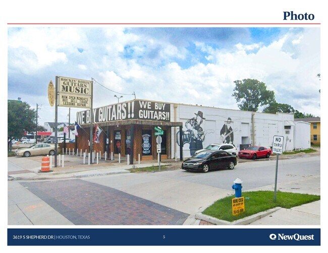
This Property Is For Sale
Property Detail
3619 S Shepherd Dr
0540580000005
TRS 5 6A 7A & 8A BLK B ALBEMARLE PLACE
Storebuilding
HARRIS
B and X Area of moderate flood hazard, usually the area between the limits of the 100-year and 500-year floods.
Texas
2024
0.22 AC
2025
Inner Loop River Oaks
410900
Houston
6,000 SF
Houston-Pasadena-The Woodlands, TX
NEARBY LISTINGS FOR SALE OR LEASE
DEMOGRAPHICS near 3619 S Shepherd Dr
1 mile
3 mile
5 mile
2025 Total Population
30,714
235,778
565,830
2030 Population
33,140
255,495
612,005
Pop Growth 2025-2030
+ 7.90%
+ 8.36%
+ 8.16%
Average Age
40
39
38
2025 Total Households
16,893
123,998
267,688
HH Growth 2025-2030
+ 8.14%
+ 8.76%
+ 8.68%
Median Household Inc
$117,823
$105,501
$90,413
Avg Household Size
1.80
1.80
2.00
2025 Avg HH Vehicles
2.00
2.00
1.00
Median Home Value
$866,896
$693,420
$591,556
Median Year Built
1994
2001
1995
Nearby Places
Map Layers
Map Styles
 Street
 Aerial
Layers
 Traffic
 Biking
Places
Listings with unknown addresses are not visible on the map
- Restaurants
- Banks
- Shops
- Fitness
- Groceries
PUBLIC TRANSPORTATION
COMMUTER RAIL
Drive
Walk
Distance
9 min
5.0 mi
AIRPORT
William P Hobby
Drive
Walk
Distance
William P Hobby
26 min
14.6 mi
George Bush Intcntl/Houston
Drive
Walk
Distance
George Bush Intcntl/Houston
31 min
23.2 mi
Freight Ports
Port of Houston
Drive
Walk
Distance
Port of Houston
23 min
13.9 mi
Nearby Properties
Address
Land Use
TOTAL SIZE
Lot Size
Zoning
Address
Land Use
TOTAL SIZE
Lot Size
Zoning
519,409 SF
1.52 AC
Address
Land Use
TOTAL SIZE
Lot Size
Zoning
1,252,274 SF
2.02 AC
Address
Land Use
TOTAL SIZE
Lot Size
Zoning
716,631 SF
7.04 AC
Address
Land Use
TOTAL SIZE
Lot Size
Zoning
1,880,742 SF
20.77 AC
Address
Land Use
TOTAL SIZE
Lot Size
Zoning
1,232,364 SF
1.49 AC
Address
Land Use
TOTAL SIZE
Lot Size
Zoning
4,169,721 SF
31.23 AC
Address
Land Use
TOTAL SIZE
Lot Size
Zoning
2,005,097 SF
1.44 AC
Address
Land Use
TOTAL SIZE
Lot Size
Zoning
1,374,271 SF
1.44 AC
Address
Land Use
TOTAL SIZE
Lot Size
Zoning
1,150,681 SF
1.17 AC
Address
Land Use
TOTAL SIZE
Lot Size
Zoning
704,249 SF
2.34 AC
Address
Land Use
TOTAL SIZE
Lot Size
Zoning
1,282,908 SF
2.74 AC
Address
Land Use
TOTAL SIZE
Lot Size
Zoning
555,351 SF
1.40 AC
Address
Land Use
TOTAL SIZE
Lot Size
Zoning
1,044,305 SF
3.16 AC
Address
Land Use
TOTAL SIZE
Lot Size
Zoning
1,359,194 SF
Address
Land Use
TOTAL SIZE
Lot Size
Zoning
565,276 SF
1.35 AC
Address
Land Use
TOTAL SIZE
Lot Size
Zoning
644,352 SF
8.05 AC
Address
Land Use
TOTAL SIZE
Lot Size
Zoning
402,467 SF
28.30 AC
Address
Land Use
TOTAL SIZE
Lot Size
Zoning
930,730 SF
1.89 AC
Address
Land Use
TOTAL SIZE
Lot Size
Zoning
567,282 SF
2.40 AC
Address
Land Use
TOTAL SIZE
Lot Size
Zoning
1,009,859 SF
28.73 AC
Address
Land Use
TOTAL SIZE
Lot Size
Zoning
748,071 SF
4.13 AC
Address
Land Use
TOTAL SIZE
Lot Size
Zoning
1,075,210 SF
2.26 AC
Address
Land Use
TOTAL SIZE
Lot Size
Zoning
771,702 SF
2.51 AC
Address
Land Use
TOTAL SIZE
Lot Size
Zoning
265,878 SF
2.23 AC
Address
Land Use
TOTAL SIZE
Lot Size
Zoning
743,548 SF
3.40 AC
Address
Land Use
TOTAL SIZE
Lot Size
Zoning
464,134 SF
3.57 AC
Address
Land Use
TOTAL SIZE
Lot Size
Zoning
408,475 SF
1.05 AC
Address
Land Use
TOTAL SIZE
Lot Size
Zoning
701,043 SF
4.69 AC
Address
Land Use
TOTAL SIZE
Lot Size
Zoning
871,650 SF
0.62 AC
Address
Land Use
TOTAL SIZE
Lot Size
Zoning
406,032 SF
2.74 AC
The World's #1 Commercial Real Estate Marketplace
Connect with us
© 2026 CoStar Group
The information above has been obtained from sources believed reliable. While we do not doubt its accuracy we have not verified it and make no guarantee, warranty or representation about it. It is your responsibility to independently confirm its accuracy and completeness. Any projections, opinions, assumptions, or estimates used are for example only and do not represent the current or future performance of the property. The value of this transaction to you depends on tax and other factors which should be evaluated by your tax, financial, and legal advisors. You and your advisors should conduct a careful, independent investigation of the property to determine to your satisfaction the suitability of the property for your needs.