Property Record
3619 Se 6Th St, Topeka, KS 66607
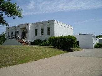


Property Detail
3619 Se 6Th St
132-03-0-10-01-003-000
S03, T12, R16, BEG NE COR OF NW 1/4 OF NE 1/4, S 40 TO POB, S 563(S), W 479, N 563(S) , E 479 TO POB LESS ROW
Industrialgeneral
Shawnee
I1,RR1
Kansas
B and X Area of moderate flood hazard, usually the area between the limits of the 100-year and 500-year floods.
5.71 AC
2024
Topeka
2025
Kansas City
003100
Topeka, KS
37,993 SF
NEARBY LISTINGS FOR SALE OR LEASE
DEMOGRAPHICS near 3619 Se 6Th St
1 mile
3 mile
5 mile
2025 Total Population
3,315
31,489
82,625
2030 Population
3,373
31,596
83,343
Pop Growth 2025-2030
+ 1.75%
+ 0.34%
+ 0.87%
Average Age
38
39
39
2025 Total Households
918
11,709
32,721
HH Growth 2025-2030
+ 2.29%
+ 0.32%
+ 0.99%
Median Household Inc
$64,087
$49,473
$51,518
Avg Household Size
2.50
2.50
2.30
2025 Avg HH Vehicles
2.00
2.00
2.00
Median Home Value
$72,107
$115,041
$120,585
Median Year Built
1962
1962
1960
Nearby Places
Map Layers
Map Styles
 Street
 Aerial
Transit
 Traffic
 Biking
Places
Listings with unknown addresses are not visible on the map
- Restaurants
- Banks
- Shops
- Fitness
- Groceries
PUBLIC TRANSPORTATION
COMMUTER RAIL
Drive
Walk
Distance
5 min
2.9 mi
Nearby Properties
Address
Land Use
TOTAL SIZE
Lot Size
Zoning
Address
Land Use
TOTAL SIZE
Lot Size
Zoning
65,687 SF
7.47 AC
C2,I1,M2
Address
Land Use
TOTAL SIZE
Lot Size
Zoning
181,781 SF
569.17 AC
R1
Address
Land Use
TOTAL SIZE
Lot Size
Zoning
127,947 SF
7.12 AC
C5
Address
Land Use
TOTAL SIZE
Lot Size
Zoning
101,766 SF
2.39 AC
C5,I1
Address
Land Use
TOTAL SIZE
Lot Size
Zoning
101,166 SF
3.31 AC
C5
Address
Land Use
TOTAL SIZE
Lot Size
Zoning
161,335 SF
37.32 AC
R1
Address
Land Use
TOTAL SIZE
Lot Size
Zoning
92,118 SF
10.87 AC
R2
Address
Land Use
TOTAL SIZE
Lot Size
Zoning
61,680 SF
2.20 AC
C5
Address
Land Use
TOTAL SIZE
Lot Size
Zoning
188,606 SF
8.42 AC
I1
Address
Land Use
TOTAL SIZE
Lot Size
Zoning
51,514 SF
1.87 AC
I2
Address
Land Use
TOTAL SIZE
Lot Size
Zoning
50,453 SF
14.29 AC
PUD,M2
Address
Land Use
TOTAL SIZE
Lot Size
Zoning
69,020 SF
26.47 AC
RR1
Address
Land Use
TOTAL SIZE
Lot Size
Zoning
47,037 SF
8 AC
R2
Address
Land Use
TOTAL SIZE
Lot Size
Zoning
34,310 SF
6.01 AC
OI2
Address
Land Use
TOTAL SIZE
Lot Size
Zoning
60,498 SF
1.02 AC
C5
Address
Land Use
TOTAL SIZE
Lot Size
Zoning
96,600 SF
23.56 AC
R1
Address
Land Use
TOTAL SIZE
Lot Size
Zoning
28,978 SF
2.90 AC
PUD,M3
Address
Land Use
TOTAL SIZE
Lot Size
Zoning
99,149 SF
14.97 AC
PUD,M1
Address
Land Use
TOTAL SIZE
Lot Size
Zoning
44,619 SF
4.35 AC
R1,R2
Address
Land Use
TOTAL SIZE
Lot Size
Zoning
55,329 SF
19.45 AC
RR1
Address
Land Use
TOTAL SIZE
Lot Size
Zoning
24,462 SF
40.76 AC
OS1
Address
Land Use
TOTAL SIZE
Lot Size
Zoning
12,464 SF
0.35 AC
I2
Address
Land Use
TOTAL SIZE
Lot Size
Zoning
66,474 SF
9.33 AC
RR1
Address
Land Use
TOTAL SIZE
Lot Size
Zoning
35,335 SF
3.08 AC
PUD,C2
Address
Land Use
TOTAL SIZE
Lot Size
Zoning
152,960 SF
7.40 AC
I1
Address
Land Use
TOTAL SIZE
Lot Size
Zoning
204.32 AC
RR1
Address
Land Use
TOTAL SIZE
Lot Size
Zoning
6,758 SF
1.86 AC
C5
Address
Land Use
TOTAL SIZE
Lot Size
Zoning
32,268 SF
0.88 AC
Address
Land Use
TOTAL SIZE
Lot Size
Zoning
158,711 SF
27.34 AC
C4,M2,R1
Address
Land Use
TOTAL SIZE
Lot Size
Zoning
88,238 SF
32.42 AC
R1,R2
The World's #1 Commercial Real Estate Marketplace
Connect with us
© 2026 CoStar Group
The information above has been obtained from sources believed reliable. While we do not doubt its accuracy we have not verified it and make no guarantee, warranty or representation about it. It is your responsibility to independently confirm its accuracy and completeness. Any projections, opinions, assumptions, or estimates used are for example only and do not represent the current or future performance of the property. The value of this transaction to you depends on tax and other factors which should be evaluated by your tax, financial, and legal advisors. You and your advisors should conduct a careful, independent investigation of the property to determine to your satisfaction the suitability of the property for your needs.