Property Record
362 Encinitas Blvd, Encinitas, CA 92024
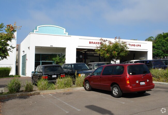

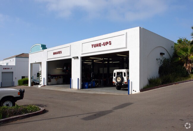
Property Detail
362 Encinitas Blvd
258-111-40
SEC 15-13-4W NWQ DOC96-353357 IN NEQ OF
Servicestation
SAN DIEGO
GC
California
B and X Area of moderate flood hazard, usually the area between the limits of the 100-year and 500-year floods.
2.20 AC
2024
Cardiff/Encinitas
2025
San Diego
017606
San Diego-Chula Vista-Carlsbad, CA
17,342 SF
NEARBY LISTINGS FOR SALE OR LEASE
DEMOGRAPHICS near 362 Encinitas Blvd
1 mile
3 mile
5 mile
2025 Total Population
14,321
70,264
138,373
2030 Population
14,488
70,715
139,313
Pop Growth 2025-2030
+ 1.17%
+ 0.64%
+ 0.68%
Average Age
43
44
44
2025 Total Households
5,714
27,662
54,432
HH Growth 2025-2030
+ 1.17%
+ 0.66%
+ 0.72%
Median Household Inc
$141,722
$163,857
$165,741
Avg Household Size
2.40
2.50
2.50
2025 Avg HH Vehicles
2.00
2.00
2.00
Median Home Value
$1,120,159
$1,115,540
$1,111,860
Median Year Built
1977
1979
1983
Nearby Places
Map Layers
Map Styles
 Street
 Aerial
Transit
 Traffic
 Biking
Places
Listings with unknown addresses are not visible on the map
- Restaurants
- Banks
- Shops
- Fitness
- Groceries
Nearby Properties
Address
Land Use
TOTAL SIZE
Lot Size
Zoning
Address
Land Use
TOTAL SIZE
Lot Size
Zoning
18.19 AC
P-C
Address
Land Use
TOTAL SIZE
Lot Size
Zoning
13.11 AC
P/SP
Address
Land Use
TOTAL SIZE
Lot Size
Zoning
30.88 AC
P-C
Address
Land Use
TOTAL SIZE
Lot Size
Zoning
4.32 AC
N-LVSC
Address
Land Use
TOTAL SIZE
Lot Size
Zoning
21.15 AC
P-C
Address
Land Use
TOTAL SIZE
Lot Size
Zoning
17.80 AC
GC
Address
Land Use
TOTAL SIZE
Lot Size
Zoning
12.44 AC
P/SP
Address
Land Use
TOTAL SIZE
Lot Size
Zoning
4.46 AC
RR1
Address
Land Use
TOTAL SIZE
Lot Size
Zoning
4.77 AC
ER-MU1
Address
Land Use
TOTAL SIZE
Lot Size
Zoning
91,431 SF
8.69 AC
C-2
Address
Land Use
TOTAL SIZE
Lot Size
Zoning
6.61 AC
P-C
Address
Land Use
TOTAL SIZE
Lot Size
Zoning
11 AC
GC
Address
Land Use
TOTAL SIZE
Lot Size
Zoning
74,583 SF
5.61 AC
R11
Address
Land Use
TOTAL SIZE
Lot Size
Zoning
7,484 SF
6.77 AC
RR2
Address
Land Use
TOTAL SIZE
Lot Size
Zoning
62,682 SF
7.36 AC
GC
Address
Land Use
TOTAL SIZE
Lot Size
Zoning
66,540 SF
6.35 AC
R11
Address
Land Use
TOTAL SIZE
Lot Size
Zoning
88,188 SF
1.95 AC
N-R3
Address
Land Use
TOTAL SIZE
Lot Size
Zoning
62,357 SF
4.38 AC
R11
Address
Land Use
TOTAL SIZE
Lot Size
Zoning
6.96 AC
R15
Address
Land Use
TOTAL SIZE
Lot Size
Zoning
5.49 AC
R15
Address
Land Use
TOTAL SIZE
Lot Size
Zoning
71,962 SF
5.33 AC
P/SP
Address
Land Use
TOTAL SIZE
Lot Size
Zoning
9.41 AC
R15
Address
Land Use
TOTAL SIZE
Lot Size
Zoning
53,017 SF
2.08 AC
R11
Address
Land Use
TOTAL SIZE
Lot Size
Zoning
10.76 AC
GC
Address
Land Use
TOTAL SIZE
Lot Size
Zoning
97,263 SF
7.73 AC
GC
Address
Land Use
TOTAL SIZE
Lot Size
Zoning
32,742 SF
5.91 AC
GC
Address
Land Use
TOTAL SIZE
Lot Size
Zoning
94,704 SF
4.21 AC
R25
Address
Land Use
TOTAL SIZE
Lot Size
Zoning
55,772 SF
4.54 AC
P-C
Address
Land Use
TOTAL SIZE
Lot Size
Zoning
7.32 AC
GC
Address
Land Use
TOTAL SIZE
Lot Size
Zoning
9.16 AC
ER-C
The World's #1 Commercial Real Estate Marketplace
Connect with us
© 2026 CoStar Group
The information above has been obtained from sources believed reliable. While we do not doubt its accuracy we have not verified it and make no guarantee, warranty or representation about it. It is your responsibility to independently confirm its accuracy and completeness. Any projections, opinions, assumptions, or estimates used are for example only and do not represent the current or future performance of the property. The value of this transaction to you depends on tax and other factors which should be evaluated by your tax, financial, and legal advisors. You and your advisors should conduct a careful, independent investigation of the property to determine to your satisfaction the suitability of the property for your needs.