Property Record
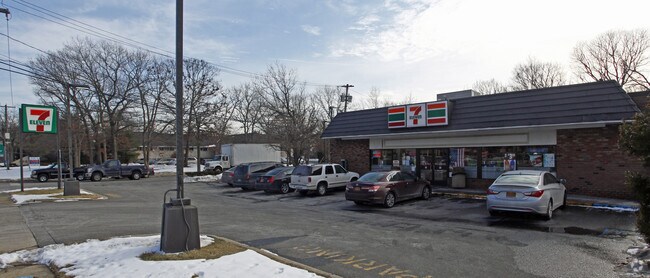
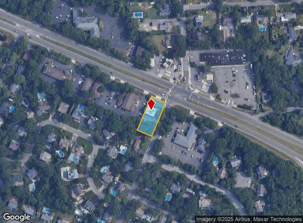
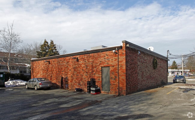
362 Veterans Memorial Hwy, Commack, NY 11725

NEARBY LISTINGS FOR SALE OR LEASE
Property Detail
362 Veterans Memorial Hwy
Nassau County-Suffolk County, NY
2-81576 TC-57 VET MEM HWY LINCOLN AVQUAKER PK MP 10SHELLEY SM
0800-151-00-01-00-008-000
Suffolk
Supermarket
New York
X
8
36103C0635H
0.44 AC
2024
Western Suffolk
2024
Long Island (New York)
135201
DEMOGRAPHICS near 362 Veterans Memorial Hwy
1 Mile
3 Mile
5 Mile
2024 Total Population
8,573
71,422
220,635
2029 Population
8,494
70,111
215,667
Pop Growth 2024-2029
(0.92%)
(1.84%)
(2.25%)
Average Age
43
41
40
2024 Total Households
2,896
21,228
65,116
HH Growth 2024-2029
(1.21%)
(2.02%)
(2.41%)
Median Household Inc
$146,181
$145,824
$132,417
Avg Household Size
2.90
3.20
3.20
2024 Avg HH Vehicles
2.00
2.00
2.00
Median Home Value
$663,884
$622,177
$576,601
Median Year Built
1965
1965
1965
Nearby Places
- Restaurants
- Banks
- Shops
- Fitness
- Groceries
PUBLIC TRANSPORTATION
COMMUTER RAIL
Smithtown Station (Port Jefferson Branch - Long Island Rail Road)
DRIVE
WALK
Distance
Smithtown Station (Port Jefferson Branch - Long Island Rail Road)
8 min
4.6 mi
Kings Park Station (Port Jefferson Branch - Long Island Rail Road)
DRIVE
WALK
Distance
Kings Park Station (Port Jefferson Branch - Long Island Rail Road)
8 min
5.5 mi
AIRPORT
Long Island MacArthur
DRIVE
WALK
Distance
Long Island MacArthur
16 min
9.9 mi
Freight Ports
Port of New Haven
DRIVE
WALK
Distance
Port of New Haven
130 min
53.4 mi
Nearby Properties
Address
Land Use
TOTAL SIZE
Lot Size
Zoning
Address
Land Use
TOTAL SIZE
Lot Size
Zoning
301 SF
3.70 AC
Address
Land Use
TOTAL SIZE
Lot Size
Zoning
97.50 AC
AAA
Address
Land Use
TOTAL SIZE
Lot Size
Zoning
196.07 AC
AAA
Address
Land Use
TOTAL SIZE
Lot Size
Zoning
30.50 AC
A
Address
Land Use
TOTAL SIZE
Lot Size
Zoning
10.20 AC
B
Address
Land Use
TOTAL SIZE
Lot Size
Zoning
10.90 AC
AAA
Address
Land Use
TOTAL SIZE
Lot Size
Zoning
52.32 AC
AAA
Address
Land Use
TOTAL SIZE
Lot Size
Zoning
3.98 AC
GSE
Address
Land Use
TOTAL SIZE
Lot Size
Zoning
7.70 AC
IND1
Address
Land Use
TOTAL SIZE
Lot Size
Zoning
1.84 AC
A
Address
Land Use
TOTAL SIZE
Lot Size
Zoning
9.89 AC
IND1
Address
Land Use
TOTAL SIZE
Lot Size
Zoning
70 SF
7.99 AC
IND1
Address
Land Use
TOTAL SIZE
Lot Size
Zoning
7.10 AC
IND1
Address
Land Use
TOTAL SIZE
Lot Size
Zoning
3.01 AC
GSE
Address
Land Use
TOTAL SIZE
Lot Size
Zoning
67.94 AC
Address
Land Use
TOTAL SIZE
Lot Size
Zoning
7.10 AC
IND1
Address
Land Use
TOTAL SIZE
Lot Size
Zoning
35.70 AC
Address
Land Use
TOTAL SIZE
Lot Size
Zoning
3.81 AC
BUS2
Address
Land Use
TOTAL SIZE
Lot Size
Zoning
10 AC
IND1
Address
Land Use
TOTAL SIZE
Lot Size
Zoning
9.72 AC
AAA
Address
Land Use
TOTAL SIZE
Lot Size
Zoning
8.80 AC
IND1
Address
Land Use
TOTAL SIZE
Lot Size
Zoning
4.85 AC
GSC
Address
Land Use
TOTAL SIZE
Lot Size
Zoning
6.50 AC
IND1
Address
Land Use
TOTAL SIZE
Lot Size
Zoning
3.73 AC
BUS2
Address
Land Use
TOTAL SIZE
Lot Size
Zoning
6.10 AC
IND1
Address
Land Use
TOTAL SIZE
Lot Size
Zoning
3.42 AC
AA
Address
Land Use
TOTAL SIZE
Lot Size
Zoning
4.46 AC
IND1
Address
Land Use
TOTAL SIZE
Lot Size
Zoning
4.80 AC
IND1
Address
Land Use
TOTAL SIZE
Lot Size
Zoning
4.53 AC
IND1
Address
Land Use
TOTAL SIZE
Lot Size
Zoning
4 AC
GSC
The World's #1 Commercial Real Estate Marketplace
Connect with us
© 2025 CoStar Group
The information above has been obtained from sources believed reliable. While we do not doubt its accuracy we have not verified it and make no guarantee, warranty or representation about it. It is your responsibility to independently confirm its accuracy and completeness. Any projections, opinions, assumptions, or estimates used are for example only and do not represent the current or future performance of the property. The value of this transaction to you depends on tax and other factors which should be evaluated by your tax, financial, and legal advisors. You and your advisors should conduct a careful, independent investigation of the property to determine to your satisfaction the suitability of the property for your needs.