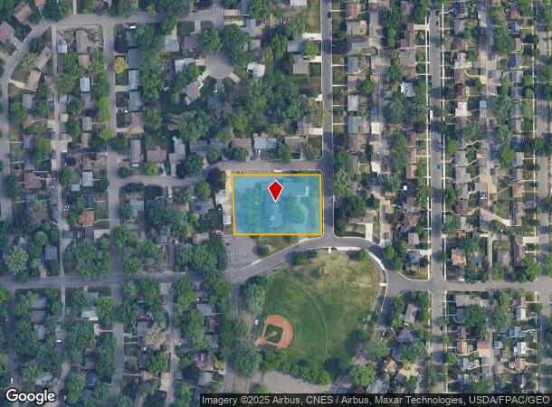
Property Record
3620 43Rd Ave N, Minneapolis, MN 55422


NEARBY LISTINGS FOR SALE OR LEASE
-
-
View all Minneapolis listings for sale on LoopNet.com
Property Detail
3620 43Rd Ave N
Minneapolis-St. Paul-Bloomington, MN-WI
Unplatted 05 029 24
05-029-24-22-0001
UNPLATTED 05 029 24 COM AT A PT IN THE S LINE OF THE N 8 AND 91 1/3 HUNDREDTHS CHAINS OF THE NW 1/4 DIS 188 FT W FROM THE SW COR OF EDLING SECOND ADDN TH W TO NW COR T 180X268.5
Commercialnec
Hennepin
X
Minnesota
27053C0212F
1.11 AC
0
Northwest
2024
Minneapolis/St Paul
021200
DEMOGRAPHICS near 3620 43Rd Ave N
1 Mile
3 Mile
5 Mile
2024 Total Population
14,724
120,394
336,047
2029 Population
14,467
117,918
331,785
Pop Growth 2024-2029
(1.75%)
(2.06%)
(1.27%)
Average Age
40
37
38
2024 Total Households
6,266
44,346
137,112
HH Growth 2024-2029
(1.71%)
(2.23%)
(1.22%)
Median Household Inc
$67,559
$66,552
$71,169
Avg Household Size
2.30
2.60
2.30
2024 Avg HH Vehicles
2.00
2.00
2.00
Median Home Value
$249,658
$240,427
$265,203
Median Year Built
1953
1956
1965
Nearby Places
Map Layers
Map Styles
 Street
 Aerial
- Restaurants
- Banks
- Shops
- Fitness
- Groceries
PUBLIC TRANSPORTATION
COMMUTER RAIL
Fridley Station (Northstar Corridor - Northstar Commuter Rail)
DRIVE
WALK
Distance
Fridley Station (Northstar Corridor - Northstar Commuter Rail)
10 min
5.4 mi
Target Field Station (Northstar Corridor - Northstar Commuter Rail)
DRIVE
WALK
Distance
Target Field Station (Northstar Corridor - Northstar Commuter Rail)
15 min
5.5 mi
AIRPORT
Minneapolis-St Paul International/Wold-Chamberlain
DRIVE
WALK
Distance
Minneapolis-St Paul International/Wold-Chamberlain
33 min
21.5 mi
Nearby Properties
Address
Land Use
TOTAL SIZE
Lot Size
Zoning
Address
Land Use
TOTAL SIZE
Lot Size
Zoning
1 SF
69.72 AC
I3
Address
Land Use
TOTAL SIZE
Lot Size
Zoning
Address
Land Use
TOTAL SIZE
Lot Size
Zoning
166.50 AC
Address
Land Use
TOTAL SIZE
Lot Size
Zoning
Address
Land Use
TOTAL SIZE
Lot Size
Zoning
351,351 SF
17.98 AC
Address
Land Use
TOTAL SIZE
Lot Size
Zoning
19.10 AC
Address
Land Use
TOTAL SIZE
Lot Size
Zoning
Address
Land Use
TOTAL SIZE
Lot Size
Zoning
14.04 AC
Address
Land Use
TOTAL SIZE
Lot Size
Zoning
255,324 SF
15.22 AC
Address
Land Use
TOTAL SIZE
Lot Size
Zoning
106,897 SF
4.37 AC
Address
Land Use
TOTAL SIZE
Lot Size
Zoning
Address
Land Use
TOTAL SIZE
Lot Size
Zoning
Address
Land Use
TOTAL SIZE
Lot Size
Zoning
4.34 AC
Address
Land Use
TOTAL SIZE
Lot Size
Zoning
Address
Land Use
TOTAL SIZE
Lot Size
Zoning
Address
Land Use
TOTAL SIZE
Lot Size
Zoning
21.10 AC
Address
Land Use
TOTAL SIZE
Lot Size
Zoning
35,762 SF
4.48 AC
Address
Land Use
TOTAL SIZE
Lot Size
Zoning
9.89 AC
Address
Land Use
TOTAL SIZE
Lot Size
Zoning
142,237 SF
3.26 AC
Address
Land Use
TOTAL SIZE
Lot Size
Zoning
51,421 SF
60.40 AC
I2
Address
Land Use
TOTAL SIZE
Lot Size
Zoning
199,980 SF
11.81 AC
Address
Land Use
TOTAL SIZE
Lot Size
Zoning
138,649 SF
1.09 AC
C1
Address
Land Use
TOTAL SIZE
Lot Size
Zoning
10.31 AC
Address
Land Use
TOTAL SIZE
Lot Size
Zoning
72.58 AC
Address
Land Use
TOTAL SIZE
Lot Size
Zoning
10.31 AC
Address
Land Use
TOTAL SIZE
Lot Size
Zoning
559,680 SF
41.33 AC
Address
Land Use
TOTAL SIZE
Lot Size
Zoning
180,015 SF
7.70 AC
Address
Land Use
TOTAL SIZE
Lot Size
Zoning
15.54 AC
Address
Land Use
TOTAL SIZE
Lot Size
Zoning
10.21 AC
Address
Land Use
TOTAL SIZE
Lot Size
Zoning
3.18 AC
The World's #1 Commercial Real Estate Marketplace
Connect with us
© 2025 CoStar Group
The information above has been obtained from sources believed reliable. While we do not doubt its accuracy we have not verified it and make no guarantee, warranty or representation about it. It is your responsibility to independently confirm its accuracy and completeness. Any projections, opinions, assumptions, or estimates used are for example only and do not represent the current or future performance of the property. The value of this transaction to you depends on tax and other factors which should be evaluated by your tax, financial, and legal advisors. You and your advisors should conduct a careful, independent investigation of the property to determine to your satisfaction the suitability of the property for your needs.