Property Record
3620 E 46Th Ave S, Minneapolis, MN 55406


Save to a Folder
{{folder.Name}}
{{folder.ListingIds.length}} Properties
{{folder.ListingIds.length}} Property
Create a New Folder
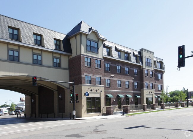
Property Detail
3620 E 46Th Ave S
07-028-23-34-0166
LOT 002 BLOCK 001 B STATION PLACE IRREGULAR
Apartment
HENNEPIN
C2
Minnesota
B and X Area of moderate flood hazard, usually the area between the limits of the 100-year and 500-year floods.
2
2025
0.54 AC
2025
Calhoun
108800
Minneapolis/St Paul
165,432 SF
Minneapolis-St. Paul-Bloomington, MN-WI
NEARBY LISTINGS FOR SALE OR LEASE
DEMOGRAPHICS near 3620 E 46Th Ave S
1 mile
3 mile
5 mile
2025 Total Population
18,143
151,696
451,663
2030 Population
18,186
151,641
453,132
Pop Growth 2025-2030
+ 0.24%
(0.04%)
+ 0.33%
Average Age
42
39
38
2025 Total Households
8,285
62,448
199,922
HH Growth 2025-2030
+ 0.21%
(0.16%)
+ 0.39%
Median Household Inc
$100,799
$95,044
$79,352
Avg Household Size
2.10
2.30
2.10
2025 Avg HH Vehicles
2.00
2.00
1.00
Median Home Value
$352,634
$369,006
$377,511
Median Year Built
1947
1947
1954
Nearby Places
Map Layers
Map Styles
 Street
 Aerial
Layers
 Traffic
 Biking
Places
Listings with unknown addresses are not visible on the map
- Restaurants
- Banks
- Shops
- Fitness
- Groceries
PUBLIC TRANSPORTATION
TRANSIT/SUBWAY
46Th Street Station (Hiawatha Line - Minneapolis-Saint Paul Metro Transit Light Rail)
Drive
Walk
Distance
46Th Street Station (Hiawatha Line - Minneapolis-Saint Paul Metro Transit Light Rail)
3 min
2 min
0.1 mi
50Th Street/Minnehaha Park Station (Hiawatha Line - Minneapolis-Saint Paul Metro Transit Light Rail)
Drive
Walk
Distance
50Th Street/Minnehaha Park Station (Hiawatha Line - Minneapolis-Saint Paul Metro Transit Light Rail)
2 min
15 min
0.8 mi
COMMUTER RAIL
Target Field Station (Northstar Corridor - Northstar Commuter Rail)
Drive
Walk
Distance
Target Field Station (Northstar Corridor - Northstar Commuter Rail)
14 min
5.7 mi
AIRPORT
Minneapolis-St Paul International/Wold-Chamberlain
Drive
Walk
Distance
Minneapolis-St Paul International/Wold-Chamberlain
12 min
5.6 mi
Freight Ports
Port Milwaukee
Drive
Walk
Distance
Port Milwaukee
377 min
338.9 mi
SALE & LEASE HISTORY
LISTING DATE
SALE/LEASE

Sep 25, 2016
For Lease
Nearby Properties
Address
Land Use
TOTAL SIZE
Lot Size
Zoning
Address
Land Use
TOTAL SIZE
Lot Size
Zoning
141,277 SF
44.78 AC
Address
Land Use
TOTAL SIZE
Lot Size
Zoning
84,316 SF
40.83 AC
Address
Land Use
TOTAL SIZE
Lot Size
Zoning
504,049 SF
75.43 AC
Address
Land Use
TOTAL SIZE
Lot Size
Zoning
176,108 SF
27.45 AC
Address
Land Use
TOTAL SIZE
Lot Size
Zoning
2.65 AC
Address
Land Use
TOTAL SIZE
Lot Size
Zoning
267,530 SF
28.60 AC
Address
Land Use
TOTAL SIZE
Lot Size
Zoning
Address
Land Use
TOTAL SIZE
Lot Size
Zoning
429,720 SF
6.02 AC
Address
Land Use
TOTAL SIZE
Lot Size
Zoning
Address
Land Use
TOTAL SIZE
Lot Size
Zoning
378,880 SF
3.42 AC
Address
Land Use
TOTAL SIZE
Lot Size
Zoning
164,639 SF
0.96 AC
C3S
Address
Land Use
TOTAL SIZE
Lot Size
Zoning
288,834 SF
1.72 AC
Address
Land Use
TOTAL SIZE
Lot Size
Zoning
169,522 SF
1.45 AC
C3A
Address
Land Use
TOTAL SIZE
Lot Size
Zoning
2.18 AC
Address
Land Use
TOTAL SIZE
Lot Size
Zoning
Address
Land Use
TOTAL SIZE
Lot Size
Zoning
254,517 SF
2.22 AC
C3A
Address
Land Use
TOTAL SIZE
Lot Size
Zoning
Address
Land Use
TOTAL SIZE
Lot Size
Zoning
165,618 SF
12.37 AC
Address
Land Use
TOTAL SIZE
Lot Size
Zoning
196,178 SF
1.26 AC
C3A
Address
Land Use
TOTAL SIZE
Lot Size
Zoning
305,011 SF
8.61 AC
Address
Land Use
TOTAL SIZE
Lot Size
Zoning
8,208 SF
0.71 AC
Address
Land Use
TOTAL SIZE
Lot Size
Zoning
Address
Land Use
TOTAL SIZE
Lot Size
Zoning
Address
Land Use
TOTAL SIZE
Lot Size
Zoning
223,680 SF
2.61 AC
R5
Address
Land Use
TOTAL SIZE
Lot Size
Zoning
Address
Land Use
TOTAL SIZE
Lot Size
Zoning
421,974 SF
3.75 AC
C3A
Address
Land Use
TOTAL SIZE
Lot Size
Zoning
14,192 SF
99.58 AC
Address
Land Use
TOTAL SIZE
Lot Size
Zoning
207,621 SF
1.65 AC
Address
Land Use
TOTAL SIZE
Lot Size
Zoning
64,557 SF
6.34 AC
C3A
Address
Land Use
TOTAL SIZE
Lot Size
Zoning
274,392 SF
8.94 AC
The World's #1 Commercial Real Estate Marketplace
Connect with us
© 2026 CoStar Group
The information above has been obtained from sources believed reliable. While we do not doubt its accuracy we have not verified it and make no guarantee, warranty or representation about it. It is your responsibility to independently confirm its accuracy and completeness. Any projections, opinions, assumptions, or estimates used are for example only and do not represent the current or future performance of the property. The value of this transaction to you depends on tax and other factors which should be evaluated by your tax, financial, and legal advisors. You and your advisors should conduct a careful, independent investigation of the property to determine to your satisfaction the suitability of the property for your needs.