Property Record
3620 E Highway 82, Gainesville, TX 76240
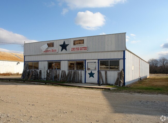

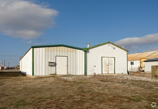
Property Detail
3620 E Highway 82
22793
SHANNON AJ 0937
Commercialnec
COOKE
A Areas with a 1% annual chance of flooding and a 26% chance of flooding over the life of a 30-year mortgage.
Texas
2024
5.49 AC
2025
Texas North Area
000100
Other Market Areas
6,400 SF
Gainesville, TX
NEARBY LISTINGS FOR SALE OR LEASE
DEMOGRAPHICS near 3620 E Highway 82
1 mile
3 mile
5 mile
2024 Total Population
875
17,741
23,017
2029 Population
919
18,730
24,288
Pop Growth 2024-2029
+ 5.03%
+ 5.57%
+ 5.52%
Average Age
38
38
38
2024 Total Households
332
6,509
8,454
HH Growth 2024-2029
+ 5.12%
+ 5.62%
+ 5.57%
Median Household Inc
$49,749
$57,372
$59,400
Avg Household Size
2.50
2.60
2.60
2024 Avg HH Vehicles
2.00
2.00
2.00
Median Home Value
$191,071
$177,751
$186,575
Median Year Built
1978
1973
1974
Nearby Places
Map Layers
Map Styles
 Street
 Aerial
Transit
 Traffic
 Biking
Places
Listings with unknown addresses are not visible on the map
- Restaurants
- Banks
- Shops
- Fitness
- Groceries
PUBLIC TRANSPORTATION
COMMUTER RAIL
Gainesville Amtrak Station (Heartland Flyer - Amtrak)
Drive
Walk
Distance
Gainesville Amtrak Station (Heartland Flyer - Amtrak)
6 min
3.6 mi
Freight Ports
Tulsa Port of Inola
Drive
Walk
Distance
Tulsa Port of Inola
281 min
245.4 mi
Nearby Properties
Address
Land Use
TOTAL SIZE
Lot Size
Zoning
Address
Land Use
TOTAL SIZE
Lot Size
Zoning
78,598 SF
2.90 AC
Address
Land Use
TOTAL SIZE
Lot Size
Zoning
402,800 SF
Address
Land Use
TOTAL SIZE
Lot Size
Zoning
208,499 SF
33.91 AC
Address
Land Use
TOTAL SIZE
Lot Size
Zoning
46,927 SF
2.50 AC
Address
Land Use
TOTAL SIZE
Lot Size
Zoning
6,939 SF
10.58 AC
Address
Land Use
TOTAL SIZE
Lot Size
Zoning
63,038 SF
30 AC
Address
Land Use
TOTAL SIZE
Lot Size
Zoning
2,694 SF
7.31 AC
Address
Land Use
TOTAL SIZE
Lot Size
Zoning
20,818 SF
3.92 AC
Address
Land Use
TOTAL SIZE
Lot Size
Zoning
11,096 SF
2.59 AC
Address
Land Use
TOTAL SIZE
Lot Size
Zoning
135,760 SF
13.51 AC
Address
Land Use
TOTAL SIZE
Lot Size
Zoning
32,875 SF
5.84 AC
Address
Land Use
TOTAL SIZE
Lot Size
Zoning
126,570 SF
27.93 AC
Address
Land Use
TOTAL SIZE
Lot Size
Zoning
108,208 SF
7.49 AC
Address
Land Use
TOTAL SIZE
Lot Size
Zoning
18,082 SF
6.81 AC
Address
Land Use
TOTAL SIZE
Lot Size
Zoning
53,032 SF
1.61 AC
Address
Land Use
TOTAL SIZE
Lot Size
Zoning
9,552 SF
5.22 AC
Address
Land Use
TOTAL SIZE
Lot Size
Zoning
11,880 SF
3 AC
Address
Land Use
TOTAL SIZE
Lot Size
Zoning
375.74 AC
Address
Land Use
TOTAL SIZE
Lot Size
Zoning
96,450 SF
12.06 AC
Address
Land Use
TOTAL SIZE
Lot Size
Zoning
136,488 SF
30 AC
Address
Land Use
TOTAL SIZE
Lot Size
Zoning
19,350 SF
1.69 AC
Address
Land Use
TOTAL SIZE
Lot Size
Zoning
1,014 SF
2.55 AC
Address
Land Use
TOTAL SIZE
Lot Size
Zoning
10,745 SF
3.56 AC
Address
Land Use
TOTAL SIZE
Lot Size
Zoning
21,900 SF
1.53 AC
Address
Land Use
TOTAL SIZE
Lot Size
Zoning
37,140 SF
5.51 AC
Address
Land Use
TOTAL SIZE
Lot Size
Zoning
36,498 SF
0.55 AC
Address
Land Use
TOTAL SIZE
Lot Size
Zoning
23,310 SF
3.28 AC
Address
Land Use
TOTAL SIZE
Lot Size
Zoning
30,256 SF
1.73 AC
Address
Land Use
TOTAL SIZE
Lot Size
Zoning
33,646 SF
9.07 AC
The World's #1 Commercial Real Estate Marketplace
Connect with us
© 2026 CoStar Group
The information above has been obtained from sources believed reliable. While we do not doubt its accuracy we have not verified it and make no guarantee, warranty or representation about it. It is your responsibility to independently confirm its accuracy and completeness. Any projections, opinions, assumptions, or estimates used are for example only and do not represent the current or future performance of the property. The value of this transaction to you depends on tax and other factors which should be evaluated by your tax, financial, and legal advisors. You and your advisors should conduct a careful, independent investigation of the property to determine to your satisfaction the suitability of the property for your needs.