Property Record
3620 Hillside Dr, Round Rock, TX 78681

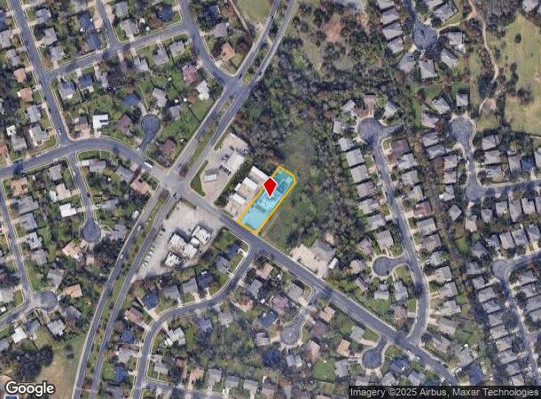

Property Detail
3620 Hillside Dr
Austin-Round Rock-San Marcos, TX
Hillside At Brushy Creek Lot 19 Blk B Re
R065180
S7141 - HILLSIDE AT BRUSHY CREEK LOT 19 BLK B REPLAT, BLOCK B, LOT 19B, ACRES 0.51
Commercialnec
Williamson
X
Texas
48491C0488F
19b
2024
0.51 AC
2025
Round Rock
020514
Austin
4,960 SF
NEARBY LISTINGS FOR SALE OR LEASE
DEMOGRAPHICS near 3620 Hillside Dr
1 mile
3 mile
5 mile
2024 Total Population
15,181
86,269
223,245
2029 Population
19,085
108,423
280,850
Pop Growth 2024-2029
+ 25.72%
+ 25.68%
+ 25.80%
Average Age
38
37
36
2024 Total Households
5,029
28,763
83,346
HH Growth 2024-2029
+ 26.13%
+ 26.20%
+ 26.39%
Median Household Inc
$129,579
$136,268
$98,998
Avg Household Size
2.90
2.90
2.60
2024 Avg HH Vehicles
2.00
2.00
2.00
Median Home Value
$430,753
$457,519
$423,165
Median Year Built
1995
2001
2003
Nearby Places
Map Layers
Map Styles
 Street
 Aerial
Transit
 Traffic
 Biking
Places
Listings with unknown addresses are not visible on the map
- Restaurants
- Banks
- Shops
- Fitness
- Groceries
PUBLIC TRANSPORTATION
AIRPORT
Austin-Bergstrom International
Drive
Walk
Distance
Austin-Bergstrom International
47 min
31.8 mi
Freight Ports
Calhoun Port
Drive
Walk
Distance
Calhoun Port
209 min
181.1 mi
SALE & LEASE HISTORY
LISTING DATE
SALE/LEASE

Jul 12, 2020
For Lease
Dec 14, 2018
For Sale
Apr 28, 2023
For Lease
Apr 02, 2021
For Lease
Nearby Properties
Address
Land Use
TOTAL SIZE
Lot Size
Zoning
Address
Land Use
TOTAL SIZE
Lot Size
Zoning
536,741 SF
80.32 AC
SF2
Address
Land Use
TOTAL SIZE
Lot Size
Zoning
757,866 SF
33.21 AC
Address
Land Use
TOTAL SIZE
Lot Size
Zoning
325,797 SF
36.36 AC
Address
Land Use
TOTAL SIZE
Lot Size
Zoning
493,699 SF
28.29 AC
Address
Land Use
TOTAL SIZE
Lot Size
Zoning
420,181 SF
18.86 AC
Address
Land Use
TOTAL SIZE
Lot Size
Zoning
350,637 SF
10.36 AC
Address
Land Use
TOTAL SIZE
Lot Size
Zoning
408,335 SF
31.16 AC
Address
Land Use
TOTAL SIZE
Lot Size
Zoning
337,685 SF
14.35 AC
Address
Land Use
TOTAL SIZE
Lot Size
Zoning
356,499 SF
9.39 AC
Address
Land Use
TOTAL SIZE
Lot Size
Zoning
303,240 SF
16.71 AC
Address
Land Use
TOTAL SIZE
Lot Size
Zoning
322,935 SF
20 AC
Address
Land Use
TOTAL SIZE
Lot Size
Zoning
351,168 SF
19.69 AC
Address
Land Use
TOTAL SIZE
Lot Size
Zoning
330,685 SF
20.17 AC
Address
Land Use
TOTAL SIZE
Lot Size
Zoning
255,253 SF
26.57 AC
Address
Land Use
TOTAL SIZE
Lot Size
Zoning
270,142 SF
16.51 AC
Address
Land Use
TOTAL SIZE
Lot Size
Zoning
370,410 SF
46.86 AC
Address
Land Use
TOTAL SIZE
Lot Size
Zoning
278,392 SF
10.72 AC
Address
Land Use
TOTAL SIZE
Lot Size
Zoning
82,000 SF
22.58 AC
LI
Address
Land Use
TOTAL SIZE
Lot Size
Zoning
30.71 AC
Address
Land Use
TOTAL SIZE
Lot Size
Zoning
173,800 SF
12.82 AC
Address
Land Use
TOTAL SIZE
Lot Size
Zoning
93,748 SF
5.11 AC
PF3
Address
Land Use
TOTAL SIZE
Lot Size
Zoning
122,500 SF
29.71 AC
Address
Land Use
TOTAL SIZE
Lot Size
Zoning
124,152 SF
13.52 AC
Address
Land Use
TOTAL SIZE
Lot Size
Zoning
313,866 SF
11.95 AC
Address
Land Use
TOTAL SIZE
Lot Size
Zoning
2,516 SF
126.36 AC
Address
Land Use
TOTAL SIZE
Lot Size
Zoning
46.37 AC
Address
Land Use
TOTAL SIZE
Lot Size
Zoning
136,794 SF
8.32 AC
Address
Land Use
TOTAL SIZE
Lot Size
Zoning
170,500 SF
11.93 AC
Address
Land Use
TOTAL SIZE
Lot Size
Zoning
187,656 SF
11.43 AC
LI
Address
Land Use
TOTAL SIZE
Lot Size
Zoning
152,400 SF
11.91 AC
The World's #1 Commercial Real Estate Marketplace
Connect with us
© 2026 CoStar Group
The information above has been obtained from sources believed reliable. While we do not doubt its accuracy we have not verified it and make no guarantee, warranty or representation about it. It is your responsibility to independently confirm its accuracy and completeness. Any projections, opinions, assumptions, or estimates used are for example only and do not represent the current or future performance of the property. The value of this transaction to you depends on tax and other factors which should be evaluated by your tax, financial, and legal advisors. You and your advisors should conduct a careful, independent investigation of the property to determine to your satisfaction the suitability of the property for your needs.