Property Record
3620 N Interstate 35, Georgetown, TX 78626
Property Detail
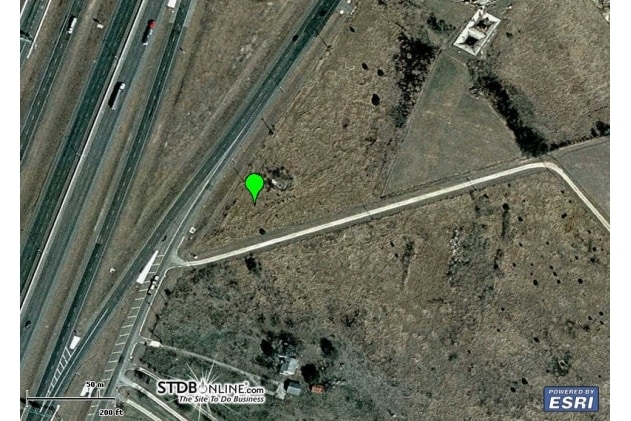
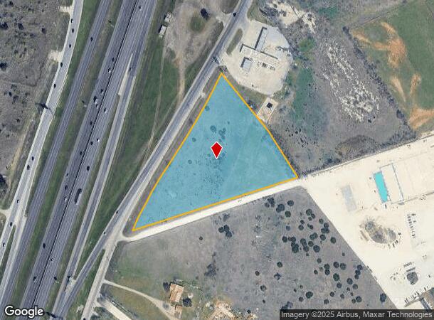
3620 N Interstate 35
Austin-Round Rock-San Marcos, TX
Berry, J. Sur.
R038979
AW0051 BERRY, J. SUR., ACRES 5.81
Commercialacreage
Williamson
X
Texas
48491C0285F
5.81 AC
2024
Georgetown
2025
Austin
020108
NEARBY LISTINGS FOR SALE OR LEASE
DEMOGRAPHICS near 3620 N Interstate 35
1 mile
3 mile
5 mile
2024 Total Population
670
17,472
65,490
2029 Population
859
22,346
83,379
Pop Growth 2024-2029
+ 28.21%
+ 27.90%
+ 27.32%
Average Age
44
41
46
2024 Total Households
259
6,673
27,176
HH Growth 2024-2029
+ 28.96%
+ 28.50%
+ 27.98%
Median Household Inc
$112,689
$95,385
$86,263
Avg Household Size
2.60
2.50
2.30
2024 Avg HH Vehicles
2.00
2.00
2.00
Median Home Value
$424,242
$385,713
$385,145
Median Year Built
2006
2001
2003
Nearby Places
Map Layers
Map Styles
 Street
 Aerial
Transit
 Traffic
 Biking
Places
Listings with unknown addresses are not visible on the map
- Restaurants
- Banks
- Shops
- Fitness
- Groceries
PUBLIC TRANSPORTATION
AIRPORT
Killeen Municipal
Drive
Walk
Distance
Killeen Municipal
47 min
37.0 mi
Robert Gray AAF
Drive
Walk
Distance
Robert Gray AAF
51 min
37.9 mi
Freight Ports
Calhoun Port
Drive
Walk
Distance
Calhoun Port
212 min
188.0 mi
Nearby Properties
Address
Land Use
TOTAL SIZE
Lot Size
Zoning
Address
Land Use
TOTAL SIZE
Lot Size
Zoning
200,200 SF
34.02 AC
Address
Land Use
TOTAL SIZE
Lot Size
Zoning
453,015 SF
22.62 AC
Address
Land Use
TOTAL SIZE
Lot Size
Zoning
326,646 SF
19.33 AC
Address
Land Use
TOTAL SIZE
Lot Size
Zoning
425,144 SF
32.97 AC
Address
Land Use
TOTAL SIZE
Lot Size
Zoning
439,044 SF
32.68 AC
Address
Land Use
TOTAL SIZE
Lot Size
Zoning
495,945 SF
56.14 AC
Address
Land Use
TOTAL SIZE
Lot Size
Zoning
520,121 SF
56.73 AC
Address
Land Use
TOTAL SIZE
Lot Size
Zoning
8,727 SF
89.67 AC
Address
Land Use
TOTAL SIZE
Lot Size
Zoning
193,985 SF
38.17 AC
Address
Land Use
TOTAL SIZE
Lot Size
Zoning
298,302 SF
20.96 AC
Address
Land Use
TOTAL SIZE
Lot Size
Zoning
241,857 SF
26.60 AC
Address
Land Use
TOTAL SIZE
Lot Size
Zoning
200,746 SF
17.52 AC
Address
Land Use
TOTAL SIZE
Lot Size
Zoning
592 SF
42.32 AC
Address
Land Use
TOTAL SIZE
Lot Size
Zoning
154,603 SF
20.04 AC
Address
Land Use
TOTAL SIZE
Lot Size
Zoning
172,657 SF
8.84 AC
Address
Land Use
TOTAL SIZE
Lot Size
Zoning
167,139 SF
10.35 AC
Address
Land Use
TOTAL SIZE
Lot Size
Zoning
174,955 SF
9.28 AC
Address
Land Use
TOTAL SIZE
Lot Size
Zoning
162,236 SF
8.99 AC
Address
Land Use
TOTAL SIZE
Lot Size
Zoning
90,821 SF
41.97 AC
Address
Land Use
TOTAL SIZE
Lot Size
Zoning
160,042 SF
10.15 AC
Address
Land Use
TOTAL SIZE
Lot Size
Zoning
184,242 SF
11 AC
Address
Land Use
TOTAL SIZE
Lot Size
Zoning
219,839 SF
24.74 AC
Address
Land Use
TOTAL SIZE
Lot Size
Zoning
99,532 SF
10.80 AC
2-I
Address
Land Use
TOTAL SIZE
Lot Size
Zoning
182,592 SF
11.20 AC
Address
Land Use
TOTAL SIZE
Lot Size
Zoning
2,400 SF
56.17 AC
Address
Land Use
TOTAL SIZE
Lot Size
Zoning
22,936 SF
111.18 AC
Address
Land Use
TOTAL SIZE
Lot Size
Zoning
150,808 SF
7.72 AC
2-I
Address
Land Use
TOTAL SIZE
Lot Size
Zoning
39.97 AC
Address
Land Use
TOTAL SIZE
Lot Size
Zoning
100,956 SF
5.32 AC
Address
Land Use
TOTAL SIZE
Lot Size
Zoning
124,292 SF
8.67 AC
The World's #1 Commercial Real Estate Marketplace
Connect with us
© 2026 CoStar Group
The information above has been obtained from sources believed reliable. While we do not doubt its accuracy we have not verified it and make no guarantee, warranty or representation about it. It is your responsibility to independently confirm its accuracy and completeness. Any projections, opinions, assumptions, or estimates used are for example only and do not represent the current or future performance of the property. The value of this transaction to you depends on tax and other factors which should be evaluated by your tax, financial, and legal advisors. You and your advisors should conduct a careful, independent investigation of the property to determine to your satisfaction the suitability of the property for your needs.