Property Record
3620 N Main St, Roswell, NM 88201

Property Detail
3620 N Main St
R044760
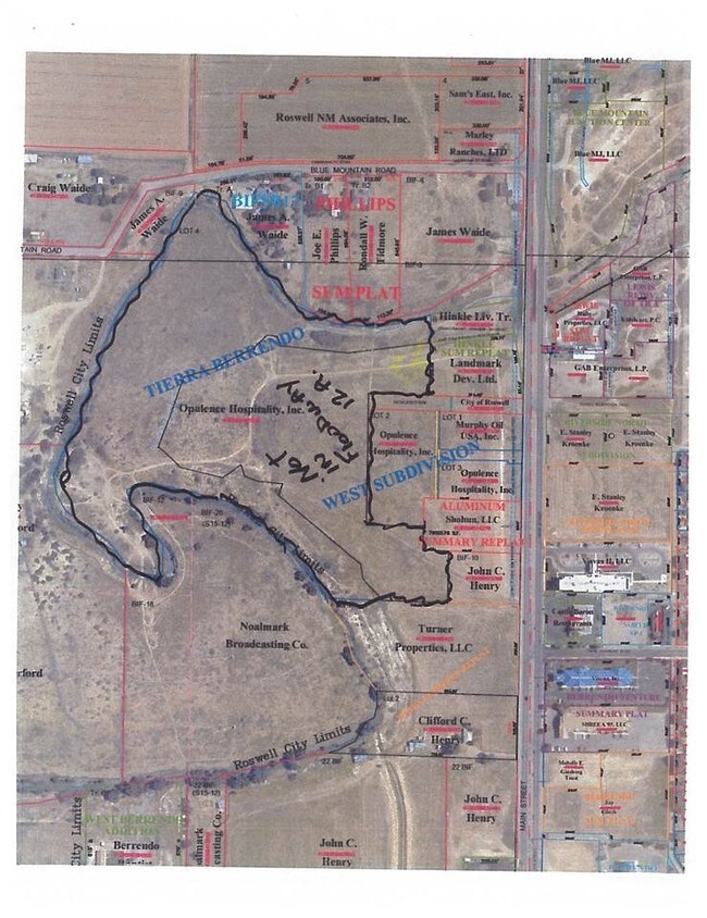
SUBD: TIERRA BERRENDO WEST SUBDIVISION LOT: 2 S: 17 T: 10S R: 24E BK: 614 PG: 313 WD
Realpropertynec
Chaves
COMMUNITY
New Mexico
AE The base floodplain where base flood elevations are provided. AE Zones are now used on new format FIRMs instead of A1-A30 Zones.
2
2024
3.04 AC
2025
New Mexico South Area
001001
Other Market Areas
59,672 SF
Roswell, NM
NEARBY LISTINGS FOR SALE OR LEASE
DEMOGRAPHICS near 3620 N Main St
1 mile
3 mile
5 mile
2025 Total Population
4,596
18,905
40,249
2030 Population
4,511
18,711
39,876
Pop Growth 2025-2030
(1.85%)
(1.03%)
(0.93%)
Average Age
40
40
39
2025 Total Households
1,706
7,335
15,275
HH Growth 2025-2030
(1.93%)
(1.05%)
(1.03%)
Median Household Inc
$86,258
$63,188
$52,448
Avg Household Size
2.60
2.50
2.50
2025 Avg HH Vehicles
2.00
2.00
2.00
Median Home Value
$251,765
$229,301
$180,455
Median Year Built
1980
1977
1970
Nearby Places
Map Layers
Map Styles
 Street
 Aerial
Layers
 Traffic
 Biking
Places
Listings with unknown addresses are not visible on the map
- Restaurants
- Banks
- Shops
- Fitness
- Groceries
PUBLIC TRANSPORTATION
AIRPORT
Roswell Air Center
Drive
Walk
Distance
Roswell Air Center
22 min
10.1 mi
SALE & LEASE HISTORY
LISTING DATE
SALE/LEASE

Mar 27, 2017
For Sale
Nearby Properties
Address
Land Use
TOTAL SIZE
Lot Size
Zoning
Address
Land Use
TOTAL SIZE
Lot Size
Zoning
10,644 SF
5.81 AC
COMMUNITY
Address
Land Use
TOTAL SIZE
Lot Size
Zoning
23.93 AC
RESIDENTIA
Address
Land Use
TOTAL SIZE
Lot Size
Zoning
230,872 SF
9.40 AC
COMMUNITY
Address
Land Use
TOTAL SIZE
Lot Size
Zoning
2.58 AC
COMMUNITY
Address
Land Use
TOTAL SIZE
Lot Size
Zoning
22.08 AC
Address
Land Use
TOTAL SIZE
Lot Size
Zoning
150.96 AC
RESIDENTIA
Address
Land Use
TOTAL SIZE
Lot Size
Zoning
56.23 AC
Address
Land Use
TOTAL SIZE
Lot Size
Zoning
6.47 AC
RESIDENTIA
Address
Land Use
TOTAL SIZE
Lot Size
Zoning
203,209 SF
22.13 AC
COMMUNITY
Address
Land Use
TOTAL SIZE
Lot Size
Zoning
9.05 AC
Address
Land Use
TOTAL SIZE
Lot Size
Zoning
Address
Land Use
TOTAL SIZE
Lot Size
Zoning
134,448 SF
15.85 AC
COMMUNITY
Address
Land Use
TOTAL SIZE
Lot Size
Zoning
20.23 AC
RESIDENTIA
Address
Land Use
TOTAL SIZE
Lot Size
Zoning
39,382 SF
1.90 AC
COMMUNITY
Address
Land Use
TOTAL SIZE
Lot Size
Zoning
29.09 AC
RESIDENTIA
Address
Land Use
TOTAL SIZE
Lot Size
Zoning
6.48 AC
RESIDENTIA
Address
Land Use
TOTAL SIZE
Lot Size
Zoning
39,383 SF
2.11 AC
COMMUNITY
Address
Land Use
TOTAL SIZE
Lot Size
Zoning
1,126 SF
0.14 AC
RESIDENTIA
Address
Land Use
TOTAL SIZE
Lot Size
Zoning
54.27 AC
RESIDENTIA
Address
Land Use
TOTAL SIZE
Lot Size
Zoning
50,281 SF
1.47 AC
COMMUNITY
Address
Land Use
TOTAL SIZE
Lot Size
Zoning
238,267 SF
18.30 AC
COMMUNITY
Address
Land Use
TOTAL SIZE
Lot Size
Zoning
12,689 SF
4.86 AC
RESIDENTIA
Address
Land Use
TOTAL SIZE
Lot Size
Zoning
9.39 AC
RESIDENTIA
Address
Land Use
TOTAL SIZE
Lot Size
Zoning
21,970 SF
2.28 AC
LIGHT INDU
Address
Land Use
TOTAL SIZE
Lot Size
Zoning
5 AC
RESIDENTIA
Address
Land Use
TOTAL SIZE
Lot Size
Zoning
14,074 SF
1.70 AC
CENTRAL BU
Address
Land Use
TOTAL SIZE
Lot Size
Zoning
92,983 SF
6.39 AC
COMMUNITY
Address
Land Use
TOTAL SIZE
Lot Size
Zoning
33,201 SF
4.27 AC
COMMUNITY
Address
Land Use
TOTAL SIZE
Lot Size
Zoning
23,576 SF
3.57 AC
COMMUNITY
The World's #1 Commercial Real Estate Marketplace
Connect with us
© 2026 CoStar Group
The information above has been obtained from sources believed reliable. While we do not doubt its accuracy we have not verified it and make no guarantee, warranty or representation about it. It is your responsibility to independently confirm its accuracy and completeness. Any projections, opinions, assumptions, or estimates used are for example only and do not represent the current or future performance of the property. The value of this transaction to you depends on tax and other factors which should be evaluated by your tax, financial, and legal advisors. You and your advisors should conduct a careful, independent investigation of the property to determine to your satisfaction the suitability of the property for your needs.