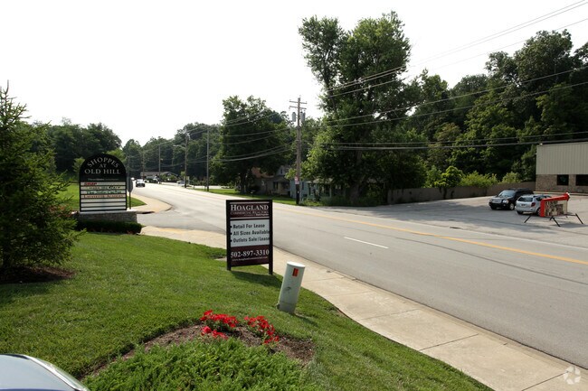
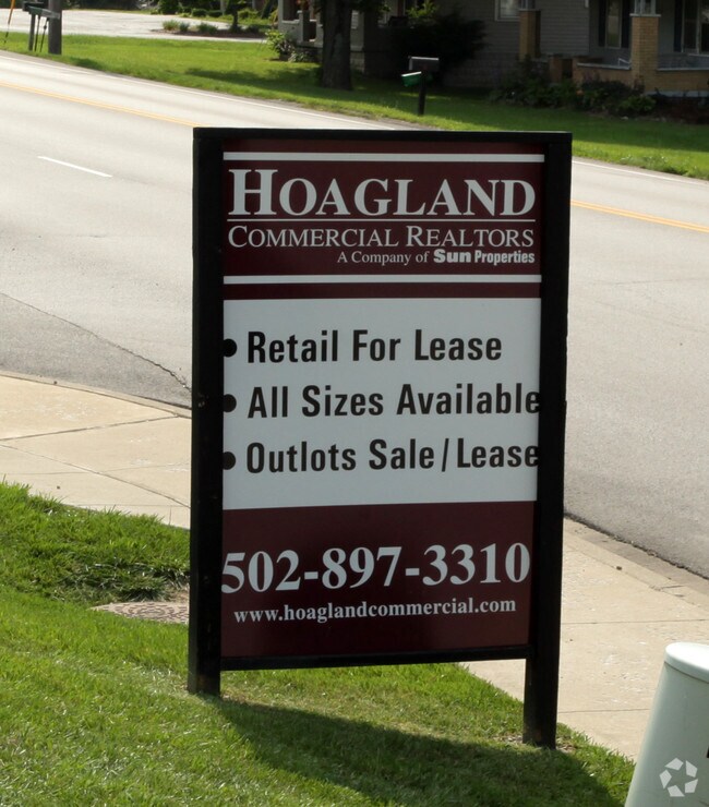
Property Record
3620 Paoli Pike, Floyds Knobs, IN 47119

Property Detail
3620 Paoli Pike
22-04-02-000-001.007-006
P 1419 L 2 2.0411 AC MP 04-02-000-243.002
Stripcommercialcenter
Floyd
B and X Area of moderate flood hazard, usually the area between the limits of the 100-year and 500-year floods.
Indiana
2025
2.04 AC
2025
Outlying Floyd County
071003
Louisville
20,250 SF
Louisville/Jefferson County, KY-IN
NEARBY LISTINGS FOR SALE OR LEASE
DEMOGRAPHICS near 3620 Paoli Pike
1 mile
3 mile
5 mile
2025 Total Population
1,717
23,717
71,611
2030 Population
1,721
24,099
73,307
Pop Growth 2025-2030
+ 0.23%
+ 1.61%
+ 2.37%
Average Age
43
41
41
2025 Total Households
636
9,580
29,341
HH Growth 2025-2030
+ 0.16%
+ 1.59%
+ 2.38%
Median Household Inc
$124,352
$75,038
$72,657
Avg Household Size
2.70
2.40
2.30
2025 Avg HH Vehicles
3.00
2.00
2.00
Median Home Value
$488,829
$252,593
$238,781
Median Year Built
1985
1974
1971
Nearby Places
Map Layers
Map Styles
 Street
 Aerial
Layers
 Traffic
 Biking
Places
Listings with unknown addresses are not visible on the map
- Restaurants
- Banks
- Shops
- Fitness
- Groceries
PUBLIC TRANSPORTATION
AIRPORT
Louisville Muhammad Ali International
Drive
Walk
Distance
Louisville Muhammad Ali International
29 min
16.6 mi
Nearby Properties
Address
Land Use
TOTAL SIZE
Lot Size
Zoning
Address
Land Use
TOTAL SIZE
Lot Size
Zoning
175,626 SF
60.10 AC
Address
Land Use
TOTAL SIZE
Lot Size
Zoning
12,270 SF
13.50 AC
Address
Land Use
TOTAL SIZE
Lot Size
Zoning
25,728 SF
10.37 AC
Address
Land Use
TOTAL SIZE
Lot Size
Zoning
4,512 SF
17.76 AC
Address
Land Use
TOTAL SIZE
Lot Size
Zoning
270,377 SF
17.54 AC
Address
Land Use
TOTAL SIZE
Lot Size
Zoning
3,692 SF
15.99 AC
Address
Land Use
TOTAL SIZE
Lot Size
Zoning
21,692 SF
30.54 AC
Address
Land Use
TOTAL SIZE
Lot Size
Zoning
39,851 SF
19.68 AC
Address
Land Use
TOTAL SIZE
Lot Size
Zoning
202,859 SF
22.95 AC
Address
Land Use
TOTAL SIZE
Lot Size
Zoning
169 SF
35.25 AC
Address
Land Use
TOTAL SIZE
Lot Size
Zoning
34,308 SF
4.59 AC
Address
Land Use
TOTAL SIZE
Lot Size
Zoning
72,332 SF
2.48 AC
Address
Land Use
TOTAL SIZE
Lot Size
Zoning
1.84 AC
Address
Land Use
TOTAL SIZE
Lot Size
Zoning
83,084 SF
14.65 AC
Address
Land Use
TOTAL SIZE
Lot Size
Zoning
31,646 SF
5.63 AC
Address
Land Use
TOTAL SIZE
Lot Size
Zoning
35,044 SF
3.39 AC
Address
Land Use
TOTAL SIZE
Lot Size
Zoning
118,371 SF
11.83 AC
Address
Land Use
TOTAL SIZE
Lot Size
Zoning
26,532 SF
4.35 AC
Address
Land Use
TOTAL SIZE
Lot Size
Zoning
56,547 SF
5.65 AC
Address
Land Use
TOTAL SIZE
Lot Size
Zoning
3,360 SF
9.40 AC
Address
Land Use
TOTAL SIZE
Lot Size
Zoning
125,751 SF
22.59 AC
Address
Land Use
TOTAL SIZE
Lot Size
Zoning
7,496 SF
9.37 AC
Address
Land Use
TOTAL SIZE
Lot Size
Zoning
65,748 SF
4.34 AC
Address
Land Use
TOTAL SIZE
Lot Size
Zoning
42,344 SF
6.77 AC
Address
Land Use
TOTAL SIZE
Lot Size
Zoning
59,998 SF
7.28 AC
Address
Land Use
TOTAL SIZE
Lot Size
Zoning
1,758 SF
10.41 AC
Address
Land Use
TOTAL SIZE
Lot Size
Zoning
185,587 SF
4.30 AC
Address
Land Use
TOTAL SIZE
Lot Size
Zoning
131,952 SF
4.32 AC
Address
Land Use
TOTAL SIZE
Lot Size
Zoning
396,757 SF
6.59 AC
Address
Land Use
TOTAL SIZE
Lot Size
Zoning
21,780 SF
11.44 AC
The World's #1 Commercial Real Estate Marketplace
Connect with us
© 2026 CoStar Group
The information above has been obtained from sources believed reliable. While we do not doubt its accuracy we have not verified it and make no guarantee, warranty or representation about it. It is your responsibility to independently confirm its accuracy and completeness. Any projections, opinions, assumptions, or estimates used are for example only and do not represent the current or future performance of the property. The value of this transaction to you depends on tax and other factors which should be evaluated by your tax, financial, and legal advisors. You and your advisors should conduct a careful, independent investigation of the property to determine to your satisfaction the suitability of the property for your needs.