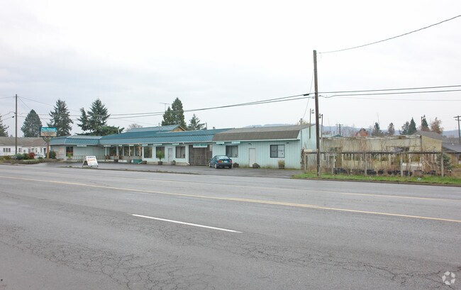
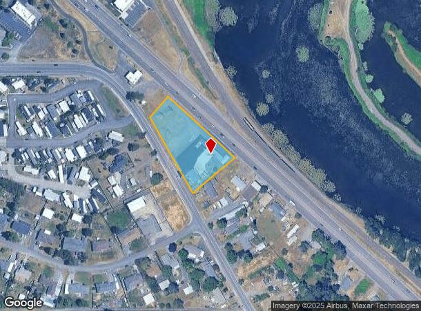
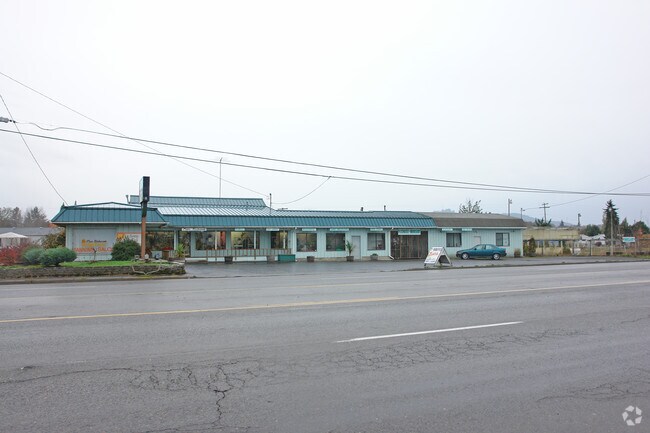
Property Record
3620 S Santiam Hwy, Lebanon, OR 97355
NEARBY LISTINGS FOR SALE OR LEASE
Property Detail
3620 S Santiam Hwy
Albany, OR
Sturtevant Subdivision
0211017
12S02W23A0
Commercialnec
Linn
X
Oregon
41043C0569G
41
2025
1.34 AC
2025
Linn County
030904
Portland
1,550 SF
DEMOGRAPHICS near 3620 S Santiam Hwy
1 Mile
3 Mile
5 Mile
2024 Total Population
6,419
26,275
29,839
2029 Population
6,796
27,679
31,383
Pop Growth 2024-2029
+ 5.87%
+ 5.34%
+ 5.17%
Average Age
41
40
41
2024 Total Households
2,502
10,145
11,435
HH Growth 2024-2029
+ 6.04%
+ 5.50%
+ 5.35%
Median Household Inc
$63,400
$55,936
$56,979
Avg Household Size
2.50
2.50
2.60
2024 Avg HH Vehicles
2.00
2.00
2.00
Median Home Value
$319,057
$301,329
$310,665
Median Year Built
1991
1977
1977
Nearby Places
Map Layers
Map Styles
 Street
 Aerial
- Restaurants
- Banks
- Shops
- Fitness
- Groceries
Nearby Properties
Address
Land Use
TOTAL SIZE
Lot Size
Zoning
Address
Land Use
TOTAL SIZE
Lot Size
Zoning
23,713 SF
25.64 AC
PUB
Address
Land Use
TOTAL SIZE
Lot Size
Zoning
6.76 AC
PUB
Address
Land Use
TOTAL SIZE
Lot Size
Zoning
5.51 AC
IND
Address
Land Use
TOTAL SIZE
Lot Size
Zoning
23.03 AC
MU
Address
Land Use
TOTAL SIZE
Lot Size
Zoning
18.88 AC
MU
Address
Land Use
TOTAL SIZE
Lot Size
Zoning
2.84 AC
MU
Address
Land Use
TOTAL SIZE
Lot Size
Zoning
7.66 AC
MU
Address
Land Use
TOTAL SIZE
Lot Size
Zoning
39,440 SF
13.71 AC
MU
Address
Land Use
TOTAL SIZE
Lot Size
Zoning
3 AC
MU
Address
Land Use
TOTAL SIZE
Lot Size
Zoning
85,756 SF
35.19 AC
PUB
Address
Land Use
TOTAL SIZE
Lot Size
Zoning
12.89 AC
IND
Address
Land Use
TOTAL SIZE
Lot Size
Zoning
4.97 AC
MU
Address
Land Use
TOTAL SIZE
Lot Size
Zoning
52,058 SF
10 AC
PUB
Address
Land Use
TOTAL SIZE
Lot Size
Zoning
5.12 AC
RH
Address
Land Use
TOTAL SIZE
Lot Size
Zoning
1.34 AC
CH
Address
Land Use
TOTAL SIZE
Lot Size
Zoning
73,935 SF
3.82 AC
RM
Address
Land Use
TOTAL SIZE
Lot Size
Zoning
1,436 SF
3.84 AC
RM
Address
Land Use
TOTAL SIZE
Lot Size
Zoning
9,731 SF
4.27 AC
PUB
Address
Land Use
TOTAL SIZE
Lot Size
Zoning
17,528 SF
7.39 AC
PUB
Address
Land Use
TOTAL SIZE
Lot Size
Zoning
1,440 SF
4.91 AC
IND
Address
Land Use
TOTAL SIZE
Lot Size
Zoning
50,519 SF
11.48 AC
RM
Address
Land Use
TOTAL SIZE
Lot Size
Zoning
4.76 AC
RM
Address
Land Use
TOTAL SIZE
Lot Size
Zoning
11,862 SF
10.13 AC
PUB
Address
Land Use
TOTAL SIZE
Lot Size
Zoning
1,328 SF
5 AC
UGA-EFU-80
Address
Land Use
TOTAL SIZE
Lot Size
Zoning
6.30 AC
IND
Address
Land Use
TOTAL SIZE
Lot Size
Zoning
55,164 SF
4.35 AC
CH
Address
Land Use
TOTAL SIZE
Lot Size
Zoning
92,580 SF
7.52 AC
UGA-EFU-80
Address
Land Use
TOTAL SIZE
Lot Size
Zoning
3.90 AC
PUB
Address
Land Use
TOTAL SIZE
Lot Size
Zoning
6.83 AC
IND
Address
Land Use
TOTAL SIZE
Lot Size
Zoning
12.68 AC
IND
The World's #1 Commercial Real Estate Marketplace
Connect with us
© 2026 CoStar Group
The information above has been obtained from sources believed reliable. While we do not doubt its accuracy we have not verified it and make no guarantee, warranty or representation about it. It is your responsibility to independently confirm its accuracy and completeness. Any projections, opinions, assumptions, or estimates used are for example only and do not represent the current or future performance of the property. The value of this transaction to you depends on tax and other factors which should be evaluated by your tax, financial, and legal advisors. You and your advisors should conduct a careful, independent investigation of the property to determine to your satisfaction the suitability of the property for your needs.