Property Record
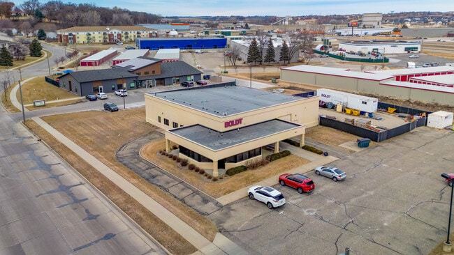
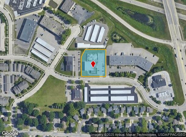
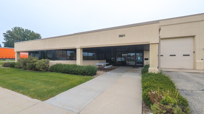
3621 9Th St Nw, Rochester, MN 55901
Current Lease Availabilities
NEARBY LISTINGS FOR SALE OR LEASE
Property Detail
3621 9Th St Nw
Rochester, MN
Radichel 3Rd Replat
74.32.11.072327
SECT-32 TWP-107 RANGE-014 RADICHEL 3RD REPLAT LOT 2 BLK 1
Industrialgeneral
Olmsted
X
Minnesota
27109C0142F
2
2025
1.27 AC
2024
Historic Southwest
001301
Other Market Areas
7,216 SF
DEMOGRAPHICS near 3621 9Th St Nw
1 Mile
3 Mile
5 Mile
2024 Total Population
6,917
53,721
115,647
2029 Population
6,967
54,813
118,673
Pop Growth 2024-2029
+ 0.72%
+ 2.03%
+ 2.62%
Average Age
39
40
39
2024 Total Households
2,634
23,195
47,691
HH Growth 2024-2029
+ 0.61%
+ 2.01%
+ 2.63%
Median Household Inc
$106,399
$81,099
$81,542
Avg Household Size
2.50
2.20
2.30
2024 Avg HH Vehicles
2.00
2.00
2.00
Median Home Value
$274,034
$281,402
$279,132
Median Year Built
1991
1982
1986
Nearby Places
- Restaurants
- Banks
- Shops
- Fitness
- Groceries
PUBLIC TRANSPORTATION
AIRPORT
Rochester International
DRIVE
WALK
Distance
Rochester International
15 min
11.2 mi
Freight Ports
Port Milwaukee
DRIVE
WALK
Distance
Port Milwaukee
309 min
280.7 mi
Nearby Properties
Address
Land Use
TOTAL SIZE
Lot Size
Zoning
Address
Land Use
TOTAL SIZE
Lot Size
Zoning
Address
Land Use
TOTAL SIZE
Lot Size
Zoning
2,238,362 SF
2.06 AC
Address
Land Use
TOTAL SIZE
Lot Size
Zoning
1,232,028 SF
2.03 AC
Address
Land Use
TOTAL SIZE
Lot Size
Zoning
2.77 AC
Address
Land Use
TOTAL SIZE
Lot Size
Zoning
791,669 SF
2.15 AC
Address
Land Use
TOTAL SIZE
Lot Size
Zoning
37,242 SF
1.06 AC
Address
Land Use
TOTAL SIZE
Lot Size
Zoning
448,296 SF
1.21 AC
Address
Land Use
TOTAL SIZE
Lot Size
Zoning
271,310 SF
27.90 AC
Address
Land Use
TOTAL SIZE
Lot Size
Zoning
4,612 SF
21.16 AC
Address
Land Use
TOTAL SIZE
Lot Size
Zoning
960 SF
38.12 AC
Address
Land Use
TOTAL SIZE
Lot Size
Zoning
339,724 SF
0.56 AC
Address
Land Use
TOTAL SIZE
Lot Size
Zoning
7,202 SF
52.44 AC
Address
Land Use
TOTAL SIZE
Lot Size
Zoning
0.88 AC
Address
Land Use
TOTAL SIZE
Lot Size
Zoning
309,127 SF
0.67 AC
Address
Land Use
TOTAL SIZE
Lot Size
Zoning
175,078 SF
1.98 AC
Address
Land Use
TOTAL SIZE
Lot Size
Zoning
98,878 SF
0.89 AC
Address
Land Use
TOTAL SIZE
Lot Size
Zoning
236,769 SF
33.30 AC
Address
Land Use
TOTAL SIZE
Lot Size
Zoning
12,016 SF
20.31 AC
Address
Land Use
TOTAL SIZE
Lot Size
Zoning
2,420 SF
10.37 AC
Address
Land Use
TOTAL SIZE
Lot Size
Zoning
195,039 SF
8.25 AC
Address
Land Use
TOTAL SIZE
Lot Size
Zoning
423,328 SF
1.89 AC
Address
Land Use
TOTAL SIZE
Lot Size
Zoning
192,929 SF
1.12 AC
Address
Land Use
TOTAL SIZE
Lot Size
Zoning
53.73 AC
Address
Land Use
TOTAL SIZE
Lot Size
Zoning
167.09 AC
Address
Land Use
TOTAL SIZE
Lot Size
Zoning
4.63 AC
Address
Land Use
TOTAL SIZE
Lot Size
Zoning
250,864 SF
4.43 AC
Address
Land Use
TOTAL SIZE
Lot Size
Zoning
122,460 SF
0.33 AC
Address
Land Use
TOTAL SIZE
Lot Size
Zoning
6,780 SF
1.16 AC
Address
Land Use
TOTAL SIZE
Lot Size
Zoning
199,348 SF
2.89 AC
Address
Land Use
TOTAL SIZE
Lot Size
Zoning
2,300 SF
6.38 AC
The World's #1 Commercial Real Estate Marketplace
Connect with us
© 2025 CoStar Group
The information above has been obtained from sources believed reliable. While we do not doubt its accuracy we have not verified it and make no guarantee, warranty or representation about it. It is your responsibility to independently confirm its accuracy and completeness. Any projections, opinions, assumptions, or estimates used are for example only and do not represent the current or future performance of the property. The value of this transaction to you depends on tax and other factors which should be evaluated by your tax, financial, and legal advisors. You and your advisors should conduct a careful, independent investigation of the property to determine to your satisfaction the suitability of the property for your needs.