Property Record
3621 Nw 63Rd St, Oklahoma City, OK 73116
This Property Is For Sale
NEARBY LISTINGS FOR SALE OR LEASE
Property Detail
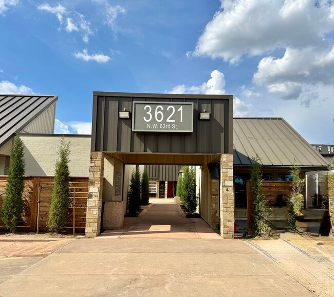
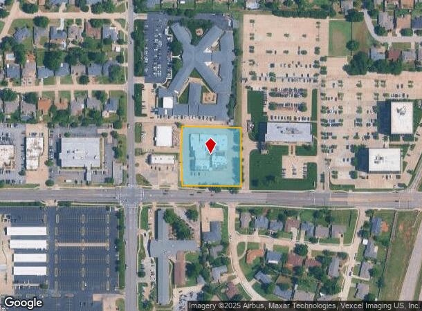
3621 Nw 63Rd St
123170010
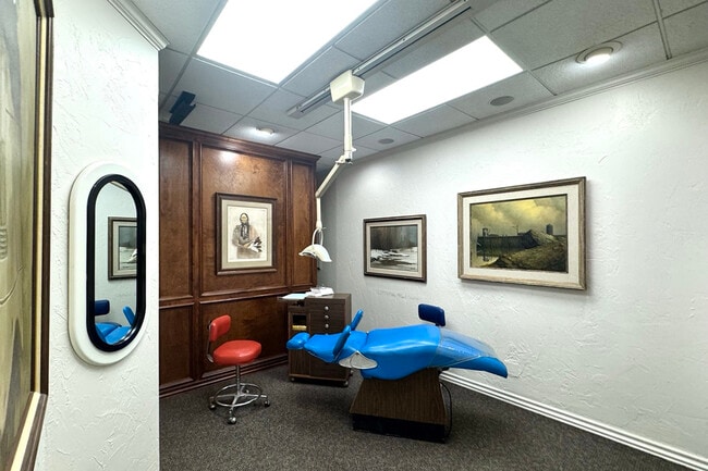
3621 Building Dental Condo
Medicalbuilding
3621 BUILDING DENTAL CONDO 000 000 UNIT A 1
X
Oklahoma
40109C0165H
Oklahoma
2023
0.23 AC
2024
Northwest
106608
Oklahoma City
2,426 SF
Oklahoma City, OK
DEMOGRAPHICS near 3621 Nw 63Rd St
1 Mile
3 Mile
5 Mile
2024 Total Population
9,647
88,018
247,867
2029 Population
9,886
90,214
254,556
Pop Growth 2024-2029
+ 2.48%
+ 2.49%
+ 2.70%
Average Age
41
39
38
2024 Total Households
4,630
39,229
108,499
HH Growth 2024-2029
+ 2.61%
+ 2.59%
+ 2.79%
Median Household Inc
$54,517
$55,461
$53,050
Avg Household Size
2.00
2.20
2.20
2024 Avg HH Vehicles
2.00
2.00
2.00
Median Home Value
$180,706
$180,002
$179,398
Median Year Built
1965
1964
1969
Nearby Places
- Restaurants
- Banks
- Shops
- Fitness
- Groceries
PUBLIC TRANSPORTATION
COMMUTER RAIL
Oklahoma City (Heartland Flyer - Amtrak)
DRIVE
WALK
Distance
Oklahoma City (Heartland Flyer - Amtrak)
14 min
9.8 mi
AIRPORT
Will Rogers World
DRIVE
WALK
Distance
Will Rogers World
22 min
11.7 mi
Freight Ports
Tulsa Port Of Catoosa
DRIVE
WALK
Distance
Tulsa Port Of Catoosa
136 min
124.2 mi
Nearby Properties
Address
Land Use
TOTAL SIZE
Lot Size
Zoning
Address
Land Use
TOTAL SIZE
Lot Size
Zoning
819,976 SF
21.87 AC
C-3
Address
Land Use
TOTAL SIZE
Lot Size
Zoning
467,216 SF
66.90 AC
C-3
Address
Land Use
TOTAL SIZE
Lot Size
Zoning
44,519 SF
3.39 AC
SPUD
Address
Land Use
TOTAL SIZE
Lot Size
Zoning
312,308 SF
9.76 AC
C-3
Address
Land Use
TOTAL SIZE
Lot Size
Zoning
90,059 SF
14.99 AC
O-2
Address
Land Use
TOTAL SIZE
Lot Size
Zoning
430,092 SF
17.35 AC
R-4
Address
Land Use
TOTAL SIZE
Lot Size
Zoning
202,147 SF
44.36 AC
PUD
Address
Land Use
TOTAL SIZE
Lot Size
Zoning
485,764 SF
6.05 AC
C-3
Address
Land Use
TOTAL SIZE
Lot Size
Zoning
452,123 SF
5.64 AC
O-2
Address
Land Use
TOTAL SIZE
Lot Size
Zoning
10,922 SF
1.04 AC
SPUD
Address
Land Use
TOTAL SIZE
Lot Size
Zoning
641,860 SF
62.12 AC
R-4
Address
Land Use
TOTAL SIZE
Lot Size
Zoning
28,099 SF
1.21 AC
O-2
Address
Land Use
TOTAL SIZE
Lot Size
Zoning
49,950 SF
3.69 AC
Address
Land Use
TOTAL SIZE
Lot Size
Zoning
21,111 SF
2.57 AC
R-4
Address
Land Use
TOTAL SIZE
Lot Size
Zoning
347,288 SF
19 AC
C-3
Address
Land Use
TOTAL SIZE
Lot Size
Zoning
29,274 SF
0.93 AC
C-3
Address
Land Use
TOTAL SIZE
Lot Size
Zoning
244,699 SF
11.83 AC
C-3
Address
Land Use
TOTAL SIZE
Lot Size
Zoning
681,708 SF
20.54 AC
C-3
Address
Land Use
TOTAL SIZE
Lot Size
Zoning
164,880 SF
8.95 AC
O-2
Address
Land Use
TOTAL SIZE
Lot Size
Zoning
285,771 SF
8.64 AC
PUD
Address
Land Use
TOTAL SIZE
Lot Size
Zoning
69,370 SF
O-2
Address
Land Use
TOTAL SIZE
Lot Size
Zoning
1 SF
3.72 AC
C-3
Address
Land Use
TOTAL SIZE
Lot Size
Zoning
327,372 SF
14.79 AC
R-4
Address
Land Use
TOTAL SIZE
Lot Size
Zoning
167,057 SF
2.62 AC
PUD
Address
Land Use
TOTAL SIZE
Lot Size
Zoning
370,066 SF
6.83 AC
O-2
Address
Land Use
TOTAL SIZE
Lot Size
Zoning
14,720 SF
0.81 AC
C-3
Address
Land Use
TOTAL SIZE
Lot Size
Zoning
259,024 SF
28.32 AC
R-4
Address
Land Use
TOTAL SIZE
Lot Size
Zoning
220,766 SF
17.65 AC
PUD
Address
Land Use
TOTAL SIZE
Lot Size
Zoning
66,965 SF
14.76 AC
SPUD
Address
Land Use
TOTAL SIZE
Lot Size
Zoning
252,731 SF
7.39 AC
C-3
The World's #1 Commercial Real Estate Marketplace
Connect with us
© 2025 CoStar Group
The information above has been obtained from sources believed reliable. While we do not doubt its accuracy we have not verified it and make no guarantee, warranty or representation about it. It is your responsibility to independently confirm its accuracy and completeness. Any projections, opinions, assumptions, or estimates used are for example only and do not represent the current or future performance of the property. The value of this transaction to you depends on tax and other factors which should be evaluated by your tax, financial, and legal advisors. You and your advisors should conduct a careful, independent investigation of the property to determine to your satisfaction the suitability of the property for your needs.