Property Record
3622 Nw 192Nd St, Oklahoma City, OK
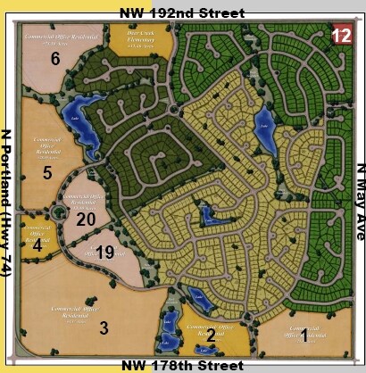

NEARBY LISTINGS FOR SALE OR LEASE
Property Detail
3622 Nw 192Nd St
Oklahoma City, OK
Deer Creek Township
168574200
DEER CREEK TOWNSHIP BLK 000 LOT 000 PT NW4 SEC 25 14N 4W BEING NW4 EX BEG NW/C TH S72.86FT E33FT NE83.54FT N33FT W105.67FT TO BEG FOR RD PURPOSES & EX BEG 447.80FT W OF NE/C NW4 TH SE65.22FT LEFT ON CURVE SE77.12FT RIGHT ON CURVE SE30.16FT LEFT ON CU
Commercialacreage
Oklahoma
X
Oklahoma
40083C0500F
25
2023
5.19 AC
2024
North Outlying
1092022095
Oklahoma City
DEMOGRAPHICS near 3622 Nw 192Nd St
1 Mile
3 Mile
5 Mile
2024 Total Population
4,661
43,900
116,940
2029 Population
4,899
45,432
120,377
Pop Growth 2024-2029
+ 5.11%
+ 3.49%
+ 2.94%
Average Age
30
35
37
2024 Total Households
1,524
15,229
46,541
HH Growth 2024-2029
+ 5.18%
+ 3.59%
+ 3.09%
Median Household Inc
$158,948
$115,273
$87,425
Avg Household Size
3.10
2.80
2.50
2024 Avg HH Vehicles
2.00
2.00
2.00
Median Home Value
$291,198
$276,848
$260,724
Median Year Built
2011
2009
2001
Nearby Places
Map Layers
Map Styles
 Street
 Aerial
- Restaurants
- Banks
- Shops
- Fitness
- Groceries
PUBLIC TRANSPORTATION
AIRPORT
Will Rogers World
DRIVE
WALK
Distance
Will Rogers World
31 min
20.8 mi
Freight Ports
Tulsa Port Of Catoosa
DRIVE
WALK
Distance
Tulsa Port Of Catoosa
135 min
124.9 mi
Nearby Properties
Address
Land Use
TOTAL SIZE
Lot Size
Zoning
Address
Land Use
TOTAL SIZE
Lot Size
Zoning
27.22 AC
PUD
Address
Land Use
TOTAL SIZE
Lot Size
Zoning
10,811 SF
1.46 AC
PUD
Address
Land Use
TOTAL SIZE
Lot Size
Zoning
151,156 SF
13.71 AC
Address
Land Use
TOTAL SIZE
Lot Size
Zoning
133,880 SF
9.70 AC
R-4
Address
Land Use
TOTAL SIZE
Lot Size
Zoning
2,086 SF
11.67 AC
PUD
Address
Land Use
TOTAL SIZE
Lot Size
Zoning
140,434 SF
18.14 AC
Address
Land Use
TOTAL SIZE
Lot Size
Zoning
154,244 SF
6.44 AC
PUD
Address
Land Use
TOTAL SIZE
Lot Size
Zoning
73,500 SF
9.93 AC
PUD
Address
Land Use
TOTAL SIZE
Lot Size
Zoning
55,073 SF
2.61 AC
SPUD
Address
Land Use
TOTAL SIZE
Lot Size
Zoning
4,413 SF
5.86 AC
R-1
Address
Land Use
TOTAL SIZE
Lot Size
Zoning
81,522 SF
5.07 AC
PUD
Address
Land Use
TOTAL SIZE
Lot Size
Zoning
35,202 SF
4.08 AC
Address
Land Use
TOTAL SIZE
Lot Size
Zoning
94,900 SF
5.36 AC
PUD
Address
Land Use
TOTAL SIZE
Lot Size
Zoning
49,266 SF
12.97 AC
PUD
Address
Land Use
TOTAL SIZE
Lot Size
Zoning
35,228 SF
3.55 AC
PUD
Address
Land Use
TOTAL SIZE
Lot Size
Zoning
15,816 SF
1.29 AC
PUD
Address
Land Use
TOTAL SIZE
Lot Size
Zoning
17,551 SF
3.44 AC
PUD
Address
Land Use
TOTAL SIZE
Lot Size
Zoning
8,423 SF
2.55 AC
PUD
Address
Land Use
TOTAL SIZE
Lot Size
Zoning
22,342 SF
5.35 AC
PUD
Address
Land Use
TOTAL SIZE
Lot Size
Zoning
86,621 SF
4.01 AC
SPUD
Address
Land Use
TOTAL SIZE
Lot Size
Zoning
113,884 SF
13.42 AC
Address
Land Use
TOTAL SIZE
Lot Size
Zoning
19,925 SF
2.51 AC
C-3
Address
Land Use
TOTAL SIZE
Lot Size
Zoning
82,993 SF
70.10 AC
I-2
Address
Land Use
TOTAL SIZE
Lot Size
Zoning
64,050 SF
21.18 AC
PUD
Address
Land Use
TOTAL SIZE
Lot Size
Zoning
21,824 SF
2.40 AC
SPUD
Address
Land Use
TOTAL SIZE
Lot Size
Zoning
27,470 SF
10.71 AC
C-3
Address
Land Use
TOTAL SIZE
Lot Size
Zoning
60,280 SF
3.33 AC
PUD
Address
Land Use
TOTAL SIZE
Lot Size
Zoning
75,310 SF
160.77 AC
Address
Land Use
TOTAL SIZE
Lot Size
Zoning
18,398 SF
1.80 AC
PUD
Address
Land Use
TOTAL SIZE
Lot Size
Zoning
42,159 SF
7.34 AC
PUD
The World's #1 Commercial Real Estate Marketplace
Connect with us
© 2026 CoStar Group
The information above has been obtained from sources believed reliable. While we do not doubt its accuracy we have not verified it and make no guarantee, warranty or representation about it. It is your responsibility to independently confirm its accuracy and completeness. Any projections, opinions, assumptions, or estimates used are for example only and do not represent the current or future performance of the property. The value of this transaction to you depends on tax and other factors which should be evaluated by your tax, financial, and legal advisors. You and your advisors should conduct a careful, independent investigation of the property to determine to your satisfaction the suitability of the property for your needs.