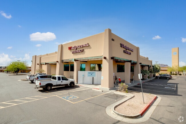
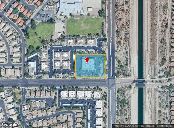
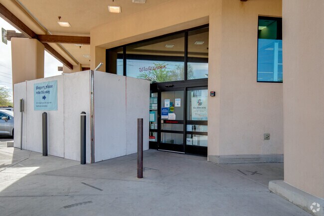
Property Record
3624 N Power Rd, Mesa, AZ 85215
NEARBY LISTINGS FOR SALE OR LEASE
Property Detail
3624 N Power Rd
141-70-722L
91St Avenue And Indian School Evergreen
Storebuilding
TH PT SE4 SEC 25 DAF COM AT SE COR SD SEC TH W 413.68F TH N 65 TO POB TH CONT N 266F TH E 338.67F TH S 246.02F TO TAN CUR CONC NW TH SWLY ALG SD CUR 31.39F TO PT ON FUTURE N 65F R/W E THOMAS RD TH W 318.69F TO POB
X
Maricopa
04013C2285L
Arizona
2025
2.07 AC
2025
Red Mountain/Mesa
420207
Phoenix
14,912 SF
Phoenix-Mesa-Chandler, AZ
DEMOGRAPHICS near 3624 N Power Rd
1 Mile
3 Mile
5 Mile
2024 Total Population
10,428
41,416
104,673
2029 Population
11,388
45,480
113,952
Pop Growth 2024-2029
+ 9.21%
+ 9.81%
+ 8.86%
Average Age
46
47
45
2024 Total Households
4,103
17,070
42,338
HH Growth 2024-2029
+ 9.24%
+ 10.05%
+ 9.14%
Median Household Inc
$119,869
$97,491
$83,062
Avg Household Size
2.50
2.40
2.40
2024 Avg HH Vehicles
2.00
2.00
2.00
Median Home Value
$464,169
$442,779
$383,986
Median Year Built
1996
1995
1992
Nearby Places
Map Layers
Map Styles
 Street
 Aerial
- Restaurants
- Banks
- Shops
- Fitness
- Groceries
PUBLIC TRANSPORTATION
AIRPORT
Phoenix-Mesa Gateway
DRIVE
WALK
Distance
Phoenix-Mesa Gateway
25 min
13.5 mi
Phoenix Sky Harbor International
DRIVE
WALK
Distance
Phoenix Sky Harbor International
28 min
20.8 mi
Nearby Properties
Address
Land Use
TOTAL SIZE
Lot Size
Zoning
Address
Land Use
TOTAL SIZE
Lot Size
Zoning
29.74 AC
Address
Land Use
TOTAL SIZE
Lot Size
Zoning
22.19 AC
Address
Land Use
TOTAL SIZE
Lot Size
Zoning
1,217,466 SF
102.41 AC
I-1
Address
Land Use
TOTAL SIZE
Lot Size
Zoning
22.71 AC
Address
Land Use
TOTAL SIZE
Lot Size
Zoning
122,042 SF
15.79 AC
PF
Address
Land Use
TOTAL SIZE
Lot Size
Zoning
242,794 SF
14.29 AC
PEP
Address
Land Use
TOTAL SIZE
Lot Size
Zoning
158,514 SF
21.39 AC
Address
Land Use
TOTAL SIZE
Lot Size
Zoning
359,204 SF
40.94 AC
LI
Address
Land Use
TOTAL SIZE
Lot Size
Zoning
214,197 SF
10.43 AC
RM3
Address
Land Use
TOTAL SIZE
Lot Size
Zoning
187,297 SF
3.99 AC
R-9
Address
Land Use
TOTAL SIZE
Lot Size
Zoning
4.79 AC
Address
Land Use
TOTAL SIZE
Lot Size
Zoning
125,534 SF
19.59 AC
I-2
Address
Land Use
TOTAL SIZE
Lot Size
Zoning
146,107 SF
10.12 AC
LI
Address
Land Use
TOTAL SIZE
Lot Size
Zoning
157,048 SF
10.75 AC
Address
Land Use
TOTAL SIZE
Lot Size
Zoning
157,592 SF
6.31 AC
C-G
Address
Land Use
TOTAL SIZE
Lot Size
Zoning
209,538 SF
13.47 AC
M-M
Address
Land Use
TOTAL SIZE
Lot Size
Zoning
168,861 SF
66.90 AC
R-90
Address
Land Use
TOTAL SIZE
Lot Size
Zoning
131,179 SF
13.24 AC
C-G
Address
Land Use
TOTAL SIZE
Lot Size
Zoning
71,524 SF
9.25 AC
R-9
Address
Land Use
TOTAL SIZE
Lot Size
Zoning
304.07 AC
GI
Address
Land Use
TOTAL SIZE
Lot Size
Zoning
62,922 SF
10 AC
R-90
Address
Land Use
TOTAL SIZE
Lot Size
Zoning
128,723 SF
2.67 AC
M-H
Address
Land Use
TOTAL SIZE
Lot Size
Zoning
108,937 SF
12.11 AC
C-G
Address
Land Use
TOTAL SIZE
Lot Size
Zoning
79,436 SF
6.84 AC
C-G
Address
Land Use
TOTAL SIZE
Lot Size
Zoning
126,947 SF
10.02 AC
LC
Address
Land Use
TOTAL SIZE
Lot Size
Zoning
60,779 SF
7.21 AC
LC
Address
Land Use
TOTAL SIZE
Lot Size
Zoning
93,358 SF
4.14 AC
I-1
Address
Land Use
TOTAL SIZE
Lot Size
Zoning
71,000 SF
13.20 AC
R-9
Address
Land Use
TOTAL SIZE
Lot Size
Zoning
63,935 SF
3.12 AC
Address
Land Use
TOTAL SIZE
Lot Size
Zoning
68,011 SF
9.63 AC
R-7
The World's #1 Commercial Real Estate Marketplace
Connect with us
© 2026 CoStar Group
The information above has been obtained from sources believed reliable. While we do not doubt its accuracy we have not verified it and make no guarantee, warranty or representation about it. It is your responsibility to independently confirm its accuracy and completeness. Any projections, opinions, assumptions, or estimates used are for example only and do not represent the current or future performance of the property. The value of this transaction to you depends on tax and other factors which should be evaluated by your tax, financial, and legal advisors. You and your advisors should conduct a careful, independent investigation of the property to determine to your satisfaction the suitability of the property for your needs.