Property Record
3625 Alleghany Dr, Salem, VA 24153


Property Detail
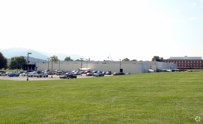
3625 Alleghany Dr
055.10-04-44
PT LTS 1 2 & 3 WHITE EST
Manufacturinglight
ROANOKE
I1
Virginia
B and X Area of moderate flood hazard, usually the area between the limits of the 100-year and 500-year floods.
1
2025
29.72 AC
2025
Northwest Roanoke
030300
Roanoke
123,361 SF
Roanoke, VA
NEARBY LISTINGS FOR SALE OR LEASE
DEMOGRAPHICS near 3625 Alleghany Dr
1 mile
3 mile
5 mile
2025 Total Population
3,166
14,144
34,057
2030 Population
3,198
14,347
34,676
Pop Growth 2025-2030
+ 1.01%
+ 1.44%
+ 1.82%
Average Age
46
45
43
2025 Total Households
1,294
5,554
13,249
HH Growth 2025-2030
+ 1.08%
+ 1.53%
+ 1.96%
Median Household Inc
$74,505
$86,412
$79,801
Avg Household Size
2.30
2.40
2.30
2025 Avg HH Vehicles
2.00
2.00
2.00
Median Home Value
$237,759
$270,256
$289,923
Median Year Built
1974
1975
1973
Nearby Places
Map Layers
Map Styles
 Street
 Aerial
Layers
 Traffic
 Biking
Places
Listings with unknown addresses are not visible on the map
- Restaurants
- Banks
- Shops
- Fitness
- Groceries
PUBLIC TRANSPORTATION
AIRPORT
Roanoke/Blacksburg Regional (Woodrum Field)
Drive
Walk
Distance
Roanoke/Blacksburg Regional (Woodrum Field)
24 min
13.5 mi
Freight Ports
Virginia Port Authority - Richmond
Drive
Walk
Distance
Virginia Port Authority - Richmond
226 min
197.4 mi
Nearby Properties
Address
Land Use
TOTAL SIZE
Lot Size
Zoning
Address
Land Use
TOTAL SIZE
Lot Size
Zoning
288,464 SF
40.14 AC
RSF
Address
Land Use
TOTAL SIZE
Lot Size
Zoning
78,701 SF
31.20 AC
C2S
Address
Land Use
TOTAL SIZE
Lot Size
Zoning
103,882 SF
93.53 AC
R1S
Address
Land Use
TOTAL SIZE
Lot Size
Zoning
95,349 SF
10.25 AC
RSF
Address
Land Use
TOTAL SIZE
Lot Size
Zoning
138,887 SF
13.03 AC
HBD
Address
Land Use
TOTAL SIZE
Lot Size
Zoning
394,937 SF
25.15 AC
I2
Address
Land Use
TOTAL SIZE
Lot Size
Zoning
161,757 SF
13.22 AC
HBD
Address
Land Use
TOTAL SIZE
Lot Size
Zoning
47,451 SF
1.58 AC
RB
Address
Land Use
TOTAL SIZE
Lot Size
Zoning
314,182 SF
22.87 AC
HM
Address
Land Use
TOTAL SIZE
Lot Size
Zoning
278,331 SF
134.03 AC
I2
Address
Land Use
TOTAL SIZE
Lot Size
Zoning
87,526 SF
4.12 AC
RMF
Address
Land Use
TOTAL SIZE
Lot Size
Zoning
178,638 SF
12.01 AC
HBD
Address
Land Use
TOTAL SIZE
Lot Size
Zoning
52,011 SF
11.63 AC
HM
Address
Land Use
TOTAL SIZE
Lot Size
Zoning
76,720 SF
4.90 AC
C2S
Address
Land Use
TOTAL SIZE
Lot Size
Zoning
6,617.90 AC
AG3
Address
Land Use
TOTAL SIZE
Lot Size
Zoning
52,390 SF
8.77 AC
C2S
Address
Land Use
TOTAL SIZE
Lot Size
Zoning
50,708 SF
5.75 AC
C2S
Address
Land Use
TOTAL SIZE
Lot Size
Zoning
74,168 SF
7.10 AC
HBD
Address
Land Use
TOTAL SIZE
Lot Size
Zoning
33,166 SF
30.20 AC
HM
Address
Land Use
TOTAL SIZE
Lot Size
Zoning
226,506 SF
35.41 AC
HM
Address
Land Use
TOTAL SIZE
Lot Size
Zoning
257,395 SF
33.20 AC
I2
Address
Land Use
TOTAL SIZE
Lot Size
Zoning
39,930 SF
2.61 AC
HBD
Address
Land Use
TOTAL SIZE
Lot Size
Zoning
43,212 SF
7.99 AC
I2
Address
Land Use
TOTAL SIZE
Lot Size
Zoning
2,400 SF
7.20 AC
HBD
Address
Land Use
TOTAL SIZE
Lot Size
Zoning
65,496 SF
22.03 AC
I2
Address
Land Use
TOTAL SIZE
Lot Size
Zoning
58,792 SF
3.38 AC
HBD
Address
Land Use
TOTAL SIZE
Lot Size
Zoning
74,314 SF
3.21 AC
HBDLM
Address
Land Use
TOTAL SIZE
Lot Size
Zoning
59,702 SF
9 AC
RSF
Address
Land Use
TOTAL SIZE
Lot Size
Zoning
53,176 SF
4.18 AC
RSF
The World's #1 Commercial Real Estate Marketplace
Connect with us
© 2026 CoStar Group
The information above has been obtained from sources believed reliable. While we do not doubt its accuracy we have not verified it and make no guarantee, warranty or representation about it. It is your responsibility to independently confirm its accuracy and completeness. Any projections, opinions, assumptions, or estimates used are for example only and do not represent the current or future performance of the property. The value of this transaction to you depends on tax and other factors which should be evaluated by your tax, financial, and legal advisors. You and your advisors should conduct a careful, independent investigation of the property to determine to your satisfaction the suitability of the property for your needs.