Property Record
3627 N State Highway H, Springfield, MO 65803

Save to a Folder
{{folder.Name}}
{{folder.ListingIds.length}} Properties
{{folder.ListingIds.length}} Property
Create a New Folder
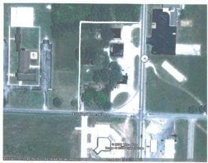
Property Detail
3627 N State Highway H
Springfield, MO
3.4A M/L BEG 69.26 FT N & 74.69 FT W SE COR NWFR1/4 LOT 5 WLY 79.16 FT W 286.61 FT N 392.03 FT E 394.24 FT S 113.94 FT SLY 94.09 FT S 56.47 FT SLY 96.88 FT TO BEG 6/29/21
12-06-102-226
GREENE
Storebuilding
Missouri
INC.
5
B and X Area of moderate flood hazard, usually the area between the limits of the 100-year and 500-year floods.
3.40 AC
2025
Outlying Greene County
2025
Springfield
004401
NEARBY LISTINGS FOR SALE OR LEASE
DEMOGRAPHICS near 3627 N State Highway H
1 mile
3 mile
5 mile
2025 Total Population
4,536
30,884
87,902
2030 Population
4,615
31,754
90,697
Pop Growth 2025-2030
+ 1.74%
+ 2.82%
+ 3.18%
Average Age
45
39
37
2025 Total Households
2,045
13,118
37,387
HH Growth 2025-2030
+ 1.76%
+ 3.00%
+ 3.44%
Median Household Inc
$58,425
$47,990
$44,286
Avg Household Size
2.10
2.20
2.10
2025 Avg HH Vehicles
2.00
2.00
2.00
Median Home Value
$225,895
$168,152
$177,083
Median Year Built
1984
1974
1974
Nearby Places
Map Layers
Map Styles
 Street
 Aerial
Layers
 Traffic
 Biking
Places
Listings with unknown addresses are not visible on the map
- Restaurants
- Banks
- Shops
- Fitness
- Groceries
PUBLIC TRANSPORTATION
AIRPORT
Springfield-Branson Ntl
Drive
Walk
Distance
Springfield-Branson Ntl
20 min
11.8 mi
Freight Ports
Tulsa Port of Inola
Drive
Walk
Distance
Tulsa Port of Inola
193 min
174.2 mi
SALE & LEASE HISTORY
LISTING DATE
SALE/LEASE

Sep 25, 2016
For Lease
Sep 24, 2016
For Sale
Sep 24, 2016
For Sale
Nearby Properties
Address
Land Use
TOTAL SIZE
Lot Size
Zoning
Address
Land Use
TOTAL SIZE
Lot Size
Zoning
35.56 AC
INC
Address
Land Use
TOTAL SIZE
Lot Size
Zoning
22.01 AC
INC.
Address
Land Use
TOTAL SIZE
Lot Size
Zoning
1,728,457 SF
123.60 AC
INC
Address
Land Use
TOTAL SIZE
Lot Size
Zoning
340,000 SF
37.93 AC
INC
Address
Land Use
TOTAL SIZE
Lot Size
Zoning
359,020 SF
14 AC
INC
Address
Land Use
TOTAL SIZE
Lot Size
Zoning
349,216 SF
29.46 AC
INC
Address
Land Use
TOTAL SIZE
Lot Size
Zoning
5.84 AC
INC
Address
Land Use
TOTAL SIZE
Lot Size
Zoning
24.54 AC
INC.
Address
Land Use
TOTAL SIZE
Lot Size
Zoning
1,825 SF
4.31 AC
INC
Address
Land Use
TOTAL SIZE
Lot Size
Zoning
5.47 AC
INC
Address
Land Use
TOTAL SIZE
Lot Size
Zoning
143,774 SF
5.85 AC
INC
Address
Land Use
TOTAL SIZE
Lot Size
Zoning
290,844 SF
20.78 AC
INC
Address
Land Use
TOTAL SIZE
Lot Size
Zoning
127,740 SF
27.70 AC
INC
Address
Land Use
TOTAL SIZE
Lot Size
Zoning
92,702 SF
42.54 AC
INC
Address
Land Use
TOTAL SIZE
Lot Size
Zoning
20.11 AC
INC
Address
Land Use
TOTAL SIZE
Lot Size
Zoning
186,125 SF
21.09 AC
INC
Address
Land Use
TOTAL SIZE
Lot Size
Zoning
2.75 AC
INC
Address
Land Use
TOTAL SIZE
Lot Size
Zoning
79.50 AC
INC
Address
Land Use
TOTAL SIZE
Lot Size
Zoning
4.62 AC
INC
Address
Land Use
TOTAL SIZE
Lot Size
Zoning
32.40 AC
INC
Address
Land Use
TOTAL SIZE
Lot Size
Zoning
1.69 AC
INC
Address
Land Use
TOTAL SIZE
Lot Size
Zoning
136,629 SF
26.79 AC
INC
Address
Land Use
TOTAL SIZE
Lot Size
Zoning
10.76 AC
INC
Address
Land Use
TOTAL SIZE
Lot Size
Zoning
16.08 AC
Address
Land Use
TOTAL SIZE
Lot Size
Zoning
75.07 AC
INC
Address
Land Use
TOTAL SIZE
Lot Size
Zoning
154,635 SF
9.16 AC
INC
Address
Land Use
TOTAL SIZE
Lot Size
Zoning
29.69 AC
INC
Address
Land Use
TOTAL SIZE
Lot Size
Zoning
Address
Land Use
TOTAL SIZE
Lot Size
Zoning
7.66 AC
INC
Address
Land Use
TOTAL SIZE
Lot Size
Zoning
5.31 AC
INC
The World's #1 Commercial Real Estate Marketplace
Connect with us
© 2026 CoStar Group
The information above has been obtained from sources believed reliable. While we do not doubt its accuracy we have not verified it and make no guarantee, warranty or representation about it. It is your responsibility to independently confirm its accuracy and completeness. Any projections, opinions, assumptions, or estimates used are for example only and do not represent the current or future performance of the property. The value of this transaction to you depends on tax and other factors which should be evaluated by your tax, financial, and legal advisors. You and your advisors should conduct a careful, independent investigation of the property to determine to your satisfaction the suitability of the property for your needs.