Property Record
363 S Main St, Alpine, UT 84004

Property Detail
363 S Main St
Provo-Orem-Lehi, UT
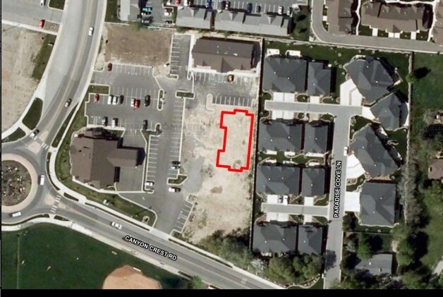
LOT D, PLAT A, ALPINE OLDE TOWNE CENTRE AMENDED SUB AREA 0.142 AC.
34-578-0004
UTAH
Officebuilding
Utah
2024
d
2025
0.14 AC
010209
Utah County
19,208 SF
Salt Lake City
NEARBY LISTINGS FOR SALE OR LEASE
-
-
View all Alpine listings for sale on LoopNet.com
DEMOGRAPHICS near 363 S Main St
1 mile
3 mile
5 mile
2025 Total Population
7,206
40,294
104,982
2030 Population
7,835
44,237
114,982
Pop Growth 2025-2030
+ 8.73%
+ 9.79%
+ 9.53%
Average Age
36
35
34
2025 Total Households
1,915
10,209
27,497
HH Growth 2025-2030
+ 9.45%
+ 10.56%
+ 10.25%
Median Household Inc
$161,550
$166,056
$148,773
Avg Household Size
3.80
3.90
3.80
2025 Avg HH Vehicles
3.00
3.00
3.00
Median Home Value
$855,276
$848,914
$766,276
Median Year Built
1999
2003
2003
Nearby Places
Map Layers
Map Styles
 Street
 Aerial
Transit
 Traffic
 Biking
Places
Listings with unknown addresses are not visible on the map
- Restaurants
- Banks
- Shops
- Fitness
- Groceries
PUBLIC TRANSPORTATION
COMMUTER RAIL
Drive
Walk
Distance
15 min
6.9 mi
Drive
Walk
Distance
14 min
8.0 mi
AIRPORT
Provo Municipal
Drive
Walk
Distance
Provo Municipal
30 min
19.7 mi
Salt Lake City International
Drive
Walk
Distance
Salt Lake City International
45 min
36.0 mi
Nearby Properties
Address
Land Use
TOTAL SIZE
Lot Size
Zoning
Address
Land Use
TOTAL SIZE
Lot Size
Zoning
165,821 SF
12.29 AC
Address
Land Use
TOTAL SIZE
Lot Size
Zoning
242,954 SF
13.54 AC
Address
Land Use
TOTAL SIZE
Lot Size
Zoning
134,728 SF
13.07 AC
Address
Land Use
TOTAL SIZE
Lot Size
Zoning
70,678 SF
4.03 AC
Address
Land Use
TOTAL SIZE
Lot Size
Zoning
43,345 SF
4.06 AC
Address
Land Use
TOTAL SIZE
Lot Size
Zoning
81,136 SF
1.85 AC
Address
Land Use
TOTAL SIZE
Lot Size
Zoning
32,740 SF
153.49 AC
Address
Land Use
TOTAL SIZE
Lot Size
Zoning
90,581 SF
3.87 AC
Address
Land Use
TOTAL SIZE
Lot Size
Zoning
52,429 SF
2.05 AC
Address
Land Use
TOTAL SIZE
Lot Size
Zoning
47,873 SF
2.24 AC
Address
Land Use
TOTAL SIZE
Lot Size
Zoning
Address
Land Use
TOTAL SIZE
Lot Size
Zoning
15,094 SF
1.73 AC
Address
Land Use
TOTAL SIZE
Lot Size
Zoning
18,918 SF
1.75 AC
Address
Land Use
TOTAL SIZE
Lot Size
Zoning
28,331 SF
5 AC
Address
Land Use
TOTAL SIZE
Lot Size
Zoning
5,954 SF
1.29 AC
Address
Land Use
TOTAL SIZE
Lot Size
Zoning
10,251 SF
1.06 AC
Address
Land Use
TOTAL SIZE
Lot Size
Zoning
14,453 SF
1.13 AC
Address
Land Use
TOTAL SIZE
Lot Size
Zoning
15,924 SF
0.98 AC
Address
Land Use
TOTAL SIZE
Lot Size
Zoning
15,206 SF
1.14 AC
Address
Land Use
TOTAL SIZE
Lot Size
Zoning
Address
Land Use
TOTAL SIZE
Lot Size
Zoning
1,953 SF
13.40 AC
Address
Land Use
TOTAL SIZE
Lot Size
Zoning
23,143 SF
11.67 AC
Address
Land Use
TOTAL SIZE
Lot Size
Zoning
4,341 SF
1.57 AC
Address
Land Use
TOTAL SIZE
Lot Size
Zoning
49,382 SF
5.19 AC
Address
Land Use
TOTAL SIZE
Lot Size
Zoning
15,552 SF
0.72 AC
Address
Land Use
TOTAL SIZE
Lot Size
Zoning
5,269 SF
2.05 AC
Address
Land Use
TOTAL SIZE
Lot Size
Zoning
Address
Land Use
TOTAL SIZE
Lot Size
Zoning
Address
Land Use
TOTAL SIZE
Lot Size
Zoning
1.94 AC
The World's #1 Commercial Real Estate Marketplace
Connect with us
© 2026 CoStar Group
The information above has been obtained from sources believed reliable. While we do not doubt its accuracy we have not verified it and make no guarantee, warranty or representation about it. It is your responsibility to independently confirm its accuracy and completeness. Any projections, opinions, assumptions, or estimates used are for example only and do not represent the current or future performance of the property. The value of this transaction to you depends on tax and other factors which should be evaluated by your tax, financial, and legal advisors. You and your advisors should conduct a careful, independent investigation of the property to determine to your satisfaction the suitability of the property for your needs.