Property Record
3635 Canfield Rd, Canfield, OH 44406

NEARBY LISTINGS FOR SALE OR LEASE
Property Detail
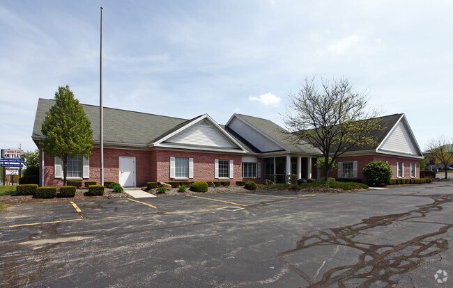
3635 Canfield Rd
Youngstown/Warren/Boardman
Lewis F Carbone Plat No 1
Youngstown-Warren-Boardman, OH-PA
LOT 3 70 X 145 L F CARBONE PL 1
48-001-0-003.00-0
Mahoning
Warehouse
Ohio
2024
3
2024
0.57 AC
812302
Mahoning County
6,402 SF
DEMOGRAPHICS near 3635 Canfield Rd
1 Mile
3 Mile
5 Mile
2024 Total Population
5,083
34,710
96,709
2029 Population
4,959
33,826
94,873
Pop Growth 2024-2029
(2.44%)
(2.55%)
(1.90%)
Average Age
45
44
43
2024 Total Households
2,382
15,628
42,644
HH Growth 2024-2029
(2.43%)
(2.60%)
(2.02%)
Median Household Inc
$71,954
$68,123
$55,847
Avg Household Size
2.10
2.20
2.20
2024 Avg HH Vehicles
2.00
2.00
2.00
Median Home Value
$246,543
$176,055
$146,494
Median Year Built
1987
1970
1965
Nearby Places
Map Layers
Map Styles
 Street
 Aerial
- Restaurants
- Banks
- Shops
- Fitness
- Groceries
SALE & LEASE HISTORY
LISTING DATE
SALE/LEASE

Nov 06, 2019
For Lease
Jun 29, 2021
For Lease
Apr 16, 2021
For Lease
Nearby Properties
Address
Land Use
TOTAL SIZE
Lot Size
Zoning
Address
Land Use
TOTAL SIZE
Lot Size
Zoning
188,134 SF
12.60 AC
R1
Address
Land Use
TOTAL SIZE
Lot Size
Zoning
127,210 SF
12.43 AC
R1
Address
Land Use
TOTAL SIZE
Lot Size
Zoning
227,713 SF
15.07 AC
Address
Land Use
TOTAL SIZE
Lot Size
Zoning
122,806 SF
9.46 AC
R1
Address
Land Use
TOTAL SIZE
Lot Size
Zoning
324,442 SF
54 AC
R1
Address
Land Use
TOTAL SIZE
Lot Size
Zoning
47,538 SF
16.14 AC
C
Address
Land Use
TOTAL SIZE
Lot Size
Zoning
101,687 SF
9.93 AC
Address
Land Use
TOTAL SIZE
Lot Size
Zoning
78,660 SF
22.36 AC
R3
Address
Land Use
TOTAL SIZE
Lot Size
Zoning
103,976 SF
16.14 AC
PUD
Address
Land Use
TOTAL SIZE
Lot Size
Zoning
100,565 SF
15.03 AC
R3
Address
Land Use
TOTAL SIZE
Lot Size
Zoning
123,472 SF
28.58 AC
R3
Address
Land Use
TOTAL SIZE
Lot Size
Zoning
63,713 SF
7.38 AC
Address
Land Use
TOTAL SIZE
Lot Size
Zoning
2.10 AC
Address
Land Use
TOTAL SIZE
Lot Size
Zoning
110,387 SF
20 AC
R3
Address
Land Use
TOTAL SIZE
Lot Size
Zoning
89,623 SF
20.45 AC
ASER
Address
Land Use
TOTAL SIZE
Lot Size
Zoning
106,276 SF
10.86 AC
Address
Land Use
TOTAL SIZE
Lot Size
Zoning
69,651 SF
2.82 AC
Address
Land Use
TOTAL SIZE
Lot Size
Zoning
81,954 SF
15 AC
R3
Address
Land Use
TOTAL SIZE
Lot Size
Zoning
49,659 SF
19.52 AC
R3
Address
Land Use
TOTAL SIZE
Lot Size
Zoning
59,999 SF
6.07 AC
B
Address
Land Use
TOTAL SIZE
Lot Size
Zoning
70,713 SF
7.73 AC
B2
Address
Land Use
TOTAL SIZE
Lot Size
Zoning
60,742 SF
10 AC
R1
Address
Land Use
TOTAL SIZE
Lot Size
Zoning
58,972 SF
23.65 AC
S
Address
Land Use
TOTAL SIZE
Lot Size
Zoning
11,472 SF
11 AC
R3
Address
Land Use
TOTAL SIZE
Lot Size
Zoning
133,122 SF
39.19 AC
R1
Address
Land Use
TOTAL SIZE
Lot Size
Zoning
43,930 SF
3.07 AC
C
Address
Land Use
TOTAL SIZE
Lot Size
Zoning
46,928 SF
12.88 AC
B2
Address
Land Use
TOTAL SIZE
Lot Size
Zoning
Address
Land Use
TOTAL SIZE
Lot Size
Zoning
25,941 SF
6.10 AC
C
Address
Land Use
TOTAL SIZE
Lot Size
Zoning
60,219 SF
5.13 AC
R3
The World's #1 Commercial Real Estate Marketplace
Connect with us
© 2025 CoStar Group
The information above has been obtained from sources believed reliable. While we do not doubt its accuracy we have not verified it and make no guarantee, warranty or representation about it. It is your responsibility to independently confirm its accuracy and completeness. Any projections, opinions, assumptions, or estimates used are for example only and do not represent the current or future performance of the property. The value of this transaction to you depends on tax and other factors which should be evaluated by your tax, financial, and legal advisors. You and your advisors should conduct a careful, independent investigation of the property to determine to your satisfaction the suitability of the property for your needs.