Property Record
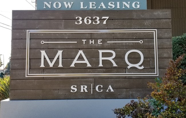
3637 Sonoma Ave, Santa Rosa, CA 95405


NEARBY LISTINGS FOR SALE OR LEASE
Property Detail
3637 Sonoma Ave
013-100-097
96 FM 13-100-92 LLA 95-0269-00 OR 95107948 & 47
Apartment
Sonoma
X
California
06097C0733E
0.73 AC
2024
Outer Santa Rosa
2025
North Bay/Santa Rosa
151702
Santa Rosa, CA
153,668 SF
DEMOGRAPHICS near 3637 Sonoma Ave
1 Mile
3 Mile
5 Mile
2024 Total Population
14,849
83,609
176,712
2029 Population
14,641
82,870
175,504
Pop Growth 2024-2029
(1.40%)
(0.88%)
(0.68%)
Average Age
44
44
42
2024 Total Households
6,113
33,786
66,529
HH Growth 2024-2029
(1.42%)
(0.93%)
(0.65%)
Median Household Inc
$99,200
$95,130
$88,842
Avg Household Size
2.30
2.40
2.60
2024 Avg HH Vehicles
2.00
2.00
2.00
Median Home Value
$742,611
$770,637
$727,362
Median Year Built
1972
1974
1979
Nearby Places
Map Layers
Map Styles
 Street
 Aerial
- Restaurants
- Banks
- Shops
- Fitness
- Groceries
PUBLIC TRANSPORTATION
COMMUTER RAIL
Santa Rosa Downtown Smart (Main Line - Sonoma Marin Area Rail Transit)
DRIVE
WALK
Distance
Santa Rosa Downtown Smart (Main Line - Sonoma Marin Area Rail Transit)
7 min
3.2 mi
Santa Rosa North Smart (Main Line - Sonoma Marin Area Rail Transit)
DRIVE
WALK
Distance
Santa Rosa North Smart (Main Line - Sonoma Marin Area Rail Transit)
10 min
4.6 mi
AIRPORT
Charles M Schulz - Sonoma County
DRIVE
WALK
Distance
Charles M Schulz - Sonoma County
18 min
10.6 mi
Freight Ports
Port of Richmond
DRIVE
WALK
Distance
Port of Richmond
67 min
51.1 mi
Nearby Properties
Address
Land Use
TOTAL SIZE
Lot Size
Zoning
Address
Land Use
TOTAL SIZE
Lot Size
Zoning
258,134 SF
7.42 AC
CITYSR
Address
Land Use
TOTAL SIZE
Lot Size
Zoning
434,911 SF
30.22 AC
Address
Land Use
TOTAL SIZE
Lot Size
Zoning
441,698 SF
10.23 AC
C2
Address
Land Use
TOTAL SIZE
Lot Size
Zoning
92,480 SF
33.80 AC
Address
Land Use
TOTAL SIZE
Lot Size
Zoning
191,385 SF
13.77 AC
C2P
Address
Land Use
TOTAL SIZE
Lot Size
Zoning
167,485 SF
7.81 AC
Address
Land Use
TOTAL SIZE
Lot Size
Zoning
74,000 SF
0.51 AC
Address
Land Use
TOTAL SIZE
Lot Size
Zoning
178,704 SF
10.76 AC
CITYSR
Address
Land Use
TOTAL SIZE
Lot Size
Zoning
90,079 SF
3.09 AC
Address
Land Use
TOTAL SIZE
Lot Size
Zoning
9,450 SF
0.76 AC
Address
Land Use
TOTAL SIZE
Lot Size
Zoning
142,297 SF
4.65 AC
Address
Land Use
TOTAL SIZE
Lot Size
Zoning
107,765 SF
5.70 AC
CITYSR
Address
Land Use
TOTAL SIZE
Lot Size
Zoning
87,750 SF
5.43 AC
Address
Land Use
TOTAL SIZE
Lot Size
Zoning
29,397 SF
6.33 AC
Address
Land Use
TOTAL SIZE
Lot Size
Zoning
122,645 SF
9.46 AC
CITYSR
Address
Land Use
TOTAL SIZE
Lot Size
Zoning
181,593 SF
0.80 AC
R3PD
Address
Land Use
TOTAL SIZE
Lot Size
Zoning
142,272 SF
0.25 AC
C2
Address
Land Use
TOTAL SIZE
Lot Size
Zoning
71,739 SF
3.14 AC
Address
Land Use
TOTAL SIZE
Lot Size
Zoning
33,698 SF
2.94 AC
CITYSR
Address
Land Use
TOTAL SIZE
Lot Size
Zoning
56,151 SF
4.21 AC
Address
Land Use
TOTAL SIZE
Lot Size
Zoning
128,092 SF
7.12 AC
Address
Land Use
TOTAL SIZE
Lot Size
Zoning
810 SF
4.19 AC
CITYSR
Address
Land Use
TOTAL SIZE
Lot Size
Zoning
62,088 SF
3.80 AC
PC
Address
Land Use
TOTAL SIZE
Lot Size
Zoning
1.94 AC
CITYSR
Address
Land Use
TOTAL SIZE
Lot Size
Zoning
78,155 SF
6.57 AC
CITYSR
Address
Land Use
TOTAL SIZE
Lot Size
Zoning
99,362 SF
0.77 AC
CITYSR
Address
Land Use
TOTAL SIZE
Lot Size
Zoning
52,150 SF
1.30 AC
R330
Address
Land Use
TOTAL SIZE
Lot Size
Zoning
160,315 SF
7.24 AC
CITYSR
Address
Land Use
TOTAL SIZE
Lot Size
Zoning
2.04 AC
CITYSR
Address
Land Use
TOTAL SIZE
Lot Size
Zoning
42,342 SF
3.96 AC
The World's #1 Commercial Real Estate Marketplace
Connect with us
© 2025 CoStar Group
The information above has been obtained from sources believed reliable. While we do not doubt its accuracy we have not verified it and make no guarantee, warranty or representation about it. It is your responsibility to independently confirm its accuracy and completeness. Any projections, opinions, assumptions, or estimates used are for example only and do not represent the current or future performance of the property. The value of this transaction to you depends on tax and other factors which should be evaluated by your tax, financial, and legal advisors. You and your advisors should conduct a careful, independent investigation of the property to determine to your satisfaction the suitability of the property for your needs.