Property Record
3638 Park St, Jacksonville, FL 32205


NEARBY LISTINGS FOR SALE OR LEASE
Property Detail
3638 Park St
Jacksonville, FL
Riverside Heights
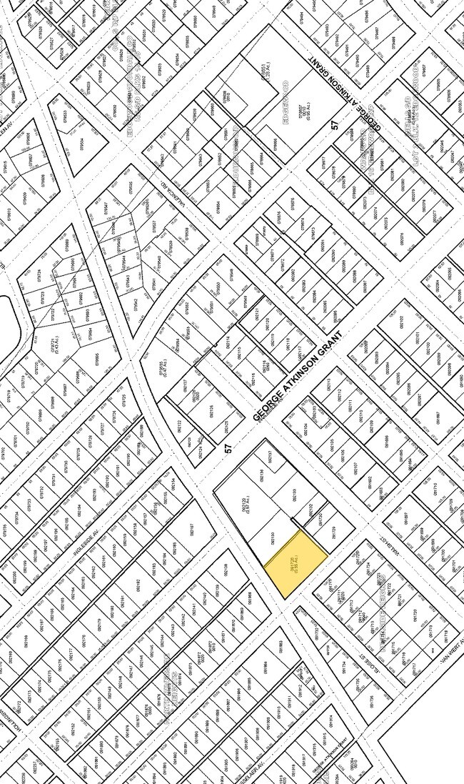
091726-0000
2-61 57-2S-26E .574 RIVERSIDE HEIGHTS LOTS 7,8,9 BLK 49, PT BLK 62, PT CLD R/W ORD#BB-153 RECD O/R 19456-1449, N 1/2 CLD ALLEY LYING S LOTS 7,8,9 BLK 49 RECD O/R 17229-1022
Restaurantbuilding
Duval
X
Florida
12031C0362J
7,8,9
2024
0.57 AC
2025
Riverside
002200
Jacksonville (Florida)
8,144 SF
DEMOGRAPHICS near 3638 Park St
1 Mile
3 Mile
5 Mile
2024 Total Population
12,488
72,219
196,644
2029 Population
13,077
76,099
207,823
Pop Growth 2024-2029
+ 4.72%
+ 5.37%
+ 5.68%
Average Age
41
39
39
2024 Total Households
6,280
32,414
82,065
HH Growth 2024-2029
+ 4.76%
+ 5.58%
+ 5.95%
Median Household Inc
$72,713
$50,257
$45,103
Avg Household Size
2.00
2.10
2.30
2024 Avg HH Vehicles
2.00
1.00
1.00
Median Home Value
$337,368
$238,976
$186,144
Median Year Built
1947
1956
1962
Nearby Places
Map Layers
Map Styles
 Street
 Aerial
- Restaurants
- Banks
- Shops
- Fitness
- Groceries
PUBLIC TRANSPORTATION
COMMUTER RAIL
DRIVE
WALK
Distance
14 min
6.3 mi
AIRPORT
Jacksonville International
DRIVE
WALK
Distance
Jacksonville International
29 min
18.4 mi
Freight Ports
Jacksonville Port
DRIVE
WALK
Distance
Jacksonville Port
16 min
8.9 mi
Nearby Properties
Address
Land Use
TOTAL SIZE
Lot Size
Zoning
Address
Land Use
TOTAL SIZE
Lot Size
Zoning
1,086,885 SF
16.83 AC
CCBD
Address
Land Use
TOTAL SIZE
Lot Size
Zoning
629,200 SF
9.64 AC
PUD
Address
Land Use
TOTAL SIZE
Lot Size
Zoning
407,122 SF
4.50 AC
CCBD
Address
Land Use
TOTAL SIZE
Lot Size
Zoning
187,278 SF
1.71 AC
CCBD
Address
Land Use
TOTAL SIZE
Lot Size
Zoning
744,280 SF
53.40 AC
RMD-D
Address
Land Use
TOTAL SIZE
Lot Size
Zoning
264,277 SF
2.07 AC
CCBD
Address
Land Use
TOTAL SIZE
Lot Size
Zoning
336,623 SF
1.98 AC
CCBD
Address
Land Use
TOTAL SIZE
Lot Size
Zoning
299,055 SF
18.93 AC
CCBD
Address
Land Use
TOTAL SIZE
Lot Size
Zoning
290,975 SF
4.49 AC
PUD
Address
Land Use
TOTAL SIZE
Lot Size
Zoning
355,967 SF
8.98 AC
PUD
Address
Land Use
TOTAL SIZE
Lot Size
Zoning
212,152 SF
8.17 AC
CCBD
Address
Land Use
TOTAL SIZE
Lot Size
Zoning
700,443 SF
8 AC
CCBD
Address
Land Use
TOTAL SIZE
Lot Size
Zoning
335,832 SF
6.67 AC
PBF-2
Address
Land Use
TOTAL SIZE
Lot Size
Zoning
352,439 SF
3.40 AC
CCBD
Address
Land Use
TOTAL SIZE
Lot Size
Zoning
888,083 SF
46.65 AC
IL
Address
Land Use
TOTAL SIZE
Lot Size
Zoning
225,440 SF
4.68 AC
PUD
Address
Land Use
TOTAL SIZE
Lot Size
Zoning
222,138 SF
13.18 AC
IL
Address
Land Use
TOTAL SIZE
Lot Size
Zoning
255,405 SF
1.91 AC
PUD
Address
Land Use
TOTAL SIZE
Lot Size
Zoning
184,092 SF
21.69 AC
CCG-1
Address
Land Use
TOTAL SIZE
Lot Size
Zoning
291,338 SF
37 AC
PBF-1
Address
Land Use
TOTAL SIZE
Lot Size
Zoning
290,597 SF
27.84 AC
RMD-D
Address
Land Use
TOTAL SIZE
Lot Size
Zoning
594,573 SF
27.69 AC
IL
Address
Land Use
TOTAL SIZE
Lot Size
Zoning
233,363 SF
20.36 AC
PUD
Address
Land Use
TOTAL SIZE
Lot Size
Zoning
147,066 SF
3.30 AC
PUD
Address
Land Use
TOTAL SIZE
Lot Size
Zoning
310,972 SF
19.91 AC
RMD-D
Address
Land Use
TOTAL SIZE
Lot Size
Zoning
416,674 SF
18.38 AC
RMD-D
Address
Land Use
TOTAL SIZE
Lot Size
Zoning
72,080 SF
4.19 AC
CCBD
Address
Land Use
TOTAL SIZE
Lot Size
Zoning
215,090 SF
4.24 AC
CCBD
Address
Land Use
TOTAL SIZE
Lot Size
Zoning
186,773 SF
9.77 AC
CCG-2
Address
Land Use
TOTAL SIZE
Lot Size
Zoning
100,600 SF
1.31 AC
PUD
The World's #1 Commercial Real Estate Marketplace
Connect with us
© 2025 CoStar Group
The information above has been obtained from sources believed reliable. While we do not doubt its accuracy we have not verified it and make no guarantee, warranty or representation about it. It is your responsibility to independently confirm its accuracy and completeness. Any projections, opinions, assumptions, or estimates used are for example only and do not represent the current or future performance of the property. The value of this transaction to you depends on tax and other factors which should be evaluated by your tax, financial, and legal advisors. You and your advisors should conduct a careful, independent investigation of the property to determine to your satisfaction the suitability of the property for your needs.