Property Record
3640 150Th Ave Ne, Redmond, WA 98052


NEARBY LISTINGS FOR SALE OR LEASE
Property Detail
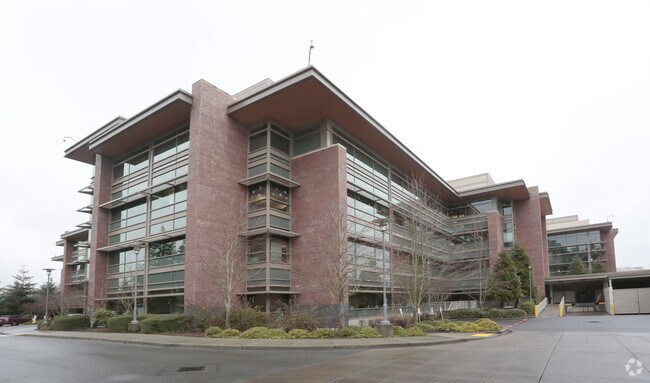
3640 150Th Ave Ne
Seattle-Tacoma-Bellevue, WA
Microsoft West Campus Bsp
550350-0040
MICROSOFT WEST CAMPUS BSP
Officebuilding
King
X
Washington
53033C0369G
4
2025
5.05 AC
2024
520 Corridor
032331
Seattle/Puget Sound
265,753 SF
DEMOGRAPHICS near 3640 150Th Ave Ne
1 Mile
3 Mile
5 Mile
2024 Total Population
18,327
125,748
267,871
2029 Population
18,721
127,661
271,431
Pop Growth 2024-2029
+ 2.15%
+ 1.52%
+ 1.33%
Average Age
35
37
38
2024 Total Households
8,072
51,584
109,002
HH Growth 2024-2029
+ 2.49%
+ 1.63%
+ 1.42%
Median Household Inc
$136,126
$145,243
$156,222
Avg Household Size
2.20
2.40
2.40
2024 Avg HH Vehicles
1.00
2.00
2.00
Median Home Value
$1,048,994
$1,010,208
$1,046,763
Median Year Built
1987
1984
1987
Nearby Places
Map Layers
Map Styles
 Street
 Aerial
- Restaurants
- Banks
- Shops
- Fitness
- Groceries
PUBLIC TRANSPORTATION
AIRPORT
Seattle-Tacoma International
DRIVE
WALK
Distance
Seattle-Tacoma International
32 min
21.3 mi
Seattle Paine Field International
DRIVE
WALK
Distance
Seattle Paine Field International
36 min
22.9 mi
Freight Ports
Port of Seattle
DRIVE
WALK
Distance
Port of Seattle
27 min
17.0 mi
Nearby Properties
Address
Land Use
TOTAL SIZE
Lot Size
Zoning
Address
Land Use
TOTAL SIZE
Lot Size
Zoning
482,658 SF
5.78 AC
BR-CR
Address
Land Use
TOTAL SIZE
Lot Size
Zoning
134,200 SF
4.04 AC
DT-OLB-N
Address
Land Use
TOTAL SIZE
Lot Size
Zoning
146,798 SF
19.63 AC
OBAT
Address
Land Use
TOTAL SIZE
Lot Size
Zoning
353,024 SF
3.19 AC
OV
Address
Land Use
TOTAL SIZE
Lot Size
Zoning
424,532 SF
30.49 AC
OUMF
Address
Land Use
TOTAL SIZE
Lot Size
Zoning
10,500 SF
2.33 AC
BR-RC-2
Address
Land Use
TOTAL SIZE
Lot Size
Zoning
188,062 SF
0.91 AC
DNTN-MU
Address
Land Use
TOTAL SIZE
Lot Size
Zoning
274,912 SF
3.25 AC
BR-RC-3
Address
Land Use
TOTAL SIZE
Lot Size
Zoning
355,212 SF
19.10 AC
R-30
Address
Land Use
TOTAL SIZE
Lot Size
Zoning
457,543 SF
1.83 AC
OV
Address
Land Use
TOTAL SIZE
Lot Size
Zoning
342,000 SF
24.18 AC
OUMF
Address
Land Use
TOTAL SIZE
Lot Size
Zoning
324,656 SF
15.40 AC
R-30
Address
Land Use
TOTAL SIZE
Lot Size
Zoning
231,088 SF
2.10 AC
TWNC
Address
Land Use
TOTAL SIZE
Lot Size
Zoning
270,158 SF
3.03 AC
TSQ
Address
Land Use
TOTAL SIZE
Lot Size
Zoning
135,130 SF
18.59 AC
BR-OR-2
Address
Land Use
TOTAL SIZE
Lot Size
Zoning
279,488 SF
20.82 AC
NMF
Address
Land Use
TOTAL SIZE
Lot Size
Zoning
209,322 SF
1.45 AC
OV
Address
Land Use
TOTAL SIZE
Lot Size
Zoning
282,532 SF
16.57 AC
NMF
Address
Land Use
TOTAL SIZE
Lot Size
Zoning
230,400 SF
1.26 AC
OV
Address
Land Use
TOTAL SIZE
Lot Size
Zoning
36,470 SF
38.01 AC
R-4
Address
Land Use
TOTAL SIZE
Lot Size
Zoning
209,400 SF
1.80 AC
TSQ
Address
Land Use
TOTAL SIZE
Lot Size
Zoning
65,000 SF
13.57 AC
EH
Address
Land Use
TOTAL SIZE
Lot Size
Zoning
298,849 SF
3.99 AC
OBAT
Address
Land Use
TOTAL SIZE
Lot Size
Zoning
300,628 SF
4.43 AC
OBAT
Address
Land Use
TOTAL SIZE
Lot Size
Zoning
240 SF
471.44 AC
R1
Address
Land Use
TOTAL SIZE
Lot Size
Zoning
10,192 SF
16.47 AC
BR-OR-2
Address
Land Use
TOTAL SIZE
Lot Size
Zoning
393,897 SF
10.05 AC
OBAT
Address
Land Use
TOTAL SIZE
Lot Size
Zoning
229,460 SF
1.53 AC
OV
Address
Land Use
TOTAL SIZE
Lot Size
Zoning
125,996 SF
7.57 AC
TWNC
Address
Land Use
TOTAL SIZE
Lot Size
Zoning
230,061 SF
1.60 AC
OV
The World's #1 Commercial Real Estate Marketplace
Connect with us
© 2026 CoStar Group
The information above has been obtained from sources believed reliable. While we do not doubt its accuracy we have not verified it and make no guarantee, warranty or representation about it. It is your responsibility to independently confirm its accuracy and completeness. Any projections, opinions, assumptions, or estimates used are for example only and do not represent the current or future performance of the property. The value of this transaction to you depends on tax and other factors which should be evaluated by your tax, financial, and legal advisors. You and your advisors should conduct a careful, independent investigation of the property to determine to your satisfaction the suitability of the property for your needs.