Property Record
3643 80Th Ave, Zeeland, MI 49464


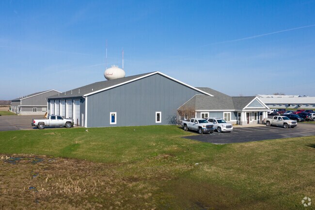
Property Detail
3643 80Th Ave
70-17-08-200-006
S 1/2 OF SE 1/4 OF NE 1/4, EXC COM E 1/4 COR, TH N 89D 34M 15S W 660 FT, N 0D 12M 27S W 330 FT S 89D 34M 15S E 660 FT, TH S
Autorepair
Ottawa
I
Michigan
B and X Area of moderate flood hazard, usually the area between the limits of the 100-year and 500-year floods.
14.67 AC
2025
Zeeland
2025
West Michigan
021903
Grand Rapids-Wyoming-Kentwood, MI
20,232 SF
NEARBY LISTINGS FOR SALE OR LEASE
-
-
View all Zeeland listings for sale on LoopNet.com
DEMOGRAPHICS near 3643 80Th Ave
1 mile
3 mile
5 mile
2025 Total Population
1,408
13,627
37,614
2030 Population
1,424
13,883
38,559
Pop Growth 2025-2030
+ 1.14%
+ 1.88%
+ 2.51%
Average Age
36
38
39
2025 Total Households
457
4,763
13,123
HH Growth 2025-2030
+ 1.31%
+ 1.99%
+ 2.62%
Median Household Inc
$78,800
$88,937
$93,103
Avg Household Size
3.00
2.80
2.80
2025 Avg HH Vehicles
2.00
2.00
2.00
Median Home Value
$282,954
$328,472
$332,124
Median Year Built
1995
1988
1993
Nearby Places
Map Layers
Map Styles
 Street
 Aerial
Layers
 Traffic
 Biking
Places
Listings with unknown addresses are not visible on the map
- Restaurants
- Banks
- Shops
- Fitness
- Groceries
PUBLIC TRANSPORTATION
COMMUTER RAIL
Drive
Walk
Distance
13 min
7.8 mi
AIRPORT
Gerald R Ford International
Drive
Walk
Distance
Gerald R Ford International
40 min
29.8 mi
Nearby Properties
Address
Land Use
TOTAL SIZE
Lot Size
Zoning
Address
Land Use
TOTAL SIZE
Lot Size
Zoning
1,134,118 SF
73.70 AC
I-2
Address
Land Use
TOTAL SIZE
Lot Size
Zoning
255,407 SF
23.18 AC
I-2
Address
Land Use
TOTAL SIZE
Lot Size
Zoning
349,583 SF
I
Address
Land Use
TOTAL SIZE
Lot Size
Zoning
716,625 SF
123.22 AC
I-2
Address
Land Use
TOTAL SIZE
Lot Size
Zoning
594,031 SF
R-1
Address
Land Use
TOTAL SIZE
Lot Size
Zoning
82,556 SF
Address
Land Use
TOTAL SIZE
Lot Size
Zoning
259,200 SF
R-1
Address
Land Use
TOTAL SIZE
Lot Size
Zoning
6,000 SF
46.50 AC
I-2
Address
Land Use
TOTAL SIZE
Lot Size
Zoning
173,176 SF
28.57 AC
I-1
Address
Land Use
TOTAL SIZE
Lot Size
Zoning
35,715 SF
Address
Land Use
TOTAL SIZE
Lot Size
Zoning
230,020 SF
Address
Land Use
TOTAL SIZE
Lot Size
Zoning
109,988 SF
12.71 AC
OS-1
Address
Land Use
TOTAL SIZE
Lot Size
Zoning
3,880 SF
80 AC
RMH
Address
Land Use
TOTAL SIZE
Lot Size
Zoning
77,624 SF
27.32 AC
I-1
Address
Land Use
TOTAL SIZE
Lot Size
Zoning
50,000 SF
20.36 AC
I-2
Address
Land Use
TOTAL SIZE
Lot Size
Zoning
181,847 SF
12.99 AC
I-1
Address
Land Use
TOTAL SIZE
Lot Size
Zoning
376,204 SF
20.10 AC
I-1
Address
Land Use
TOTAL SIZE
Lot Size
Zoning
19,966 SF
Address
Land Use
TOTAL SIZE
Lot Size
Zoning
88,093 SF
Address
Land Use
TOTAL SIZE
Lot Size
Zoning
243,795 SF
17.31 AC
AG
Address
Land Use
TOTAL SIZE
Lot Size
Zoning
Address
Land Use
TOTAL SIZE
Lot Size
Zoning
220,885 SF
10 AC
I-2
Address
Land Use
TOTAL SIZE
Lot Size
Zoning
222,251 SF
12.96 AC
I
Address
Land Use
TOTAL SIZE
Lot Size
Zoning
209,312 SF
10.01 AC
I-2
Address
Land Use
TOTAL SIZE
Lot Size
Zoning
203,840 SF
8.97 AC
I-2
Address
Land Use
TOTAL SIZE
Lot Size
Zoning
671,142 SF
Address
Land Use
TOTAL SIZE
Lot Size
Zoning
172,480 SF
14.62 AC
I
Address
Land Use
TOTAL SIZE
Lot Size
Zoning
202,238 SF
14.87 AC
I-1
Address
Land Use
TOTAL SIZE
Lot Size
Zoning
103,171 SF
4.02 AC
ON
Address
Land Use
TOTAL SIZE
Lot Size
Zoning
42,863 SF
6.15 AC
C
The World's #1 Commercial Real Estate Marketplace
Connect with us
© 2026 CoStar Group
The information above has been obtained from sources believed reliable. While we do not doubt its accuracy we have not verified it and make no guarantee, warranty or representation about it. It is your responsibility to independently confirm its accuracy and completeness. Any projections, opinions, assumptions, or estimates used are for example only and do not represent the current or future performance of the property. The value of this transaction to you depends on tax and other factors which should be evaluated by your tax, financial, and legal advisors. You and your advisors should conduct a careful, independent investigation of the property to determine to your satisfaction the suitability of the property for your needs.