Property Record
36435 Groesbeck Hwy, Clinton Township, MI 48035


NEARBY LISTINGS FOR SALE OR LEASE
Property Detail
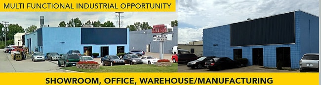
36435 Groesbeck Hwy
Detroit-Warren-Dearborn, MI
Groesbeck Nunneley Sub
16-11-28-228-014
50-11-28-228-014 D 65 G73 GROESBECK NUNNELEY SUB LOT 65.
Lightindustrial
Macomb
X
Michigan
26099C0333G
65
2025
1.25 AC
2025
Groesbeck Central
241200
Detroit
21,624 SF
DEMOGRAPHICS near 36435 Groesbeck Hwy
1 Mile
3 Mile
5 Mile
2024 Total Population
14,000
99,793
268,144
2029 Population
13,789
99,207
265,702
Pop Growth 2024-2029
(1.51%)
(0.59%)
(0.91%)
Average Age
41
42
42
2024 Total Households
6,002
43,506
116,583
HH Growth 2024-2029
(1.65%)
(0.59%)
(0.89%)
Median Household Inc
$57,523
$62,792
$64,386
Avg Household Size
2.30
2.20
2.20
2024 Avg HH Vehicles
2.00
2.00
2.00
Median Home Value
$151,268
$173,136
$184,167
Median Year Built
1967
1972
1974
Nearby Places
Map Layers
Map Styles
 Street
 Aerial
- Restaurants
- Banks
- Shops
- Fitness
- Groceries
PUBLIC TRANSPORTATION
AIRPORT
Windsor International
DRIVE
WALK
Distance
Windsor International
56 min
34.3 mi
Freight Ports
Port of Toledo
DRIVE
WALK
Distance
Port of Toledo
105 min
82.2 mi
SALE & LEASE HISTORY
LISTING DATE
SALE/LEASE

Sep 24, 2016
For Sale
Nearby Properties
Address
Land Use
TOTAL SIZE
Lot Size
Zoning
Address
Land Use
TOTAL SIZE
Lot Size
Zoning
40.39 AC
RML
Address
Land Use
TOTAL SIZE
Lot Size
Zoning
436,218 SF
36.43 AC
B-2
Address
Land Use
TOTAL SIZE
Lot Size
Zoning
74,382 SF
3.99 AC
OS-1
Address
Land Use
TOTAL SIZE
Lot Size
Zoning
29.33 AC
RML
Address
Land Use
TOTAL SIZE
Lot Size
Zoning
24.38 AC
RML
Address
Land Use
TOTAL SIZE
Lot Size
Zoning
249,162 SF
27.87 AC
IC
Address
Land Use
TOTAL SIZE
Lot Size
Zoning
91,386 SF
B-2
Address
Land Use
TOTAL SIZE
Lot Size
Zoning
209,501 SF
17.74 AC
B-3
Address
Land Use
TOTAL SIZE
Lot Size
Zoning
247,177 SF
26.94 AC
CG
Address
Land Use
TOTAL SIZE
Lot Size
Zoning
217,369 SF
20.15 AC
B-2
Address
Land Use
TOTAL SIZE
Lot Size
Zoning
57,316 SF
26.07 AC
RML
Address
Land Use
TOTAL SIZE
Lot Size
Zoning
6.10 AC
RM-1
Address
Land Use
TOTAL SIZE
Lot Size
Zoning
17.44 AC
RML
Address
Land Use
TOTAL SIZE
Lot Size
Zoning
214,201 SF
24.10 AC
B-3
Address
Land Use
TOTAL SIZE
Lot Size
Zoning
7.18 AC
RMH
Address
Land Use
TOTAL SIZE
Lot Size
Zoning
370,077 SF
18.24 AC
B-2
Address
Land Use
TOTAL SIZE
Lot Size
Zoning
15.05 AC
RM-2
Address
Land Use
TOTAL SIZE
Lot Size
Zoning
10.37 AC
RML
Address
Land Use
TOTAL SIZE
Lot Size
Zoning
117,664 SF
6.66 AC
I-1
Address
Land Use
TOTAL SIZE
Lot Size
Zoning
157,610 SF
5.30 AC
RMH
Address
Land Use
TOTAL SIZE
Lot Size
Zoning
17.85 AC
RML
Address
Land Use
TOTAL SIZE
Lot Size
Zoning
11.87 AC
RM-2
Address
Land Use
TOTAL SIZE
Lot Size
Zoning
120,360 SF
10.70 AC
GC
Address
Land Use
TOTAL SIZE
Lot Size
Zoning
88.65 AC
MH
Address
Land Use
TOTAL SIZE
Lot Size
Zoning
10.43 AC
RML
Address
Land Use
TOTAL SIZE
Lot Size
Zoning
256 SF
5.57 AC
SP-1
Address
Land Use
TOTAL SIZE
Lot Size
Zoning
10.89 AC
RML
Address
Land Use
TOTAL SIZE
Lot Size
Zoning
41,065 SF
4.30 AC
B-3
Address
Land Use
TOTAL SIZE
Lot Size
Zoning
131,812 SF
12.56 AC
B-3
Address
Land Use
TOTAL SIZE
Lot Size
Zoning
10.18 AC
RM-2
The World's #1 Commercial Real Estate Marketplace
Connect with us
© 2026 CoStar Group
The information above has been obtained from sources believed reliable. While we do not doubt its accuracy we have not verified it and make no guarantee, warranty or representation about it. It is your responsibility to independently confirm its accuracy and completeness. Any projections, opinions, assumptions, or estimates used are for example only and do not represent the current or future performance of the property. The value of this transaction to you depends on tax and other factors which should be evaluated by your tax, financial, and legal advisors. You and your advisors should conduct a careful, independent investigation of the property to determine to your satisfaction the suitability of the property for your needs.