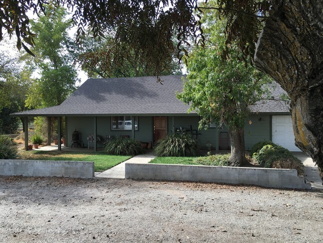
Property Record
36444 State Highway 16, Woodland, CA 95695
NEARBY LISTINGS FOR SALE OR LEASE
Property Detail
36444 State Highway 16
025-130-084-000
LEGAL VERFIED 2016-0028556 PCL ONE
Orchard
Yolo
X
California
06113C0440G
15.19 AC
2024
Davis/Woodland
2025
Sacramento
0112062009
Sacramento--Roseville--Arden-Arcade, CA
969 SF
DEMOGRAPHICS near 36444 State Highway 16
1 Mile
3 Mile
5 Mile
2024 Total Population
380
25,831
53,832
2029 Population
367
26,011
54,390
Pop Growth 2024-2029
(3.42%)
+ 0.70%
+ 1.04%
Average Age
42
40
39
2024 Total Households
132
9,520
18,761
HH Growth 2024-2029
(4.55%)
+ 0.77%
+ 1.02%
Median Household Inc
$58,845
$70,320
$73,212
Avg Household Size
2.70
2.60
2.80
2024 Avg HH Vehicles
2.00
2.00
2.00
Median Home Value
$816,176
$474,920
$455,369
Median Year Built
1968
1976
1976
Nearby Places
Map Layers
Map Styles
 Street
 Aerial
- Restaurants
- Banks
- Shops
- Fitness
- Groceries
PUBLIC TRANSPORTATION
AIRPORT
Sacramento International
DRIVE
WALK
Distance
Sacramento International
26 min
17.5 mi
Freight Ports
Port of Stockton
DRIVE
WALK
Distance
Port of Stockton
84 min
70.9 mi
SALE & LEASE HISTORY
LISTING DATE
SALE/LEASE

Sep 24, 2016
For Sale
Nearby Properties
Address
Land Use
TOTAL SIZE
Lot Size
Zoning
Address
Land Use
TOTAL SIZE
Lot Size
Zoning
112.50 AC
A1
Address
Land Use
TOTAL SIZE
Lot Size
Zoning
180,816 SF
0.17 AC
R-M
Address
Land Use
TOTAL SIZE
Lot Size
Zoning
83,280 SF
0.22 AC
R-M
Address
Land Use
TOTAL SIZE
Lot Size
Zoning
4,000 SF
51.48 AC
A1
Address
Land Use
TOTAL SIZE
Lot Size
Zoning
2.98 AC
C2
Address
Land Use
TOTAL SIZE
Lot Size
Zoning
0.21 AC
R1
Address
Land Use
TOTAL SIZE
Lot Size
Zoning
101,334 SF
8.52 AC
C2
Address
Land Use
TOTAL SIZE
Lot Size
Zoning
9.83 AC
R-M
Address
Land Use
TOTAL SIZE
Lot Size
Zoning
64,896 SF
4.39 AC
R-M
Address
Land Use
TOTAL SIZE
Lot Size
Zoning
58,050 SF
6.55 AC
R-M
Address
Land Use
TOTAL SIZE
Lot Size
Zoning
62,208 SF
3.07 AC
R-M
Address
Land Use
TOTAL SIZE
Lot Size
Zoning
130,647 SF
0.14 AC
R2
Address
Land Use
TOTAL SIZE
Lot Size
Zoning
4.16 AC
R4
Address
Land Use
TOTAL SIZE
Lot Size
Zoning
71,280 SF
0.23 AC
R-M
Address
Land Use
TOTAL SIZE
Lot Size
Zoning
3.43 AC
Address
Land Use
TOTAL SIZE
Lot Size
Zoning
90,320 SF
7.18 AC
C2
Address
Land Use
TOTAL SIZE
Lot Size
Zoning
12.43 AC
R1
Address
Land Use
TOTAL SIZE
Lot Size
Zoning
40,452 SF
2.41 AC
R3
Address
Land Use
TOTAL SIZE
Lot Size
Zoning
18,804 SF
1.09 AC
NP
Address
Land Use
TOTAL SIZE
Lot Size
Zoning
22,058 SF
1.31 AC
R-M
Address
Land Use
TOTAL SIZE
Lot Size
Zoning
30,530 SF
0.74 AC
C2
Address
Land Use
TOTAL SIZE
Lot Size
Zoning
40,664 SF
4.06 AC
R3
Address
Land Use
TOTAL SIZE
Lot Size
Zoning
56,732 SF
31.20 AC
RM
Address
Land Use
TOTAL SIZE
Lot Size
Zoning
13,783 SF
0.83 AC
C2
Address
Land Use
TOTAL SIZE
Lot Size
Zoning
17,340 SF
1.49 AC
Address
Land Use
TOTAL SIZE
Lot Size
Zoning
64,996 SF
0.32 AC
R3
Address
Land Use
TOTAL SIZE
Lot Size
Zoning
34,414 SF
2.29 AC
C2
Address
Land Use
TOTAL SIZE
Lot Size
Zoning
1.50 AC
RM
Address
Land Use
TOTAL SIZE
Lot Size
Zoning
35,795 SF
2.67 AC
C2
Address
Land Use
TOTAL SIZE
Lot Size
Zoning
0.33 AC
R3
The World's #1 Commercial Real Estate Marketplace
Connect with us
© 2026 CoStar Group
The information above has been obtained from sources believed reliable. While we do not doubt its accuracy we have not verified it and make no guarantee, warranty or representation about it. It is your responsibility to independently confirm its accuracy and completeness. Any projections, opinions, assumptions, or estimates used are for example only and do not represent the current or future performance of the property. The value of this transaction to you depends on tax and other factors which should be evaluated by your tax, financial, and legal advisors. You and your advisors should conduct a careful, independent investigation of the property to determine to your satisfaction the suitability of the property for your needs.