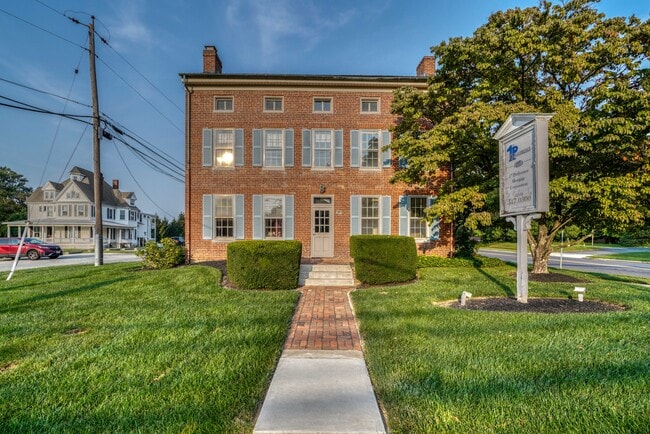
Property Record
365 Main St, Reisterstown, MD 21136


NEARBY LISTINGS FOR SALE OR LEASE
Property Detail
365 Main St
04-2400006667
Lndn Prfsnl Cntr Condo
Officecondo
SUITE 1-B BLDG 1 LNDN PRFSNL CNTR CNDO
X
Baltimore
2400100205G
Maryland
2024
0.01 AC
2025
Reisterstown Rd Corridor
404501
Baltimore
1,051 SF
Baltimore-Columbia-Towson, MD
DEMOGRAPHICS near 365 Main St
1 Mile
3 Mile
5 Mile
2024 Total Population
10,370
43,428
86,276
2029 Population
10,237
42,837
85,481
Pop Growth 2024-2029
(1.28%)
(1.36%)
(0.92%)
Average Age
41
40
39
2024 Total Households
3,968
16,330
33,548
HH Growth 2024-2029
(1.31%)
(1.41%)
(0.97%)
Median Household Inc
$74,927
$86,552
$90,888
Avg Household Size
2.50
2.60
2.50
2024 Avg HH Vehicles
2.00
2.00
2.00
Median Home Value
$315,916
$361,695
$353,637
Median Year Built
1982
1984
1990
Nearby Places
Map Layers
Map Styles
 Street
 Aerial
- Restaurants
- Banks
- Shops
- Fitness
- Groceries
PUBLIC TRANSPORTATION
AIRPORT
Baltimore/Washington International Thurgood Marshall
DRIVE
WALK
Distance
Baltimore/Washington International Thurgood Marshall
37 min
24.0 mi
Freight Ports
Port of Baltimore
DRIVE
WALK
Distance
Port of Baltimore
37 min
24.5 mi
SALE & LEASE HISTORY
LISTING DATE
SALE/LEASE

Oct 23, 2023
For Lease
Oct 19, 2022
For Sale
Jul 23, 2024
For Lease
Dec 28, 2023
For Sale
Aug 28, 2023
For Sale
Nearby Properties
Address
Land Use
TOTAL SIZE
Lot Size
Zoning
Address
Land Use
TOTAL SIZE
Lot Size
Zoning
31,185 SF
486.08 AC
RC2
Address
Land Use
TOTAL SIZE
Lot Size
Zoning
18.87 AC
DR16
Address
Land Use
TOTAL SIZE
Lot Size
Zoning
151,140 SF
39.06 AC
Address
Land Use
TOTAL SIZE
Lot Size
Zoning
16.86 AC
Address
Land Use
TOTAL SIZE
Lot Size
Zoning
114,141 SF
54.89 AC
Address
Land Use
TOTAL SIZE
Lot Size
Zoning
15.86 AC
DR16
Address
Land Use
TOTAL SIZE
Lot Size
Zoning
4,762 SF
15.93 AC
BMCCC
Address
Land Use
TOTAL SIZE
Lot Size
Zoning
125,171 SF
8.80 AC
Address
Land Use
TOTAL SIZE
Lot Size
Zoning
11.76 AC
DR3.5
Address
Land Use
TOTAL SIZE
Lot Size
Zoning
8.47 AC
DR16
Address
Land Use
TOTAL SIZE
Lot Size
Zoning
8.70 AC
DR16
Address
Land Use
TOTAL SIZE
Lot Size
Zoning
7.75 AC
DR5.5
Address
Land Use
TOTAL SIZE
Lot Size
Zoning
12.96 AC
DR16
Address
Land Use
TOTAL SIZE
Lot Size
Zoning
11.14 AC
DR16
Address
Land Use
TOTAL SIZE
Lot Size
Zoning
107,713 SF
3.85 AC
Address
Land Use
TOTAL SIZE
Lot Size
Zoning
157,975 SF
5.49 AC
BL
Address
Land Use
TOTAL SIZE
Lot Size
Zoning
7.13 AC
DR16
Address
Land Use
TOTAL SIZE
Lot Size
Zoning
6.97 AC
DR3.5
Address
Land Use
TOTAL SIZE
Lot Size
Zoning
7.93 AC
DR16
Address
Land Use
TOTAL SIZE
Lot Size
Zoning
87,871 SF
7.88 AC
ML-IM
Address
Land Use
TOTAL SIZE
Lot Size
Zoning
6.88 AC
DR3.5
Address
Land Use
TOTAL SIZE
Lot Size
Zoning
91,776 SF
1.33 AC
Address
Land Use
TOTAL SIZE
Lot Size
Zoning
120,544 SF
9.23 AC
Address
Land Use
TOTAL SIZE
Lot Size
Zoning
126,358 SF
6.51 AC
ML
Address
Land Use
TOTAL SIZE
Lot Size
Zoning
8.33 AC
DR16
Address
Land Use
TOTAL SIZE
Lot Size
Zoning
70,882 SF
19.06 AC
Address
Land Use
TOTAL SIZE
Lot Size
Zoning
5.69 AC
DR16
Address
Land Use
TOTAL SIZE
Lot Size
Zoning
58,200 SF
6.89 AC
BL
Address
Land Use
TOTAL SIZE
Lot Size
Zoning
5.91 AC
DR16
Address
Land Use
TOTAL SIZE
Lot Size
Zoning
15 AC
BMCCC
The World's #1 Commercial Real Estate Marketplace
Connect with us
© 2025 CoStar Group
The information above has been obtained from sources believed reliable. While we do not doubt its accuracy we have not verified it and make no guarantee, warranty or representation about it. It is your responsibility to independently confirm its accuracy and completeness. Any projections, opinions, assumptions, or estimates used are for example only and do not represent the current or future performance of the property. The value of this transaction to you depends on tax and other factors which should be evaluated by your tax, financial, and legal advisors. You and your advisors should conduct a careful, independent investigation of the property to determine to your satisfaction the suitability of the property for your needs.