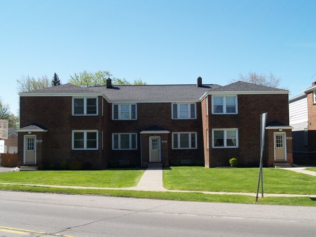
Property Record
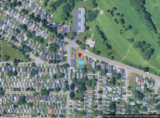
365 Potters Rd, Buffalo, NY 14220
NEARBY LISTINGS FOR SALE OR LEASE
Property Detail
365 Potters Rd
Buffalo-Cheektowaga-Niagara Falls, NY
Buffalo Creek Reservation
146800-133-200-0001-002-100
MC-1217 SL-2,3 (FL-272) CAZ GARDENS S/D 104.9 X 181.13 IRR.
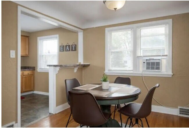
Apartment
Erie
X
New York
36029C0333H
2.100
2025
0.44 AC
2024
South Abbott
012001
Buffalo/Niagara Falls
5,284 SF
DEMOGRAPHICS near 365 Potters Rd
1 Mile
3 Mile
5 Mile
2024 Total Population
16,490
87,735
194,698
2029 Population
16,022
85,835
191,648
Pop Growth 2024-2029
(2.84%)
(2.17%)
(1.57%)
Average Age
41
41
41
2024 Total Households
7,339
38,293
85,075
HH Growth 2024-2029
(2.90%)
(2.23%)
(1.54%)
Median Household Inc
$66,018
$56,731
$53,463
Avg Household Size
2.20
2.20
2.20
2024 Avg HH Vehicles
2.00
1.00
1.00
Median Home Value
$154,034
$149,341
$153,658
Median Year Built
1948
1950
1955
Nearby Places
- Restaurants
- Banks
- Shops
- Fitness
- Groceries
SALE & LEASE HISTORY
LISTING DATE
SALE/LEASE

May 15, 2017
For Sale
Dec 12, 2023
For Sale
Apr 29, 2019
For Sale
Nearby Properties
Address
Land Use
TOTAL SIZE
Lot Size
Zoning
Address
Land Use
TOTAL SIZE
Lot Size
Zoning
1,053,391 SF
88.26 AC
D-IL
Address
Land Use
TOTAL SIZE
Lot Size
Zoning
425,796 SF
7.10 AC
D-M
Address
Land Use
TOTAL SIZE
Lot Size
Zoning
972 SF
194.01 AC
D-OG
Address
Land Use
TOTAL SIZE
Lot Size
Zoning
5,340 SF
233.33 AC
D-ON
Address
Land Use
TOTAL SIZE
Lot Size
Zoning
80,440 SF
1.54 AC
N-1C
Address
Land Use
TOTAL SIZE
Lot Size
Zoning
48.14 AC
OP
Address
Land Use
TOTAL SIZE
Lot Size
Zoning
104,881 SF
24.43 AC
12
Address
Land Use
TOTAL SIZE
Lot Size
Zoning
2,600 SF
14.80 AC
D-IL
Address
Land Use
TOTAL SIZE
Lot Size
Zoning
151,200 SF
8.36 AC
BETH
Address
Land Use
TOTAL SIZE
Lot Size
Zoning
151,200 SF
8.29 AC
IND
Address
Land Use
TOTAL SIZE
Lot Size
Zoning
43,942 SF
14.34 AC
CBD
Address
Land Use
TOTAL SIZE
Lot Size
Zoning
Address
Land Use
TOTAL SIZE
Lot Size
Zoning
124,112 SF
53.10 AC
05 - COMME
Address
Land Use
TOTAL SIZE
Lot Size
Zoning
205,680 SF
37.40 AC
11
Address
Land Use
TOTAL SIZE
Lot Size
Zoning
314,904 SF
30.05 AC
D-IL
Address
Land Use
TOTAL SIZE
Lot Size
Zoning
15.78 AC
IND
Address
Land Use
TOTAL SIZE
Lot Size
Zoning
174,812 SF
52.04 AC
05C
Address
Land Use
TOTAL SIZE
Lot Size
Zoning
7.50 AC
Address
Land Use
TOTAL SIZE
Lot Size
Zoning
107,760 SF
4.14 AC
D-E
Address
Land Use
TOTAL SIZE
Lot Size
Zoning
0.07 AC
Address
Land Use
TOTAL SIZE
Lot Size
Zoning
123 AC
OP
Address
Land Use
TOTAL SIZE
Lot Size
Zoning
Address
Land Use
TOTAL SIZE
Lot Size
Zoning
198,558 SF
3.16 AC
N-3R
Address
Land Use
TOTAL SIZE
Lot Size
Zoning
191,026 SF
32.60 AC
10
Address
Land Use
TOTAL SIZE
Lot Size
Zoning
279,026 SF
25.08 AC
D-IL
Address
Land Use
TOTAL SIZE
Lot Size
Zoning
72.11 AC
Address
Land Use
TOTAL SIZE
Lot Size
Zoning
182,741 SF
7.02 AC
D-IL
Address
Land Use
TOTAL SIZE
Lot Size
Zoning
34,968 SF
18.26 AC
10
Address
Land Use
TOTAL SIZE
Lot Size
Zoning
99,000 SF
26.60 AC
N-3R
Address
Land Use
TOTAL SIZE
Lot Size
Zoning
33,345 SF
2.50 AC
OP
The World's #1 Commercial Real Estate Marketplace
Connect with us
© 2025 CoStar Group
The information above has been obtained from sources believed reliable. While we do not doubt its accuracy we have not verified it and make no guarantee, warranty or representation about it. It is your responsibility to independently confirm its accuracy and completeness. Any projections, opinions, assumptions, or estimates used are for example only and do not represent the current or future performance of the property. The value of this transaction to you depends on tax and other factors which should be evaluated by your tax, financial, and legal advisors. You and your advisors should conduct a careful, independent investigation of the property to determine to your satisfaction the suitability of the property for your needs.