Property Record
365 Range Rd, Kimball, MI 48074

Property Detail
365 Range Rd
25-370-0002-000
LOTS 2, 3, 4, 31, 32 & 33 LINCOLN PARK PLAT
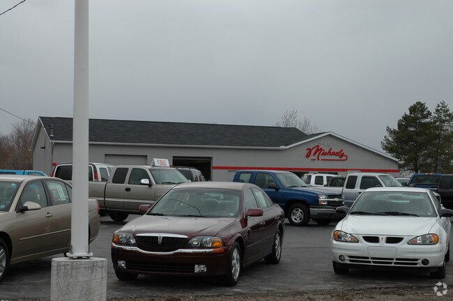
Vehiclerentalsvehiclesales
Saint Clair
R-2 RES
Michigan
B and X Area of moderate flood hazard, usually the area between the limits of the 100-year and 500-year floods.
2-4,31
2025
0.62 AC
2025
St Clair & Lapeer Counties
634600
Detroit
3,601 SF
Detroit-Warren-Dearborn, MI
NEARBY LISTINGS FOR SALE OR LEASE
DEMOGRAPHICS near 365 Range Rd
1 mile
3 mile
5 mile
2025 Total Population
3,826
16,601
35,819
2030 Population
3,810
16,558
35,718
Pop Growth 2025-2030
(0.42%)
(0.26%)
(0.28%)
Average Age
41
42
41
2025 Total Households
1,486
6,713
14,302
HH Growth 2025-2030
(0.61%)
(0.37%)
(0.39%)
Median Household Inc
$83,191
$65,707
$59,989
Avg Household Size
2.50
2.40
2.40
2025 Avg HH Vehicles
2.00
2.00
2.00
Median Home Value
$193,827
$190,574
$182,655
Median Year Built
1973
1979
1975
Nearby Places
Map Layers
Map Styles
 Street
 Aerial
Transit
 Traffic
 Biking
Places
Listings with unknown addresses are not visible on the map
- Restaurants
- Banks
- Shops
- Fitness
- Groceries
PUBLIC TRANSPORTATION
COMMUTER RAIL
Port Huron Amtrak Station (Blue Water - Amtrak)
Drive
Walk
Distance
Port Huron Amtrak Station (Blue Water - Amtrak)
9 min
5.1 mi
Freight Ports
Port of Toledo
Drive
Walk
Distance
Port of Toledo
137 min
114.3 mi
Nearby Properties
Address
Land Use
TOTAL SIZE
Lot Size
Zoning
Address
Land Use
TOTAL SIZE
Lot Size
Zoning
682,515 SF
211.45 AC
M-2
Address
Land Use
TOTAL SIZE
Lot Size
Zoning
79,276 SF
316.65 AC
M-1
Address
Land Use
TOTAL SIZE
Lot Size
Zoning
1,246,586 SF
83.70 AC
M-2
Address
Land Use
TOTAL SIZE
Lot Size
Zoning
98,904 SF
29.48 AC
R1-A
Address
Land Use
TOTAL SIZE
Lot Size
Zoning
79,276 SF
311.74 AC
M-1
Address
Land Use
TOTAL SIZE
Lot Size
Zoning
204,347 SF
35.13 AC
C-2
Address
Land Use
TOTAL SIZE
Lot Size
Zoning
134,379 SF
15 AC
RM-2
Address
Land Use
TOTAL SIZE
Lot Size
Zoning
80,662 SF
R1-A
Address
Land Use
TOTAL SIZE
Lot Size
Zoning
138,360 SF
6.01 AC
M-1
Address
Land Use
TOTAL SIZE
Lot Size
Zoning
Address
Land Use
TOTAL SIZE
Lot Size
Zoning
77,868 SF
8.91 AC
RM-2
Address
Land Use
TOTAL SIZE
Lot Size
Zoning
108,767 SF
7.29 AC
R1-A
Address
Land Use
TOTAL SIZE
Lot Size
Zoning
83,623 SF
5.49 AC
M-1
Address
Land Use
TOTAL SIZE
Lot Size
Zoning
250,775 SF
11.29 AC
M-1
Address
Land Use
TOTAL SIZE
Lot Size
Zoning
69,440 SF
12.30 AC
C-2
Address
Land Use
TOTAL SIZE
Lot Size
Zoning
100,096 SF
13.85 AC
M-2
Address
Land Use
TOTAL SIZE
Lot Size
Zoning
50,314 SF
58.60 AC
M-2
Address
Land Use
TOTAL SIZE
Lot Size
Zoning
47,332 SF
19.33 AC
M-1
Address
Land Use
TOTAL SIZE
Lot Size
Zoning
213,967 SF
9.27 AC
M-1
Address
Land Use
TOTAL SIZE
Lot Size
Zoning
125,367 SF
19.45 AC
M1
Address
Land Use
TOTAL SIZE
Lot Size
Zoning
68,348 SF
6.33 AC
M-1
Address
Land Use
TOTAL SIZE
Lot Size
Zoning
4,480 SF
40 AC
MH
Address
Land Use
TOTAL SIZE
Lot Size
Zoning
37,998 SF
6.04 AC
C-2
Address
Land Use
TOTAL SIZE
Lot Size
Zoning
28,565 SF
R1-A
Address
Land Use
TOTAL SIZE
Lot Size
Zoning
58,656 SF
12.03 AC
I-H
Address
Land Use
TOTAL SIZE
Lot Size
Zoning
5,213 SF
45 AC
I-2
Address
Land Use
TOTAL SIZE
Lot Size
Zoning
55,760 SF
7.86 AC
M-1
Address
Land Use
TOTAL SIZE
Lot Size
Zoning
18,000 SF
9.62 AC
M-1
Address
Land Use
TOTAL SIZE
Lot Size
Zoning
16,621 SF
3.63 AC
C-3
Address
Land Use
TOTAL SIZE
Lot Size
Zoning
39,926 SF
8.94 AC
I-L
The World's #1 Commercial Real Estate Marketplace
Connect with us
© 2026 CoStar Group
The information above has been obtained from sources believed reliable. While we do not doubt its accuracy we have not verified it and make no guarantee, warranty or representation about it. It is your responsibility to independently confirm its accuracy and completeness. Any projections, opinions, assumptions, or estimates used are for example only and do not represent the current or future performance of the property. The value of this transaction to you depends on tax and other factors which should be evaluated by your tax, financial, and legal advisors. You and your advisors should conduct a careful, independent investigation of the property to determine to your satisfaction the suitability of the property for your needs.