Property Record
365 Talbot Ave, Pacifica, CA 94044
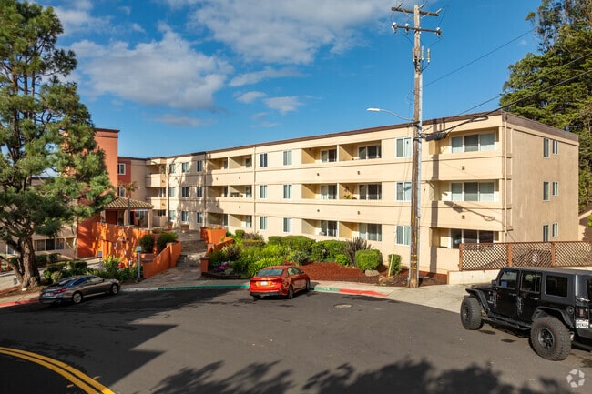

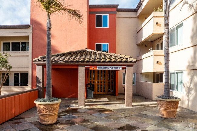
Property Detail
365 Talbot Ave
016-220-120
PARCEL A 3.038 AC MOL PARCEL MAP VOL 29/35
Multifamilydwelling
San Mateo
R30000
California
B and X Area of moderate flood hazard, usually the area between the limits of the 100-year and 500-year floods.
3.04 AC
2024
Sharp Park
2025
San Francisco
603000
San Francisco-San Mateo-Redwood City, CA
58,775 SF
NEARBY LISTINGS FOR SALE OR LEASE
DEMOGRAPHICS near 365 Talbot Ave
1 mile
3 mile
5 mile
2025 Total Population
7,146
90,130
233,537
2030 Population
7,180
90,213
233,931
Pop Growth 2025-2030
+ 0.48%
+ 0.09%
+ 0.17%
Average Age
44
44
43
2025 Total Households
2,824
29,620
77,695
HH Growth 2025-2030
+ 0.50%
+ 0.06%
+ 0.15%
Median Household Inc
$161,420
$149,316
$131,822
Avg Household Size
2.50
2.90
2.90
2025 Avg HH Vehicles
2.00
2.00
2.00
Median Home Value
$1,100,000
$1,084,222
$1,068,630
Median Year Built
1963
1966
1964
Nearby Places
Map Layers
Map Styles
 Street
 Aerial
Transit
 Traffic
 Biking
Places
Listings with unknown addresses are not visible on the map
- Restaurants
- Banks
- Shops
- Fitness
- Groceries
PUBLIC TRANSPORTATION
COMMUTER RAIL
Drive
Walk
Distance
13 min
6.7 mi
Drive
Walk
Distance
16 min
7.3 mi
AIRPORT
San Francisco International
Drive
Walk
Distance
San Francisco International
19 min
9.4 mi
Metro Oakland International
Drive
Walk
Distance
Metro Oakland International
47 min
33.1 mi
Freight Ports
Port of San Francisco
Drive
Walk
Distance
Port of San Francisco
24 min
16.5 mi
Nearby Properties
Address
Land Use
TOTAL SIZE
Lot Size
Zoning
Address
Land Use
TOTAL SIZE
Lot Size
Zoning
53.85 AC
Address
Land Use
TOTAL SIZE
Lot Size
Zoning
167,105 SF
2.07 AC
C10000
Address
Land Use
TOTAL SIZE
Lot Size
Zoning
209,692 SF
8.20 AC
R30000
Address
Land Use
TOTAL SIZE
Lot Size
Zoning
12.83 AC
PD0000
Address
Land Use
TOTAL SIZE
Lot Size
Zoning
108,917 SF
4.61 AC
PD0004
Address
Land Use
TOTAL SIZE
Lot Size
Zoning
75,559 SF
2.48 AC
R30000
Address
Land Use
TOTAL SIZE
Lot Size
Zoning
410,683 SF
9.76 AC
R30000
Address
Land Use
TOTAL SIZE
Lot Size
Zoning
80,607 SF
6.83 AC
C20000
Address
Land Use
TOTAL SIZE
Lot Size
Zoning
94,381 SF
2.39 AC
R30000
Address
Land Use
TOTAL SIZE
Lot Size
Zoning
1.53 AC
CH00C2
Address
Land Use
TOTAL SIZE
Lot Size
Zoning
192,282 SF
2.63 AC
Address
Land Use
TOTAL SIZE
Lot Size
Zoning
1.35 AC
CH00C2
Address
Land Use
TOTAL SIZE
Lot Size
Zoning
192,282 SF
2.99 AC
Address
Land Use
TOTAL SIZE
Lot Size
Zoning
1.50 AC
CH00C2
Address
Land Use
TOTAL SIZE
Lot Size
Zoning
55,758 SF
1.25 AC
CH00C2
Address
Land Use
TOTAL SIZE
Lot Size
Zoning
1.87 AC
CH00C2
Address
Land Use
TOTAL SIZE
Lot Size
Zoning
144,294 SF
12.12 AC
CL00C1
Address
Land Use
TOTAL SIZE
Lot Size
Zoning
88,468 SF
4.25 AC
C10000
Address
Land Use
TOTAL SIZE
Lot Size
Zoning
55,920 SF
4.28 AC
Address
Land Use
TOTAL SIZE
Lot Size
Zoning
47,064 SF
5.20 AC
PD0000
Address
Land Use
TOTAL SIZE
Lot Size
Zoning
91,360 SF
4.50 AC
PD0000
Address
Land Use
TOTAL SIZE
Lot Size
Zoning
83,760 SF
1.49 AC
R30000
Address
Land Use
TOTAL SIZE
Lot Size
Zoning
0.75 AC
Address
Land Use
TOTAL SIZE
Lot Size
Zoning
89,405 SF
9.12 AC
C10000
Address
Land Use
TOTAL SIZE
Lot Size
Zoning
2.24 AC
CH00C2
Address
Land Use
TOTAL SIZE
Lot Size
Zoning
81,660 SF
3.20 AC
PD0000
Address
Land Use
TOTAL SIZE
Lot Size
Zoning
160,346 SF
3.05 AC
CH00C2
Address
Land Use
TOTAL SIZE
Lot Size
Zoning
45,352 SF
1.14 AC
PD0004
Address
Land Use
TOTAL SIZE
Lot Size
Zoning
1,970 SF
1.30 AC
R30000
The World's #1 Commercial Real Estate Marketplace
Connect with us
© 2026 CoStar Group
The information above has been obtained from sources believed reliable. While we do not doubt its accuracy we have not verified it and make no guarantee, warranty or representation about it. It is your responsibility to independently confirm its accuracy and completeness. Any projections, opinions, assumptions, or estimates used are for example only and do not represent the current or future performance of the property. The value of this transaction to you depends on tax and other factors which should be evaluated by your tax, financial, and legal advisors. You and your advisors should conduct a careful, independent investigation of the property to determine to your satisfaction the suitability of the property for your needs.