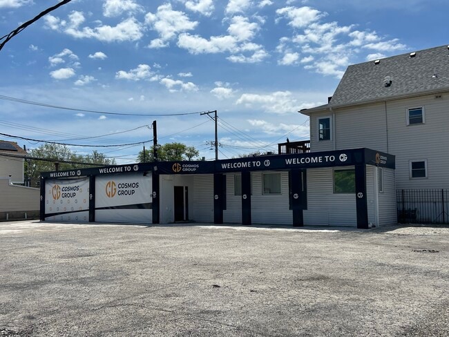
Property Record
3655 N Cicero Ave, Chicago, IL 60641
Current Lease Availabilities
NEARBY LISTINGS FOR SALE OR LEASE
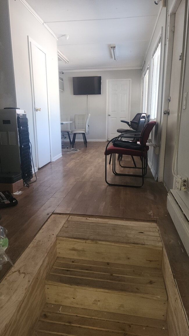
Property Detail
3655 N Cicero Ave
Chicago-Naperville-Elgin, IL-IN-WI
Gross Milwaukee
13-22-121-043-0000
(GROSS)(MILWAUKEE) AVE ADD SUB OF PTS BLKS19&22 & ALL BLKS18&23-25 IN GRAYLAND SUB IN NW SEC 22-40-13
Commercialnec
Cook
X
Illinois
17031C0403J
20,21
2023
0.14 AC
2024
Northwest City
831700
Chicago
300 SF
DEMOGRAPHICS near 3655 N Cicero Ave
1 Mile
3 Mile
5 Mile
2024 Total Population
40,974
375,366
993,488
2029 Population
37,719
348,380
942,183
Pop Growth 2024-2029
(7.94%)
(7.19%)
(5.16%)
Average Age
39
39
39
2024 Total Households
15,026
136,163
391,904
HH Growth 2024-2029
(8.46%)
(7.69%)
(5.52%)
Median Household Inc
$75,044
$74,111
$80,241
Avg Household Size
2.60
2.60
2.40
2024 Avg HH Vehicles
2.00
1.00
1.00
Median Home Value
$363,150
$344,441
$378,061
Median Year Built
1946
1947
1948
Nearby Places
- Restaurants
- Banks
- Shops
- Fitness
- Groceries
PUBLIC TRANSPORTATION
TRANSIT/SUBWAY
Grayland Station (Milwaukee District North Line - Northeast Illinois Regional Commuter Railroad (Metra))
DRIVE
WALK
Distance
Grayland Station (Milwaukee District North Line - Northeast Illinois Regional Commuter Railroad (Metra))
2 min
12 min
0.6 mi
Mayfair Station (Milwaukee District North Line - Northeast Illinois Regional Commuter Railroad (Metra))
DRIVE
WALK
Distance
Mayfair Station (Milwaukee District North Line - Northeast Illinois Regional Commuter Railroad (Metra))
3 min
19 min
1.0 mi
COMMUTER RAIL
Grayland Station (Milwaukee District North Line - Northeast Illinois Regional Commuter Railroad (Metra))
DRIVE
WALK
Distance
Grayland Station (Milwaukee District North Line - Northeast Illinois Regional Commuter Railroad (Metra))
2 min
11 min
0.6 mi
Mayfair Station (Milwaukee District North Line - Northeast Illinois Regional Commuter Railroad (Metra))
DRIVE
WALK
Distance
Mayfair Station (Milwaukee District North Line - Northeast Illinois Regional Commuter Railroad (Metra))
3 min
20 min
1.0 mi
AIRPORT
Chicago O'Hare International
DRIVE
WALK
Distance
Chicago O'Hare International
18 min
10.3 mi
Chicago Midway International
DRIVE
WALK
Distance
Chicago Midway International
24 min
11.3 mi
Nearby Properties
Address
Land Use
TOTAL SIZE
Lot Size
Zoning
Address
Land Use
TOTAL SIZE
Lot Size
Zoning
Address
Land Use
TOTAL SIZE
Lot Size
Zoning
16.93 AC
POS-1,PD 1
Address
Land Use
TOTAL SIZE
Lot Size
Zoning
192,365 SF
21.34 AC
PD 127
Address
Land Use
TOTAL SIZE
Lot Size
Zoning
PD 184
Address
Land Use
TOTAL SIZE
Lot Size
Zoning
237,832 SF
14.04 AC
PD 418
Address
Land Use
TOTAL SIZE
Lot Size
Zoning
190,011 SF
5.90 AC
PD 353
Address
Land Use
TOTAL SIZE
Lot Size
Zoning
170,538 SF
0.76 AC
PD 112
Address
Land Use
TOTAL SIZE
Lot Size
Zoning
331,294 SF
13.03 AC
PD 439
Address
Land Use
TOTAL SIZE
Lot Size
Zoning
1.04 AC
PD 130
Address
Land Use
TOTAL SIZE
Lot Size
Zoning
139.71 AC
PD 184
Address
Land Use
TOTAL SIZE
Lot Size
Zoning
6.31 AC
PD 1013
Address
Land Use
TOTAL SIZE
Lot Size
Zoning
140,451 SF
9.48 AC
PD 213
Address
Land Use
TOTAL SIZE
Lot Size
Zoning
15,600 SF
0.77 AC
M1-1
Address
Land Use
TOTAL SIZE
Lot Size
Zoning
3.33 AC
PD 1013
Address
Land Use
TOTAL SIZE
Lot Size
Zoning
100,900 SF
4.85 AC
PD 1415
Address
Land Use
TOTAL SIZE
Lot Size
Zoning
340,838 SF
31 AC
PD 1411
Address
Land Use
TOTAL SIZE
Lot Size
Zoning
194,582 SF
12.68 AC
PD 699
Address
Land Use
TOTAL SIZE
Lot Size
Zoning
382,635 SF
5.90 AC
M1-1
Address
Land Use
TOTAL SIZE
Lot Size
Zoning
13.33 AC
PD 127
Address
Land Use
TOTAL SIZE
Lot Size
Zoning
226,155 SF
5.86 AC
PMD 9
Address
Land Use
TOTAL SIZE
Lot Size
Zoning
78,410 SF
4.87 AC
PD 171
Address
Land Use
TOTAL SIZE
Lot Size
Zoning
0.43 AC
RS-2
Address
Land Use
TOTAL SIZE
Lot Size
Zoning
389,400 SF
28.83 AC
PMD 9
Address
Land Use
TOTAL SIZE
Lot Size
Zoning
67,588 SF
2.50 AC
PD 415
Address
Land Use
TOTAL SIZE
Lot Size
Zoning
277,819 SF
10.58 AC
PD 127
Address
Land Use
TOTAL SIZE
Lot Size
Zoning
897,723 SF
23.04 AC
PMD 15
Address
Land Use
TOTAL SIZE
Lot Size
Zoning
141,095 SF
9.15 AC
PD 127
Address
Land Use
TOTAL SIZE
Lot Size
Zoning
83,288 SF
13.43 AC
RT-4
Address
Land Use
TOTAL SIZE
Lot Size
Zoning
68,831 SF
3.11 AC
PD 353
Address
Land Use
TOTAL SIZE
Lot Size
Zoning
92,380 SF
7.28 AC
RS-2
The World's #1 Commercial Real Estate Marketplace
Connect with us
© 2025 CoStar Group
The information above has been obtained from sources believed reliable. While we do not doubt its accuracy we have not verified it and make no guarantee, warranty or representation about it. It is your responsibility to independently confirm its accuracy and completeness. Any projections, opinions, assumptions, or estimates used are for example only and do not represent the current or future performance of the property. The value of this transaction to you depends on tax and other factors which should be evaluated by your tax, financial, and legal advisors. You and your advisors should conduct a careful, independent investigation of the property to determine to your satisfaction the suitability of the property for your needs.