Property Record
3655 Athena School Rd, De Soto, MO 63020


Property Detail
3655 Athena School Rd
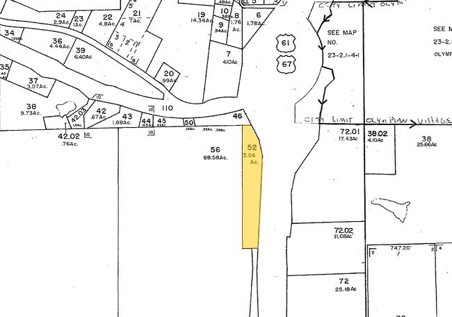
23-2.1-04.0-0-000-052
NW CORNER E1/2 LOT 3 NE1/4
Shipyard
Jefferson
CC2
Missouri
B and X Area of moderate flood hazard, usually the area between the limits of the 100-year and 500-year floods.
3
2024
5.06 AC
2025
Jefferson County
701300
St. Louis
16,560 SF
St. Louis, MO-IL
NEARBY LISTINGS FOR SALE OR LEASE
-
-
View all De Soto listings for sale on LoopNet.com
DEMOGRAPHICS near 3655 Athena School Rd
1 mile
3 mile
5 mile
2025 Total Population
881
5,275
16,835
2030 Population
902
5,397
17,252
Pop Growth 2025-2030
+ 2.38%
+ 2.31%
+ 2.48%
Average Age
41
42
41
2025 Total Households
324
1,963
6,468
HH Growth 2025-2030
+ 2.47%
+ 2.39%
+ 2.54%
Median Household Inc
$74,437
$80,530
$71,925
Avg Household Size
2.70
2.60
2.50
2025 Avg HH Vehicles
3.00
2.00
2.00
Median Home Value
$176,723
$185,455
$188,422
Median Year Built
1989
1985
1980
Nearby Places
Map Layers
Map Styles
 Street
 Aerial
Layers
 Traffic
 Biking
Places
Listings with unknown addresses are not visible on the map
- Restaurants
- Banks
- Shops
- Fitness
- Groceries
Nearby Properties
Address
Land Use
TOTAL SIZE
Lot Size
Zoning
Address
Land Use
TOTAL SIZE
Lot Size
Zoning
9,100 SF
3.31 AC
CC2
Address
Land Use
TOTAL SIZE
Lot Size
Zoning
2.58 AC
CC2
Address
Land Use
TOTAL SIZE
Lot Size
Zoning
1,176 SF
12.65 AC
NC1
Address
Land Use
TOTAL SIZE
Lot Size
Zoning
2,904 SF
0.94 AC
CC2
Address
Land Use
TOTAL SIZE
Lot Size
Zoning
15,828 SF
11.62 AC
CC2
Address
Land Use
TOTAL SIZE
Lot Size
Zoning
4,160 SF
2.02 AC
R20
Address
Land Use
TOTAL SIZE
Lot Size
Zoning
5,040 SF
0.82 AC
CC2
Address
Land Use
TOTAL SIZE
Lot Size
Zoning
4,298 SF
12.11 AC
Address
Land Use
TOTAL SIZE
Lot Size
Zoning
3,559 SF
10.06 AC
Address
Land Use
TOTAL SIZE
Lot Size
Zoning
2,840 SF
2.16 AC
CC2
Address
Land Use
TOTAL SIZE
Lot Size
Zoning
5,305 SF
100.46 AC
R40
Address
Land Use
TOTAL SIZE
Lot Size
Zoning
10,000 SF
3.50 AC
CC2
Address
Land Use
TOTAL SIZE
Lot Size
Zoning
2,400 SF
0.91 AC
CC2
Address
Land Use
TOTAL SIZE
Lot Size
Zoning
5,663 SF
2.05 AC
Address
Land Use
TOTAL SIZE
Lot Size
Zoning
3,140 SF
5.72 AC
R20
Address
Land Use
TOTAL SIZE
Lot Size
Zoning
3,080 SF
5.69 AC
CC2
Address
Land Use
TOTAL SIZE
Lot Size
Zoning
9,000 SF
1.78 AC
NC1
Address
Land Use
TOTAL SIZE
Lot Size
Zoning
1,064 SF
3.70 AC
CC2
Address
Land Use
TOTAL SIZE
Lot Size
Zoning
3,200 SF
1.88 AC
R20
Address
Land Use
TOTAL SIZE
Lot Size
Zoning
1.29 AC
CC2
Address
Land Use
TOTAL SIZE
Lot Size
Zoning
1,736 SF
8 AC
LR2
Address
Land Use
TOTAL SIZE
Lot Size
Zoning
4,930 SF
4.48 AC
PI
Address
Land Use
TOTAL SIZE
Lot Size
Zoning
21.03 AC
R20
Address
Land Use
TOTAL SIZE
Lot Size
Zoning
3,134 SF
7.94 AC
R40
Address
Land Use
TOTAL SIZE
Lot Size
Zoning
1,247 SF
3.94 AC
R10
Address
Land Use
TOTAL SIZE
Lot Size
Zoning
20.04 AC
Address
Land Use
TOTAL SIZE
Lot Size
Zoning
2,800 SF
0.79 AC
R20
Address
Land Use
TOTAL SIZE
Lot Size
Zoning
0.17 AC
CT1
Address
Land Use
TOTAL SIZE
Lot Size
Zoning
3,000 SF
1.76 AC
CC2
The World's #1 Commercial Real Estate Marketplace
Connect with us
© 2026 CoStar Group
The information above has been obtained from sources believed reliable. While we do not doubt its accuracy we have not verified it and make no guarantee, warranty or representation about it. It is your responsibility to independently confirm its accuracy and completeness. Any projections, opinions, assumptions, or estimates used are for example only and do not represent the current or future performance of the property. The value of this transaction to you depends on tax and other factors which should be evaluated by your tax, financial, and legal advisors. You and your advisors should conduct a careful, independent investigation of the property to determine to your satisfaction the suitability of the property for your needs.