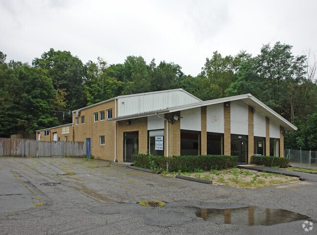
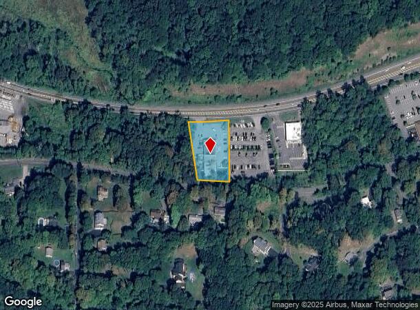
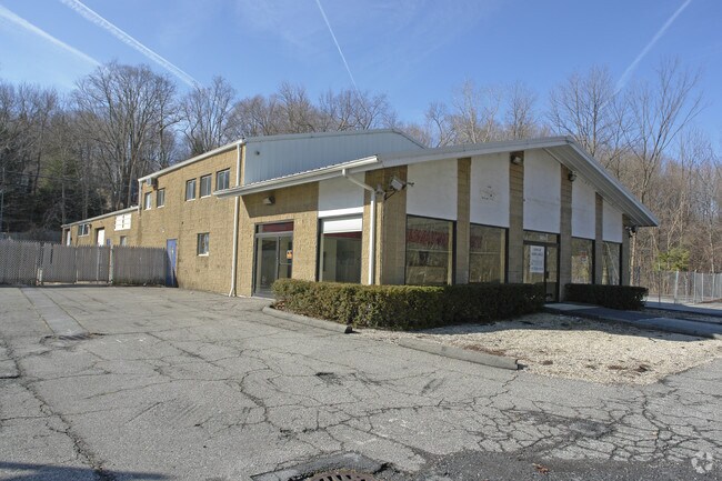
Property Record
3655 Crompond Rd, Cortlandt Manor, NY 10567
NEARBY LISTINGS FOR SALE OR LEASE
Property Detail
3655 Crompond Rd
5400-036-005-00001-000-0018
Minor Subdivision Map Prepared For Quarr
Animalhospitalvet
Westchester
A
New York
36119C0037F
18.000
2025
0.94 AC
2024
Northwest
014805
Westchester/So Connecticut
1,361 SF
New York-Jersey City-White Plains, NY-NJ
DEMOGRAPHICS near 3655 Crompond Rd
1 Mile
3 Mile
5 Mile
2024 Total Population
2,703
33,122
90,948
2029 Population
2,639
32,227
88,775
Pop Growth 2024-2029
(2.37%)
(2.70%)
(2.39%)
Average Age
43
43
42
2024 Total Households
876
11,588
32,494
HH Growth 2024-2029
(2.74%)
(2.99%)
(2.60%)
Median Household Inc
$179,496
$143,910
$122,546
Avg Household Size
2.90
2.80
2.70
2024 Avg HH Vehicles
2.00
2.00
2.00
Median Home Value
$533,163
$489,634
$461,122
Median Year Built
1962
1964
1964
Nearby Places
- Restaurants
- Banks
- Shops
- Fitness
- Groceries
PUBLIC TRANSPORTATION
COMMUTER RAIL
Peekskill Station (Hudson Line - Metro-North Commuter Railroad Company (Metro-North))
DRIVE
WALK
Distance
Peekskill Station (Hudson Line - Metro-North Commuter Railroad Company (Metro-North))
10 min
5.5 mi
Cortlandt Station (Hudson Line - Metro-North Commuter Railroad Company (Metro-North))
DRIVE
WALK
Distance
Cortlandt Station (Hudson Line - Metro-North Commuter Railroad Company (Metro-North))
18 min
8.6 mi
AIRPORT
Westchester County
DRIVE
WALK
Distance
Westchester County
36 min
25.1 mi
New York Stewart International
DRIVE
WALK
Distance
New York Stewart International
51 min
29.0 mi
Freight Ports
NY - Red Hook Container Terminal
DRIVE
WALK
Distance
NY - Red Hook Container Terminal
79 min
52.5 mi
Nearby Properties
Address
Land Use
TOTAL SIZE
Lot Size
Zoning
Address
Land Use
TOTAL SIZE
Lot Size
Zoning
Address
Land Use
TOTAL SIZE
Lot Size
Zoning
878 SF
62.50 AC
R1-20
Address
Land Use
TOTAL SIZE
Lot Size
Zoning
Address
Land Use
TOTAL SIZE
Lot Size
Zoning
13 AC
R1-40
Address
Land Use
TOTAL SIZE
Lot Size
Zoning
Address
Land Use
TOTAL SIZE
Lot Size
Zoning
1,124 SF
8 AC
R1-80
Address
Land Use
TOTAL SIZE
Lot Size
Zoning
2,241 SF
595 AC
R1-16
Address
Land Use
TOTAL SIZE
Lot Size
Zoning
Address
Land Use
TOTAL SIZE
Lot Size
Zoning
82.53 AC
Address
Land Use
TOTAL SIZE
Lot Size
Zoning
1,504 SF
45.28 AC
R1-80
Address
Land Use
TOTAL SIZE
Lot Size
Zoning
Address
Land Use
TOTAL SIZE
Lot Size
Zoning
22.61 AC
Address
Land Use
TOTAL SIZE
Lot Size
Zoning
Address
Land Use
TOTAL SIZE
Lot Size
Zoning
38.05 AC
Address
Land Use
TOTAL SIZE
Lot Size
Zoning
12 AC
R1-40
Address
Land Use
TOTAL SIZE
Lot Size
Zoning
1,449 SF
580 AC
R1-16
Address
Land Use
TOTAL SIZE
Lot Size
Zoning
Address
Land Use
TOTAL SIZE
Lot Size
Zoning
35.97 AC
Address
Land Use
TOTAL SIZE
Lot Size
Zoning
1,642 SF
11.50 AC
R1-20
Address
Land Use
TOTAL SIZE
Lot Size
Zoning
64.38 AC
Address
Land Use
TOTAL SIZE
Lot Size
Zoning
12.38 AC
R1-40
Address
Land Use
TOTAL SIZE
Lot Size
Zoning
10.19 AC
R1-40
Address
Land Use
TOTAL SIZE
Lot Size
Zoning
Address
Land Use
TOTAL SIZE
Lot Size
Zoning
9.77 AC
IN
Address
Land Use
TOTAL SIZE
Lot Size
Zoning
Address
Land Use
TOTAL SIZE
Lot Size
Zoning
879 SF
24.13 AC
OB
Address
Land Use
TOTAL SIZE
Lot Size
Zoning
20.81 AC
R1-80
Address
Land Use
TOTAL SIZE
Lot Size
Zoning
Address
Land Use
TOTAL SIZE
Lot Size
Zoning
1,620 SF
127.19 AC
R1-16
Address
Land Use
TOTAL SIZE
Lot Size
Zoning
The World's #1 Commercial Real Estate Marketplace
Connect with us
© 2025 CoStar Group
The information above has been obtained from sources believed reliable. While we do not doubt its accuracy we have not verified it and make no guarantee, warranty or representation about it. It is your responsibility to independently confirm its accuracy and completeness. Any projections, opinions, assumptions, or estimates used are for example only and do not represent the current or future performance of the property. The value of this transaction to you depends on tax and other factors which should be evaluated by your tax, financial, and legal advisors. You and your advisors should conduct a careful, independent investigation of the property to determine to your satisfaction the suitability of the property for your needs.