Property Record
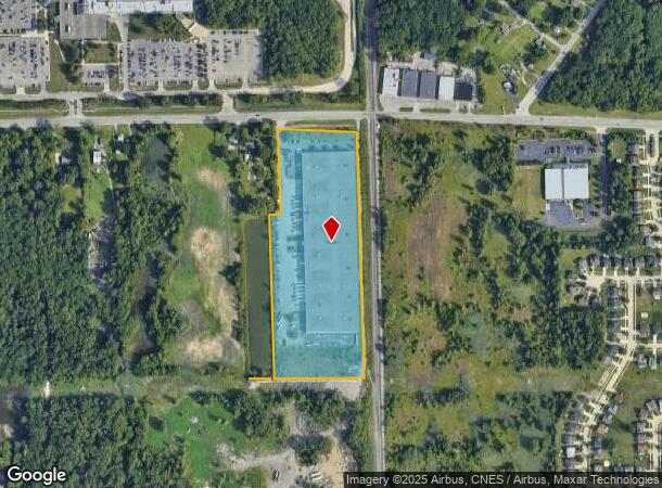
36555 Ecorse Rd, Romulus, MI 48174


NEARBY LISTINGS FOR SALE OR LEASE
Property Detail
36555 Ecorse Rd
80-030-99-0001-701
08J1 PT OF THE NW 1/4 OF SEC 8 T3S R9E DESC AS BEG AT THE N 1/4 COR OF SAID SEC 8 DUE W 73.03 FT MEASURED (71.80 FT RECORD) ALONG THE N LINE OF SAID SEC 8 SAID LINE BEING THE CENTERLINE OF ECORSE RD (WIDTH VARIES) THE THE POB TH S 00D 03M 50S W MEASU
Warehouse
Wayne
X
Michigan
26163C0220F
0001
2025
17.47 AC
2025
Airport District
585800
Detroit
268,800 SF
Detroit-Warren-Dearborn, MI
DEMOGRAPHICS near 36555 Ecorse Rd
1 Mile
3 Mile
5 Mile
2024 Total Population
2,683
34,011
119,623
2029 Population
2,578
32,730
115,017
Pop Growth 2024-2029
(3.91%)
(3.77%)
(3.85%)
Average Age
38
40
40
2024 Total Households
1,058
13,816
47,999
HH Growth 2024-2029
(3.88%)
(3.84%)
(3.91%)
Median Household Inc
$50,606
$57,844
$63,886
Avg Household Size
2.50
2.40
2.40
2024 Avg HH Vehicles
2.00
2.00
2.00
Median Home Value
$173,900
$150,144
$169,635
Median Year Built
1970
1966
1970
Nearby Places
Map Layers
Map Styles
 Street
 Aerial
- Restaurants
- Banks
- Shops
- Fitness
- Groceries
PUBLIC TRANSPORTATION
AIRPORT
Detroit Metro Wayne County
DRIVE
WALK
Distance
Detroit Metro Wayne County
13 min
7.5 mi
Windsor International
DRIVE
WALK
Distance
Windsor International
51 min
31.8 mi
Freight Ports
Port of Toledo
DRIVE
WALK
Distance
Port of Toledo
65 min
50.5 mi
SALE & LEASE HISTORY
LISTING DATE
SALE/LEASE

Sep 25, 2016
For Lease
Nearby Properties
Address
Land Use
TOTAL SIZE
Lot Size
Zoning
Address
Land Use
TOTAL SIZE
Lot Size
Zoning
857,173 SF
84.70 AC
M-1/COND
Address
Land Use
TOTAL SIZE
Lot Size
Zoning
739,289 SF
238.69 AC
AG
Address
Land Use
TOTAL SIZE
Lot Size
Zoning
108,809 SF
AP-AIRPORT
Address
Land Use
TOTAL SIZE
Lot Size
Zoning
919,978 SF
65.96 AC
MT IND
Address
Land Use
TOTAL SIZE
Lot Size
Zoning
495,062 SF
52.40 AC
M1 LIG
Address
Land Use
TOTAL SIZE
Lot Size
Zoning
1,141,765 SF
154.21 AC
M2-GEN
Address
Land Use
TOTAL SIZE
Lot Size
Zoning
393,948 SF
43.43 AC
M2-GEN
Address
Land Use
TOTAL SIZE
Lot Size
Zoning
354,968 SF
25.72 AC
RC/M-1
Address
Land Use
TOTAL SIZE
Lot Size
Zoning
435,648 SF
27.84 AC
M2-GEN
Address
Land Use
TOTAL SIZE
Lot Size
Zoning
366,820 SF
20.83 AC
RC/M-1
Address
Land Use
TOTAL SIZE
Lot Size
Zoning
366,820 SF
20.72 AC
RC/M-1
Address
Land Use
TOTAL SIZE
Lot Size
Zoning
1,182 SF
25.21 AC
G-1
Address
Land Use
TOTAL SIZE
Lot Size
Zoning
268,272 SF
22.70 AC
M-1/COND
Address
Land Use
TOTAL SIZE
Lot Size
Zoning
1,071,200 SF
85.27 AC
M1 LIG
Address
Land Use
TOTAL SIZE
Lot Size
Zoning
685,104 SF
44.25 AC
M1 LIG
Address
Land Use
TOTAL SIZE
Lot Size
Zoning
1,789,755 SF
138.32 AC
IND-2 HVY
Address
Land Use
TOTAL SIZE
Lot Size
Zoning
920,139 SF
56.56 AC
M2-GEN
Address
Land Use
TOTAL SIZE
Lot Size
Zoning
250,263 SF
18.81 AC
RM-MLTI
Address
Land Use
TOTAL SIZE
Lot Size
Zoning
285,080 SF
21.89 AC
M2-GEN
Address
Land Use
TOTAL SIZE
Lot Size
Zoning
244,760 SF
22.63 AC
M-1/COND
Address
Land Use
TOTAL SIZE
Lot Size
Zoning
186,738 SF
15.89 AC
RM-MLTI
Address
Land Use
TOTAL SIZE
Lot Size
Zoning
443,082 SF
30.01 AC
LI-2
Address
Land Use
TOTAL SIZE
Lot Size
Zoning
489,500 SF
58.51 AC
M2-GEN
Address
Land Use
TOTAL SIZE
Lot Size
Zoning
240,355 SF
26.05 AC
M2-GEN
Address
Land Use
TOTAL SIZE
Lot Size
Zoning
462,840 SF
45.66 AC
PDA
Address
Land Use
TOTAL SIZE
Lot Size
Zoning
6,128 SF
50.14 AC
RC-REG
Address
Land Use
TOTAL SIZE
Lot Size
Zoning
5,382 SF
109.33 AC
RMH-MOB
Address
Land Use
TOTAL SIZE
Lot Size
Zoning
1,619,168 SF
150.49 AC
M2-GEN
Address
Land Use
TOTAL SIZE
Lot Size
Zoning
659,516 SF
46.15 AC
MT IND
Address
Land Use
TOTAL SIZE
Lot Size
Zoning
437,836 SF
28.75 AC
M1 LIG
The World's #1 Commercial Real Estate Marketplace
Connect with us
© 2025 CoStar Group
The information above has been obtained from sources believed reliable. While we do not doubt its accuracy we have not verified it and make no guarantee, warranty or representation about it. It is your responsibility to independently confirm its accuracy and completeness. Any projections, opinions, assumptions, or estimates used are for example only and do not represent the current or future performance of the property. The value of this transaction to you depends on tax and other factors which should be evaluated by your tax, financial, and legal advisors. You and your advisors should conduct a careful, independent investigation of the property to determine to your satisfaction the suitability of the property for your needs.