Property Record
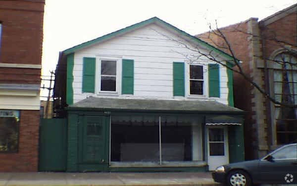
366 Park Ave, Glencoe, IL 60022

NEARBY LISTINGS FOR SALE OR LEASE
Property Detail
366 Park Ave
Chicago-Naperville-Elgin, IL-IN
Fletchers Sub
05-07-205-033-0000
(FLETCHERS) SUB OF LT 1 & NW 50 FT OF LT 2 IN BLK 32 OF GLENCOE A SUB IN SECS 5,6,7 & 8 SEC 07-42-13
Storebuilding
Cook
X
Illinois
17097C0294L
1,2
2023
0.14 AC
2025
Central North
800200
Chicago
DEMOGRAPHICS near 366 Park Ave
1 Mile
3 Mile
5 Mile
2024 Total Population
7,787
40,437
136,963
2029 Population
7,565
39,754
134,125
Pop Growth 2024-2029
(2.85%)
(1.69%)
(2.07%)
Average Age
41
43
43
2024 Total Households
2,598
14,309
50,434
HH Growth 2024-2029
(3.27%)
(1.91%)
(2.25%)
Median Household Inc
$206,264
$195,148
$151,975
Avg Household Size
3.00
2.70
2.60
2024 Avg HH Vehicles
2.00
2.00
2.00
Median Home Value
$1,031,709
$825,176
$695,120
Median Year Built
1954
1960
1965
Nearby Places
Map Layers
Map Styles
 Street
 Aerial
- Restaurants
- Banks
- Shops
- Fitness
- Groceries
PUBLIC TRANSPORTATION
COMMUTER RAIL
Glencoe Station (Union Pacific North Line - Northeast Illinois Regional Commuter Railroad (Metra))
DRIVE
WALK
Distance
Glencoe Station (Union Pacific North Line - Northeast Illinois Regional Commuter Railroad (Metra))
2 min
4 min
0.2 mi
Hubbard Woods Station (Union Pacific North Line - Northeast Illinois Regional Commuter Railroad (Metra))
DRIVE
WALK
Distance
Hubbard Woods Station (Union Pacific North Line - Northeast Illinois Regional Commuter Railroad (Metra))
5 min
1.6 mi
AIRPORT
Chicago O'Hare International
DRIVE
WALK
Distance
Chicago O'Hare International
33 min
18.8 mi
Chicago Midway International
DRIVE
WALK
Distance
Chicago Midway International
45 min
33.4 mi
Freight Ports
Port of Baltimore
DRIVE
WALK
Distance
Port of Baltimore
1 min
617.0 mi
Nearby Properties
Address
Land Use
TOTAL SIZE
Lot Size
Zoning
Address
Land Use
TOTAL SIZE
Lot Size
Zoning
333,202 SF
13.88 AC
Address
Land Use
TOTAL SIZE
Lot Size
Zoning
629,447 SF
3.96 AC
Address
Land Use
TOTAL SIZE
Lot Size
Zoning
579,162 SF
6.41 AC
Address
Land Use
TOTAL SIZE
Lot Size
Zoning
419,812 SF
13.88 AC
Address
Land Use
TOTAL SIZE
Lot Size
Zoning
534,816 SF
6.98 AC
Address
Land Use
TOTAL SIZE
Lot Size
Zoning
14.11 AC
Address
Land Use
TOTAL SIZE
Lot Size
Zoning
230,886 SF
9.30 AC
Address
Land Use
TOTAL SIZE
Lot Size
Zoning
679,109 SF
24.46 AC
Address
Land Use
TOTAL SIZE
Lot Size
Zoning
Address
Land Use
TOTAL SIZE
Lot Size
Zoning
1.37 AC
Address
Land Use
TOTAL SIZE
Lot Size
Zoning
215,633 SF
9.78 AC
Address
Land Use
TOTAL SIZE
Lot Size
Zoning
58,280 SF
3.46 AC
Address
Land Use
TOTAL SIZE
Lot Size
Zoning
193,804 SF
7.98 AC
Address
Land Use
TOTAL SIZE
Lot Size
Zoning
169,657 SF
7.25 AC
Address
Land Use
TOTAL SIZE
Lot Size
Zoning
18.69 AC
Address
Land Use
TOTAL SIZE
Lot Size
Zoning
127,191 SF
76.51 AC
Address
Land Use
TOTAL SIZE
Lot Size
Zoning
17.91 AC
Address
Land Use
TOTAL SIZE
Lot Size
Zoning
114,174 SF
16.77 AC
Address
Land Use
TOTAL SIZE
Lot Size
Zoning
97.02 AC
Address
Land Use
TOTAL SIZE
Lot Size
Zoning
126.61 AC
Address
Land Use
TOTAL SIZE
Lot Size
Zoning
109,192 SF
3.64 AC
Address
Land Use
TOTAL SIZE
Lot Size
Zoning
71,565 SF
6.17 AC
Address
Land Use
TOTAL SIZE
Lot Size
Zoning
60,301 SF
3.35 AC
Address
Land Use
TOTAL SIZE
Lot Size
Zoning
126,621 SF
3.03 AC
Address
Land Use
TOTAL SIZE
Lot Size
Zoning
160,166 SF
5.67 AC
Address
Land Use
TOTAL SIZE
Lot Size
Zoning
13.88 AC
Address
Land Use
TOTAL SIZE
Lot Size
Zoning
167,843 SF
12.55 AC
Address
Land Use
TOTAL SIZE
Lot Size
Zoning
5.90 AC
Address
Land Use
TOTAL SIZE
Lot Size
Zoning
31,463 SF
1.59 AC
Address
Land Use
TOTAL SIZE
Lot Size
Zoning
154,086 SF
5.90 AC
The World's #1 Commercial Real Estate Marketplace
Connect with us
© 2026 CoStar Group
The information above has been obtained from sources believed reliable. While we do not doubt its accuracy we have not verified it and make no guarantee, warranty or representation about it. It is your responsibility to independently confirm its accuracy and completeness. Any projections, opinions, assumptions, or estimates used are for example only and do not represent the current or future performance of the property. The value of this transaction to you depends on tax and other factors which should be evaluated by your tax, financial, and legal advisors. You and your advisors should conduct a careful, independent investigation of the property to determine to your satisfaction the suitability of the property for your needs.