Property Record
366 Post Rd, Westerly, RI 02891
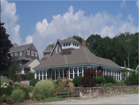

Property Detail
366 Post Rd
WEST-000115-000001
Washington
Commercialbuilding
Rhode Island
B and X Area of moderate flood hazard, usually the area between the limits of the 100-year and 500-year floods.
0.56 AC
2025
Washington County
2025
Providence
050902
Providence-Warwick, RI-MA
2,140 SF
NEARBY LISTINGS FOR SALE OR LEASE
DEMOGRAPHICS near 366 Post Rd
1 mile
3 mile
5 mile
2025 Total Population
1,251
7,897
22,353
2030 Population
1,317
8,297
22,623
Pop Growth 2025-2030
+ 5.28%
+ 5.07%
+ 1.21%
Average Age
50
50
48
2025 Total Households
554
3,546
9,964
HH Growth 2025-2030
+ 5.60%
+ 5.41%
+ 1.27%
Median Household Inc
$119,946
$117,627
$105,323
Avg Household Size
2.20
2.20
2.20
2025 Avg HH Vehicles
2.00
2.00
2.00
Median Home Value
$663,934
$703,615
$540,869
Median Year Built
1981
1981
1974
Nearby Places
Map Layers
Map Styles
 Street
 Aerial
Transit
 Traffic
 Biking
Places
Listings with unknown addresses are not visible on the map
- Restaurants
- Banks
- Shops
- Fitness
- Groceries
PUBLIC TRANSPORTATION
COMMUTER RAIL
Drive
Walk
Distance
9 min
6.0 mi
AIRPORT
Rhode Island Tf Green International
Drive
Walk
Distance
Rhode Island Tf Green International
58 min
42.2 mi
Freight Ports
Port of Davisville, RI
Drive
Walk
Distance
Port of Davisville, RI
48 min
31.4 mi
Nearby Properties
Address
Land Use
TOTAL SIZE
Lot Size
Zoning
Address
Land Use
TOTAL SIZE
Lot Size
Zoning
157,662 SF
27.62 AC
Address
Land Use
TOTAL SIZE
Lot Size
Zoning
21.25 AC
Address
Land Use
TOTAL SIZE
Lot Size
Zoning
290.30 AC
Address
Land Use
TOTAL SIZE
Lot Size
Zoning
43,251 SF
Address
Land Use
TOTAL SIZE
Lot Size
Zoning
6.54 AC
GI
Address
Land Use
TOTAL SIZE
Lot Size
Zoning
2.78 AC
R2A
Address
Land Use
TOTAL SIZE
Lot Size
Zoning
2.12 AC
R2A
Address
Land Use
TOTAL SIZE
Lot Size
Zoning
847 AC
OSR
Address
Land Use
TOTAL SIZE
Lot Size
Zoning
31,018 SF
4.05 AC
Address
Land Use
TOTAL SIZE
Lot Size
Zoning
7.65 AC
Address
Land Use
TOTAL SIZE
Lot Size
Zoning
142.05 AC
Address
Land Use
TOTAL SIZE
Lot Size
Zoning
10.61 AC
Address
Land Use
TOTAL SIZE
Lot Size
Zoning
0.31 AC
Address
Land Use
TOTAL SIZE
Lot Size
Zoning
2,260 SF
4.32 AC
Address
Land Use
TOTAL SIZE
Lot Size
Zoning
2.66 AC
Address
Land Use
TOTAL SIZE
Lot Size
Zoning
43,068 SF
10.36 AC
Address
Land Use
TOTAL SIZE
Lot Size
Zoning
0.89 AC
Address
Land Use
TOTAL SIZE
Lot Size
Zoning
59.12 AC
Address
Land Use
TOTAL SIZE
Lot Size
Zoning
1.27 AC
Address
Land Use
TOTAL SIZE
Lot Size
Zoning
21,025 SF
7.62 AC
Address
Land Use
TOTAL SIZE
Lot Size
Zoning
0.41 AC
Address
Land Use
TOTAL SIZE
Lot Size
Zoning
116 AC
RA
Address
Land Use
TOTAL SIZE
Lot Size
Zoning
46.61 AC
Address
Land Use
TOTAL SIZE
Lot Size
Zoning
1,578 SF
0.41 AC
Address
Land Use
TOTAL SIZE
Lot Size
Zoning
5.14 AC
R3A
Address
Land Use
TOTAL SIZE
Lot Size
Zoning
32,137 SF
4.17 AC
Address
Land Use
TOTAL SIZE
Lot Size
Zoning
3,200 SF
90.44 AC
Address
Land Use
TOTAL SIZE
Lot Size
Zoning
2.72 AC
RB
Address
Land Use
TOTAL SIZE
Lot Size
Zoning
1,692 SF
0.27 AC
Address
Land Use
TOTAL SIZE
Lot Size
Zoning
The World's #1 Commercial Real Estate Marketplace
Connect with us
© 2026 CoStar Group
The information above has been obtained from sources believed reliable. While we do not doubt its accuracy we have not verified it and make no guarantee, warranty or representation about it. It is your responsibility to independently confirm its accuracy and completeness. Any projections, opinions, assumptions, or estimates used are for example only and do not represent the current or future performance of the property. The value of this transaction to you depends on tax and other factors which should be evaluated by your tax, financial, and legal advisors. You and your advisors should conduct a careful, independent investigation of the property to determine to your satisfaction the suitability of the property for your needs.