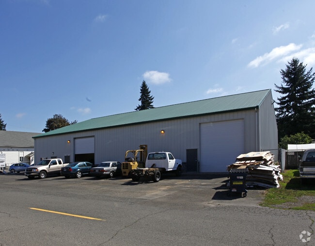
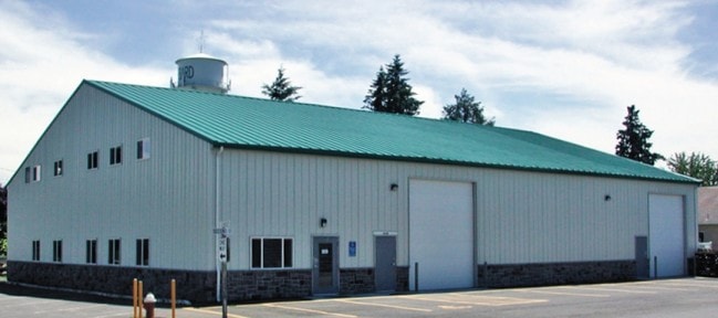
Property Record
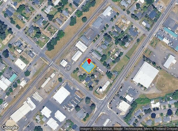
3660 2Nd St, Hubbard, OR 97032
Property Detail
3660 2Nd St
Salem, OR
Hubbard
599623
HUBBARD BLOCK 4 LOT 7 & 8 & FR VAC ALLEY ACRES .25
Officebuilding
Marion
X
Oregon
41005C0500D
7,8
2024
0.25 AC
2025
Marion County
010202
Portland
7,935 SF
NEARBY LISTINGS FOR SALE OR LEASE
DEMOGRAPHICS near 3660 2Nd St
1 mile
3 mile
5 mile
2024 Total Population
3,608
10,549
40,583
2029 Population
3,629
10,693
41,064
Pop Growth 2024-2029
+ 0.58%
+ 1.37%
+ 1.19%
Average Age
37
38
39
2024 Total Households
1,150
3,260
12,956
HH Growth 2024-2029
+ 0.61%
+ 1.32%
+ 1.20%
Median Household Inc
$84,069
$78,683
$58,896
Avg Household Size
3.20
3.10
3.00
2024 Avg HH Vehicles
2.00
2.00
2.00
Median Home Value
$424,285
$428,376
$357,705
Median Year Built
1977
1978
1976
Nearby Places
Map Layers
Map Styles
 Street
 Aerial
Transit
 Traffic
 Biking
Places
Listings with unknown addresses are not visible on the map
- Restaurants
- Banks
- Shops
- Fitness
- Groceries
PUBLIC TRANSPORTATION
AIRPORT
Portland International
Drive
Walk
Distance
Portland International
55 min
37.8 mi
Freight Ports
Port of Portland
Drive
Walk
Distance
Port of Portland
41 min
29.0 mi
SALE & LEASE HISTORY
LISTING DATE
SALE/LEASE

Sep 23, 2016
For Sale
Sep 12, 2023
For Lease
Nearby Properties
Address
Land Use
TOTAL SIZE
Lot Size
Zoning
Address
Land Use
TOTAL SIZE
Lot Size
Zoning
171.61 AC
P
Address
Land Use
TOTAL SIZE
Lot Size
Zoning
26,283 SF
56.26 AC
P/SP
Address
Land Use
TOTAL SIZE
Lot Size
Zoning
234,131 SF
9.47 AC
CG
Address
Land Use
TOTAL SIZE
Lot Size
Zoning
198,139 SF
8.60 AC
CG
Address
Land Use
TOTAL SIZE
Lot Size
Zoning
82,150 SF
7.05 AC
CG
Address
Land Use
TOTAL SIZE
Lot Size
Zoning
20 SF
100.66 AC
P
Address
Land Use
TOTAL SIZE
Lot Size
Zoning
72,935 SF
9.73 AC
CG
Address
Land Use
TOTAL SIZE
Lot Size
Zoning
100,645 SF
3.24 AC
CG
Address
Land Use
TOTAL SIZE
Lot Size
Zoning
90,582 SF
3.39 AC
CG
Address
Land Use
TOTAL SIZE
Lot Size
Zoning
16.12 AC
EFU
Address
Land Use
TOTAL SIZE
Lot Size
Zoning
152,390 SF
20.40 AC
IP
Address
Land Use
TOTAL SIZE
Lot Size
Zoning
27,204 SF
9.16 AC
P/SP
Address
Land Use
TOTAL SIZE
Lot Size
Zoning
99,924 SF
8.50 AC
CG
Address
Land Use
TOTAL SIZE
Lot Size
Zoning
6.22 AC
IL
Address
Land Use
TOTAL SIZE
Lot Size
Zoning
52,328 SF
9.68 AC
CG
Address
Land Use
TOTAL SIZE
Lot Size
Zoning
29,547 SF
3.92 AC
CO
Address
Land Use
TOTAL SIZE
Lot Size
Zoning
151,472 SF
11.98 AC
IP
Address
Land Use
TOTAL SIZE
Lot Size
Zoning
Address
Land Use
TOTAL SIZE
Lot Size
Zoning
47,709 SF
29.13 AC
IP
Address
Land Use
TOTAL SIZE
Lot Size
Zoning
39,666 SF
8.39 AC
I
Address
Land Use
TOTAL SIZE
Lot Size
Zoning
81,772 SF
3.92 AC
IC
Address
Land Use
TOTAL SIZE
Lot Size
Zoning
74,888 SF
4.02 AC
IL
Address
Land Use
TOTAL SIZE
Lot Size
Zoning
420 SF
1.39 AC
P/SP
Address
Land Use
TOTAL SIZE
Lot Size
Zoning
39,323 SF
15.38 AC
IL
Address
Land Use
TOTAL SIZE
Lot Size
Zoning
11.13 AC
IP
Address
Land Use
TOTAL SIZE
Lot Size
Zoning
10.65 AC
IP
Address
Land Use
TOTAL SIZE
Lot Size
Zoning
10.65 AC
IP
Address
Land Use
TOTAL SIZE
Lot Size
Zoning
41,276 SF
3.04 AC
CG
Address
Land Use
TOTAL SIZE
Lot Size
Zoning
86,020 SF
3.83 AC
IC
Address
Land Use
TOTAL SIZE
Lot Size
Zoning
The World's #1 Commercial Real Estate Marketplace
Connect with us
© 2026 CoStar Group
The information above has been obtained from sources believed reliable. While we do not doubt its accuracy we have not verified it and make no guarantee, warranty or representation about it. It is your responsibility to independently confirm its accuracy and completeness. Any projections, opinions, assumptions, or estimates used are for example only and do not represent the current or future performance of the property. The value of this transaction to you depends on tax and other factors which should be evaluated by your tax, financial, and legal advisors. You and your advisors should conduct a careful, independent investigation of the property to determine to your satisfaction the suitability of the property for your needs.